This content was originally published by the Longmont Observer and is licensed under a Creative Commons license.
Forecast Discussion:
(Many thanks to the National Weather Service (NWS) and weather5280.com for today's forecast...)
Fantastic heat hit Wednesday with some down-slope flow and some compression of the atmosphere ahead of the shortwave trough. It looks like Longmont hit 84F, tying the record for the date. (And another 80F+ day happened when I said we were done with them. Darn.)
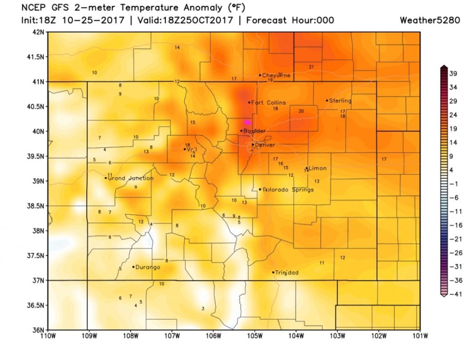
Figure 1 shows that temperatures in Longmont were about 20 degrees F above normal in the evening Wednesday. But that can only mean - here comes the storm.
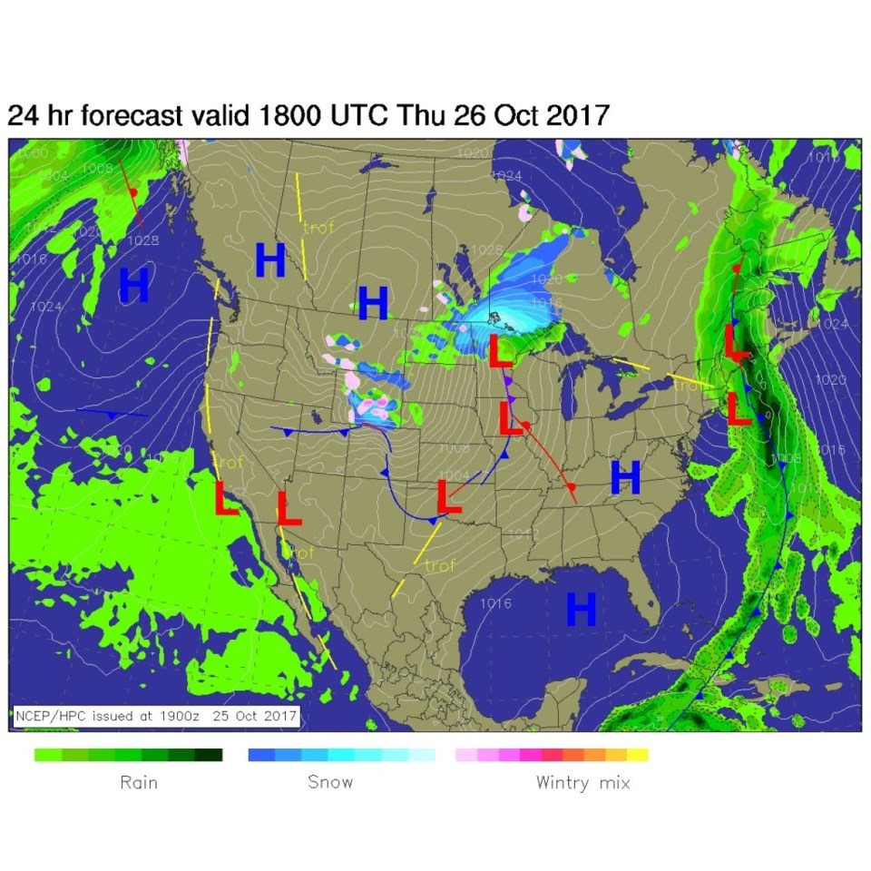
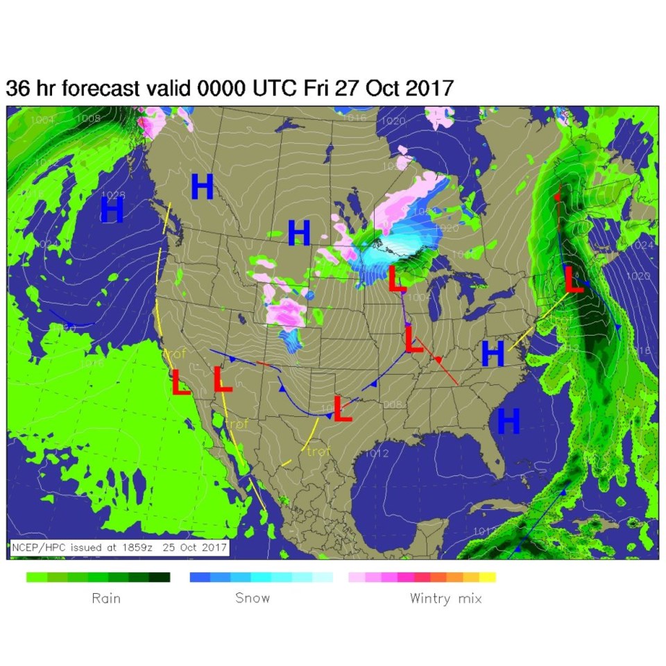
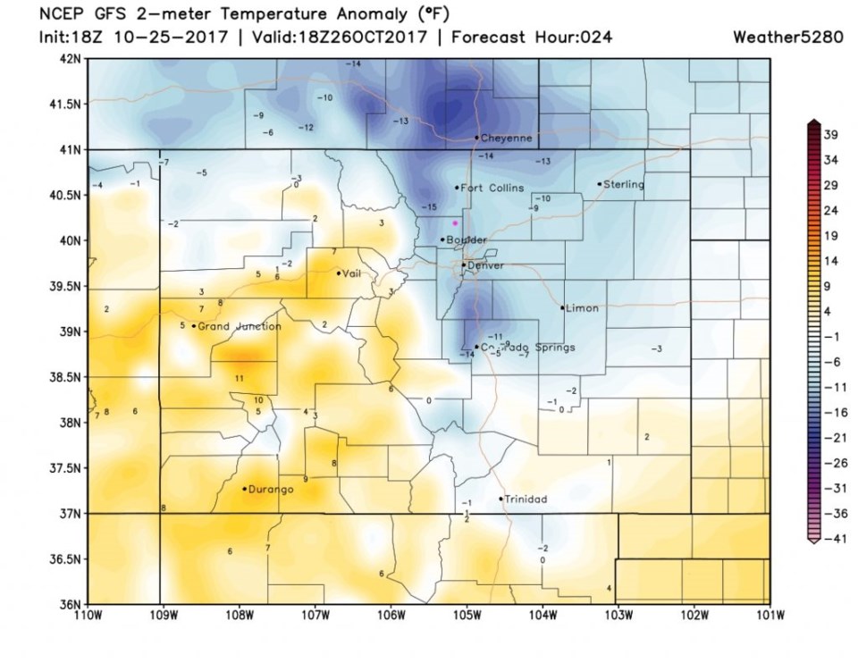
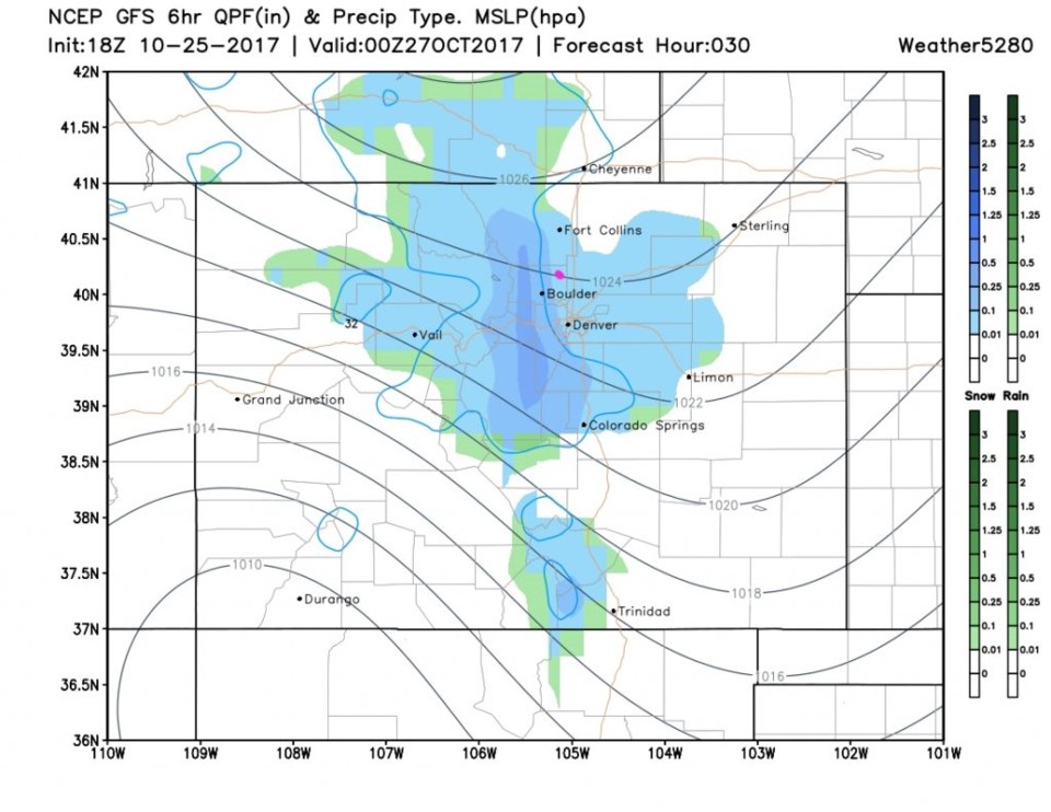
Figure 2 is the forecast surface map for noon today (Thursday). The front is sweeping down the plains and precipitation is just forming on the Wyoming border. By 6pm Thursday, the peak of the storm is in place... but only for a few hours (Figure 3). Figure 4 is the temperatures today, at the same time as yesterday. We are now about 10 degrees below normal.
As the NWS spells it out: The warmest temperature for today will have occurred just after midnight Thursday morning (about when this column posts). At 6am the wind direction will shift to come out of the north along the Wyoming border. By 7:30am it hits Longmont, then is down to Denver by 8am. About an hour or two later, sustained winds at 25-35mph with gusts up to 45mph will hit our town. There will only be a 4-6 hour period of showers with temperatures down to the mid-30's in Longmont. It will cool a bit more as rain, then snow, falls. Visibilities in blowing snow will - briefly- be pretty low.
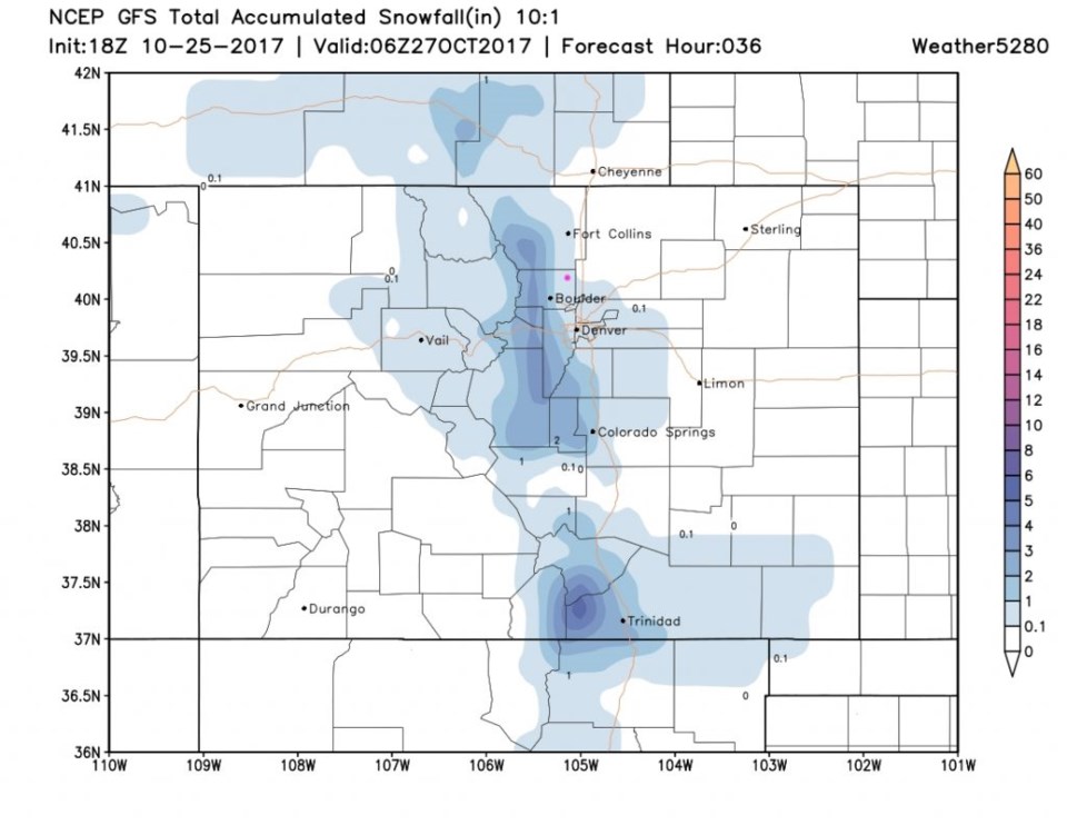
Estes Park might see 1-4" inches. Fort Collins to Berthoud to Longmont and to Denver are all generally in the Trace to 1" snow total area. The Palmer Divide might see 1-2" and 2-4" may pile up in the Front Range foothills.
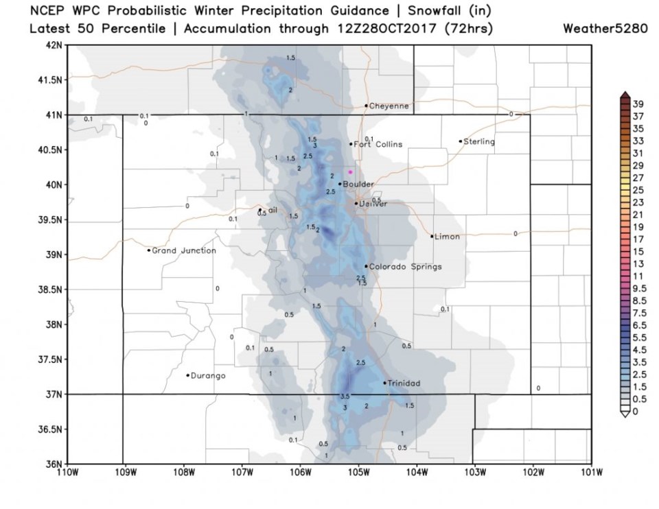
Figure 5 shows the peak of the storm, with it ramping up and ending in just a few hours either side of 5-6pm. Figure 6 is the GFS showing Longmont in the 0.1-1" snow total. Figure 7 is the WPC model take on it with Longmont in the 2nd grey coloration in 0.5-1.5" area.
The longer range forecast:
We warm to the low 70's by Sunday then another period of showers and maybe an evening of light snow is possible Sunday PM through Tuesday. More on this after our current storm clears!


