This content was originally published by the Longmont Observer and is licensed under a Creative Commons license.
Forecast Discussion:
I'm traveling again (I know!) so a brief update today... Some snow swept down the Front Range foothills and I-25 corridor. The CoCoRaHS reports come in at 7am local time, so I'll hop in and update this post to include notable (or not so notable) snowfall amounts in the morning.
** Longmont received a coating of snow at 0.1" - total water content w/rain was about 0.05" across the town.
Boulder received about 1-1.5", Estes Park about 1.5-2", Berthoud received a Trace, Fort Collins received a Trace, Denver received a Trace to an inch on the west side, The Palmer Divide picked up a Trace to an inch in places. **
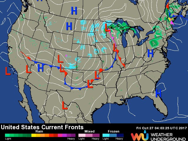
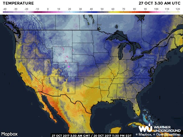
At 10pm Thursday evening (Figure 1) the front was clear of the state in the south and the small batch of falling snow was down in the SE corner. Temperatures were getting very chilly at that time as well (Figure 2).
In the longer range:
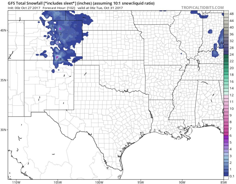
A pair of troughs in the upper air pattern will sweep over us (as northwest flow aloft continues, little fronts can hit at any time). The NWS and weatherunderground models show the Monday morning trough to be the more significant snow maker. Figure 3 is the total GFS snowfall total after the Thursday storm through Monday night. It looks more impressive than what we just experienced, still not a lot of snow. One other model (not shown since it is an outlier) has the Tuesday storm being a big snow maker... we'll see!
Halloween Forecast: Our old forecast had it warm and clear on Halloween. The models thought the jet stream would be a few hundred miles further north... now not so much.
With some clouds and a chance (15%) of rain/snow, Halloween may have a high of only 41F and a Low of 31F. At 7pm it should be about 34F with west breezes of about 3-6mph.