This content was originally published by the Longmont Observer and is licensed under a Creative Commons license.
Forecast Discussion:
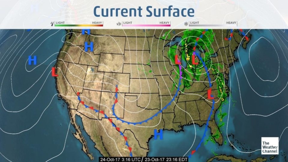
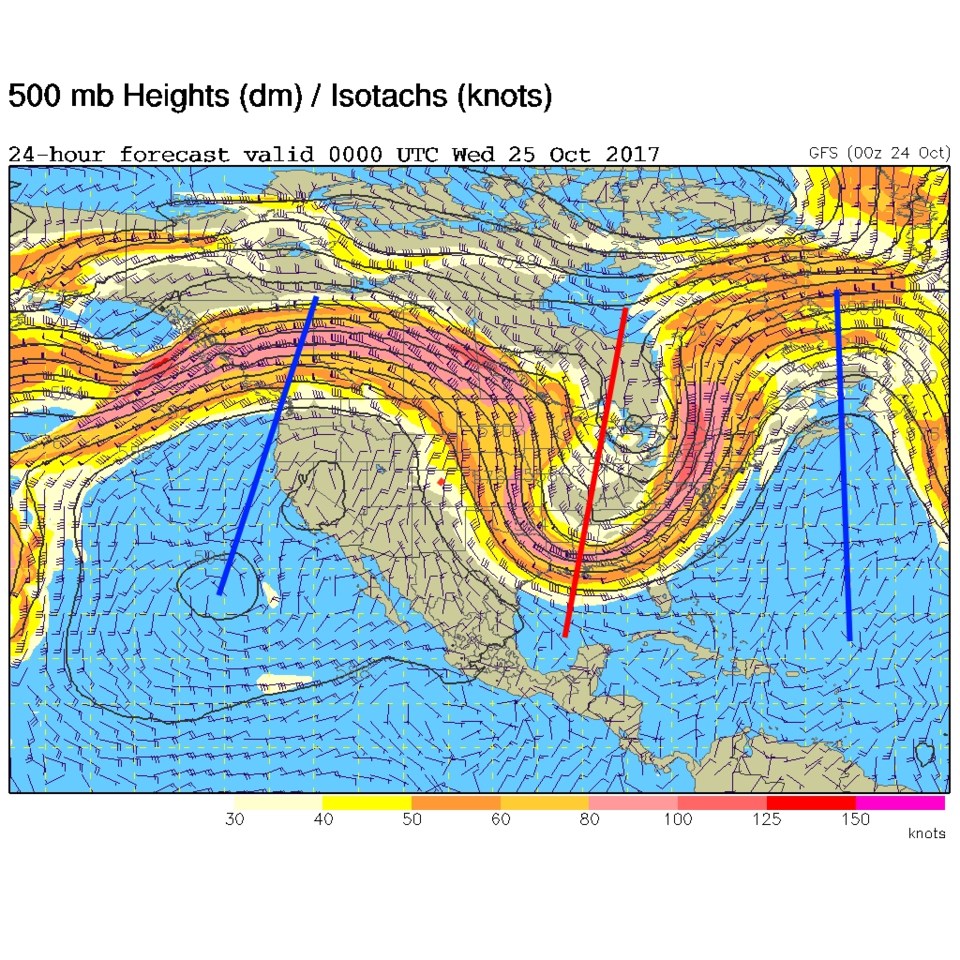
The front is past and warm air will return on the southern side of the jet stream (Figure 2) and from west of the stationary front just overhead (Figure 1). Things are very quiet again over Colorado as another warm up takes us to near 80F by Wednesday.
In the longer range:
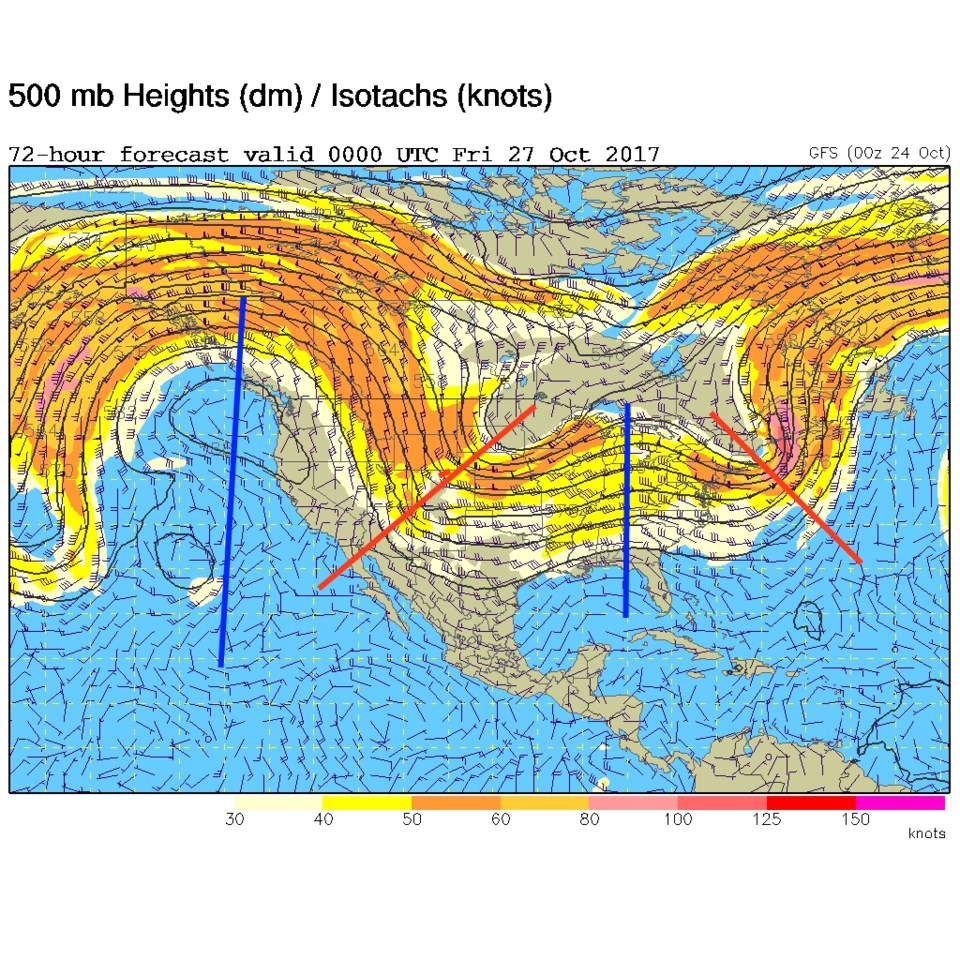
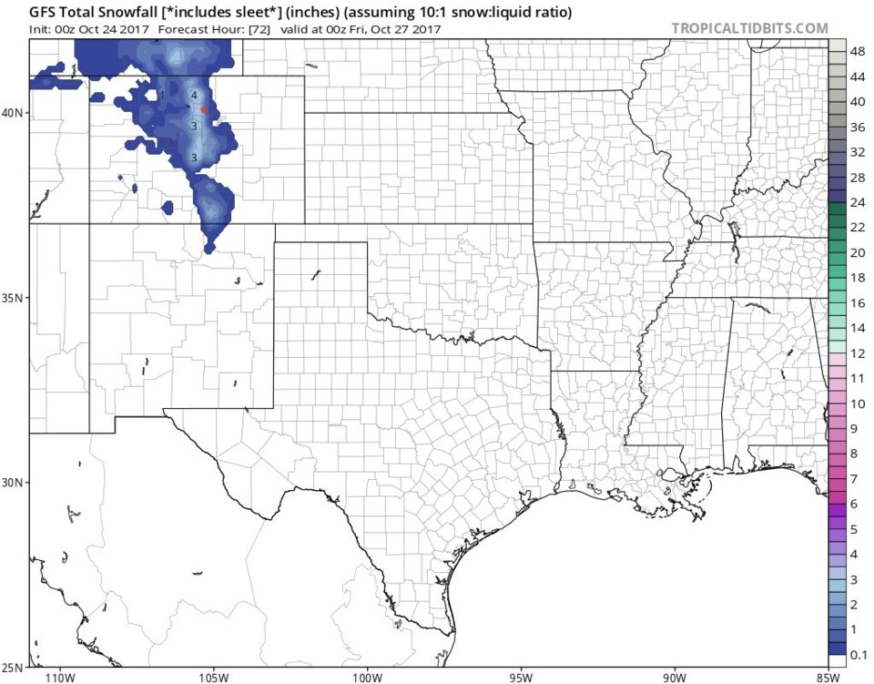
We are still watching the Thursday storm for cold air (starting in the morning bringing dropping temperatures all day, instead of the normal warm up to a high mid-afternoon) and potential snow. Figure 3 shows the buckling of the jet stream with cold air pushing southwest for just a day. The NWS is talking about only a brief mix of rain and snow along I-25 Thursday afternoon. The weatherunderground.com model is giving only a small chance of rain. The GFS in Figure 4 is giving us 3-4 inches of snow in a brief heavy shot.
The main takeaway is that it will be quite cold for one day. The amount of moisture is in question and hopefully will come into focus in another day of forecasting!