Skip to content

The Next Storm/Next Snow Forecast Discussion from the Cherrywood Observatory – October 22, 2017

This content was originally published by the Longmont Observer and is licensed under a Creative Commons license.

Forecast Discussion:

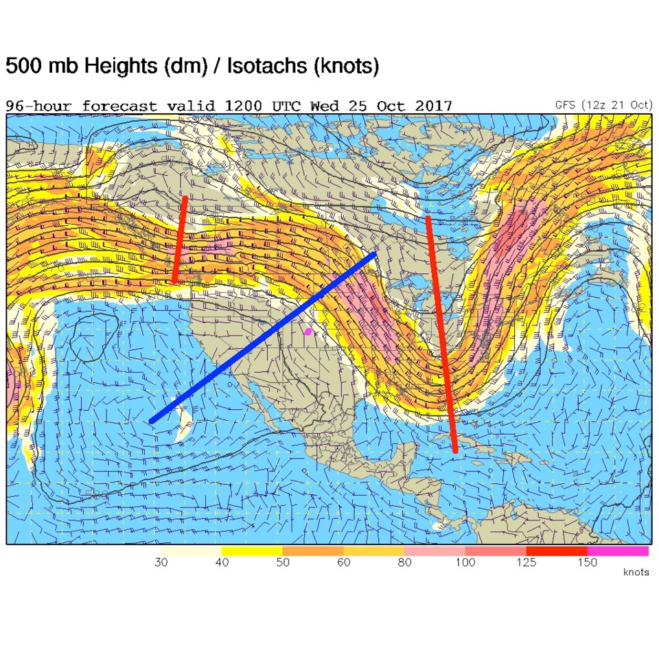
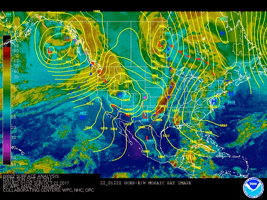
The cold front came through pre-dawn with blustery winds that faded out as Saturday went on.  We did warm up to 60F, which is about 5 degrees below normal.  Today (Sunday) we return to 71F which is 6 degrees above normal.  The front is way down into New Mexico and is off making severe weather in Oklahoma and North Texas (Figure 1). Behind the front, our temporary cold can be seen as the turquoise colors over our region.   The upper air pattern for Saturday PM (Figure 2) shows the trough (red line) past us already.

Figure 1: Saturday PM Infrared Satellite Image with surface analysis

Figure 2: Saturday PM 500mb upper air map with red lines in troughs, blue lines on ridges

In the longer range:

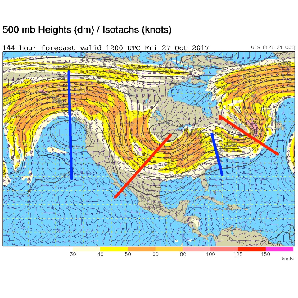
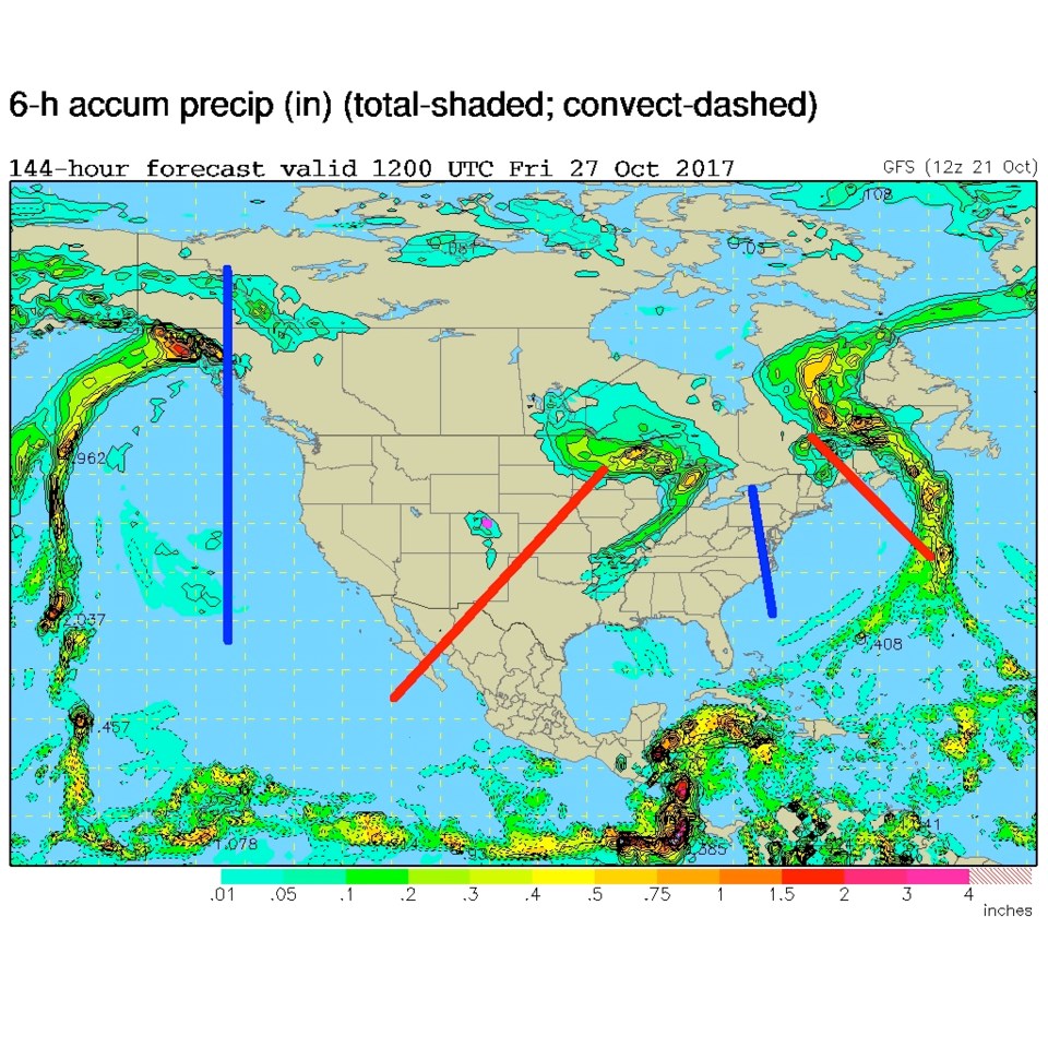
The western ridge, already present Saturday night in Figure 2, builds across the west and warms us up, but gives us northwest flow aloft. By Wednesday morning, we are well under the tilted ridge, but change is also on the map (Figure 3).   The shortwave trough over western Canada will come down and help back build our eastern US trough towards us (Figure 4) by Friday AM.  The surface map on Friday AM shows a small blob of moisture over the Front Range (Figure 5).  With the troughs and ridges on Figure 4 drawn on Figure 5, note that most of the precipitation is orientated with the troughs and on the right side of those troughs.  A neat bit of meteorology illustrated there!

A cool down, and somewhat better chance of moisture, is in the forecast for Thursday afternoon on into the weekend...

Figure 3: GFS forecasted 500mb upper air map Wednesday AM. Longmont is the pink dot as always.

Figure 4: GFS forecasted 500mb upper air map for Friday AM. Troughs and ridges are marked again.

Figure 5: GFS forecasted surface precipitation map for Friday AM. Troughs and ridges are marked again matching their positions in figure 4.

Current Weather

Snow

Snow

34°F

UV Index
0 Low
Pressure
30.21 Falling
Visibility
1 miles
Dewpoint
32 °F
Humidity
93%
Wind
ENE 1.1 mph
Gust
2.8 mph
Wind Chill
34 °F

Hourly Forecast

Today
4 AM
34°F
Mostly cloudy
Today
5 AM
34°F
Mostly cloudy
Today
6 AM
34°F
Cloudy
Today
7 AM
35°F
Cloudy
Today
8 AM
34°F
Intermittent clouds
Today
9 AM
35°F
Intermittent clouds
Today
10 AM
36°F
Intermittent clouds
Today
11 AM
38°F
Intermittent clouds
Today
12 PM
40°F
Intermittent clouds
Today
1 PM
41°F
Intermittent clouds
Today
2 PM
42°F
Cloudy
Today
3 PM
43°F
Cloudy

7 Day Forecast

Rain and snow

Thursday

37 °F

Cloudy and much colder; snow showers in the morning, accumulating a coating to an inch followed by brief showers in the afternoon


Showers

Thursday Night

34 °F

Mostly cloudy with a brief shower or two late


Mostly cloudy w/ showers

Friday

43 °F

Chilly with some sun, then turning cloudy; a little rain this afternoon


Rain and snow

Friday Night

32 °F

Periods of snow; rain mixed in early, accumulating an inch or two


Flurries

Saturday

40 °F

A bit of morning snow with little or no accumulation; otherwise, cloudy and chilly; storm total snowfall an inch or two


Intermittent clouds

Saturday Night

31 °F

Partly cloudy


Partly sunny

Sunday

64 °F

Partly sunny, pleasant and warmer


Partly cloudy

Sunday Night

41 °F

Partly cloudy


Intermittent clouds

Monday

79 °F

Warmer with a blend of sun and clouds


Partly cloudy

Monday Night

36 °F

Partly cloudy


Sunrise and Sunset

Sunrise
6:17 AM
Sunset
7:43 PM

Based on AccuWeather data