Skip to content

The Next Storm/Next Snow Forecast Discussion from the Cherrywood Observatory – October 16, 2017

This content was originally published by the Longmont Observer and is licensed under a Creative Commons license.

Forecast Discussion:

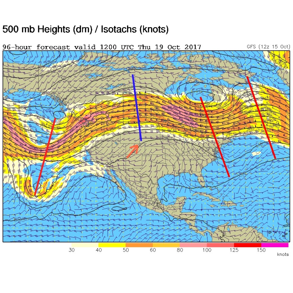
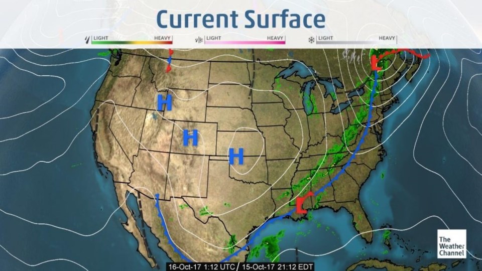
I won't take too much of your time when things are so quiet. A big high pressure system has settled over the region.  Cool lower level air is very stable so no 'weather' has happened nearby (Figure 1). The upper air pattern from Sunday PM shows the approaching ridge that will track slowly across the Western US this week.  We have dry northwest flow for the next few days (Figure 2).

Figure 1: Current surface analysis from Sunday PM.

Figure 2: Upper air 500mb analysis from Sunday PM. The northwest flow orange arrow shouldn't have a blue arrow head stem. Oops.

The Longer Range Forecast:

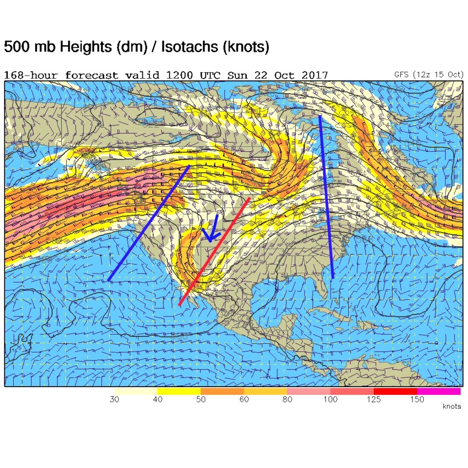
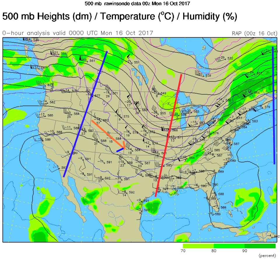
By Thursday morning (Figure 3) the ridge is passing us and we have dry southwest flow.  Temperatures Tuesday and Thursday/Friday may get quite close to 80F. Figure 4 is the GFS's take on next weekend where a trough finally replaces our ridge (which is over the Great Lakes by this time). Other models show an earlier arrival of trough and storm Friday/Saturday rather than Saturday/Sunday.

Figure 3: The Thursday AM 500mb forecast from the GFS. Darn program was changing colors on me a lot... the ridge off in the Atlantic should be a blue line. Troughs are red lines.

Figure 4: The Sunday AM 500mb forecast from the GFS.

Current Weather

Mostly cloudy

Mostly cloudy

49°F

UV Index
1 Low
Pressure
29.89 Falling
Visibility
7 miles
Dewpoint
44 °F
Humidity
83%
Wind
NW 1.1 mph
Gust
2.1 mph
Wind Chill
49 °F

Hourly Forecast

Today
8 AM
48°F
Intermittent clouds
Today
9 AM
54°F
Partly sunny
Today
10 AM
60°F
Intermittent clouds
Today
11 AM
68°F
Intermittent clouds
Today
12 PM
75°F
Intermittent clouds
Today
1 PM
77°F
Intermittent clouds
Today
2 PM
75°F
Thunderstorms
Today
3 PM
73°F
Cloudy
Today
4 PM
73°F
Cloudy
Today
5 PM
72°F
Cloudy
Today
6 PM
68°F
Cloudy
Today
7 PM
65°F
Cloudy

7 Day Forecast

Mostly cloudy w/ t-storms

Thursday

77 °F

Turning cloudy, warm; breezy, a stray thunderstorm this afternoon


Thunderstorms

Thursday Night

47 °F

A thunderstorm in spots this evening; otherwise, considerable cloudiness


Thunderstorms

Friday

69 °F

Mostly cloudy and not as warm with a couple of thundershowers


Thunderstorms

Friday Night

44 °F

Cloudy with a couple of thundershowers


Rain

Saturday

46 °F

Chilly with periods of rain and a thunderstorm


Rain and snow

Saturday Night

39 °F

Cloudy with rain, mixed with a little snow late


Mostly cloudy

Sunday

59 °F

Mostly cloudy and warmer; a stray afternoon thundershower


Partly cloudy

Sunday Night

36 °F

Partly cloudy


Mostly sunny

Monday

71 °F

Mostly sunny and warmer


Partly cloudy

Monday Night

39 °F

Partly cloudy


Sunrise and Sunset

Sunrise
6:07 AM
Sunset
7:50 PM

Based on AccuWeather data