Skip to content

The Next Storm/Next Snow Forecast Discussion from the Cherrywood Observatory – October 15, 2017

This content was originally published by the Longmont Observer and is licensed under a Creative Commons license.

Forecast Discussion:

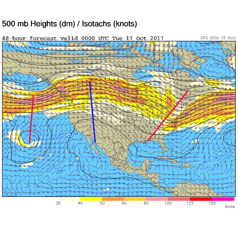
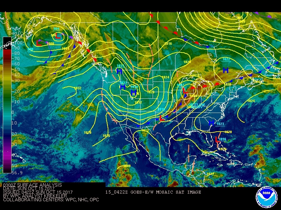
We enter a long quiet week after the 30-45mph+ wind gusts with Saturday's frontal passage. There was even a brief period of snow showers in the northern Colorado Rockies as the front came down. Figure 1 shows the late-night Saturday surface map and infrared/temperature background.  The high pressure center over Idaho and western Wyoming has a large shield of green colored cold air that covers Colorado right up to the front to our south.

Figure 1: Infrared satellite image from late Saturday PM and surface analysis.

In the longer range forecast:

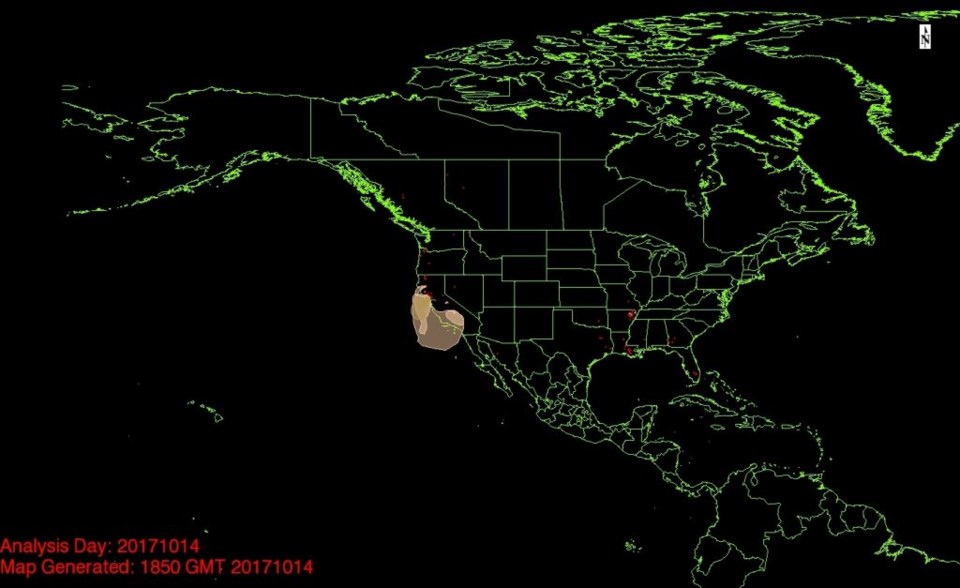
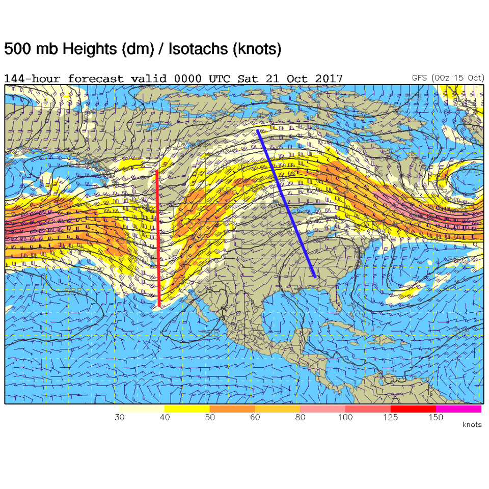
A ridge builds over the western US (Figure 2) and the jet stream retreats to the north.  Quiet and seasonal weather will be the norm. The smoke (Figure 3) is also gone to the south and mixed out.  This high will fan flames in California again, like the first front that did so much damage, indirectly.

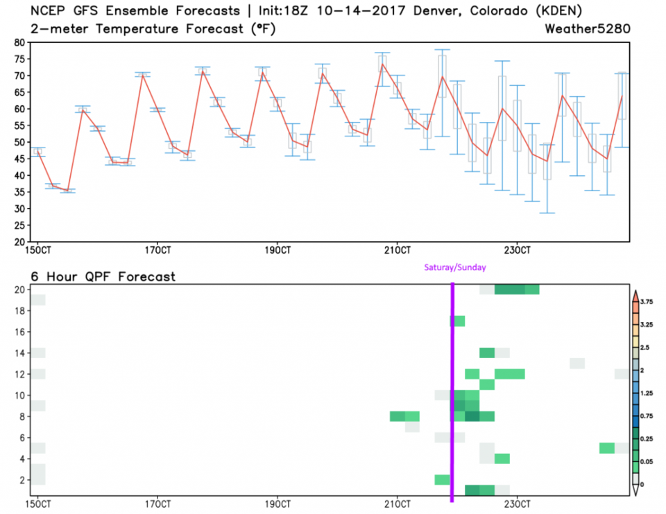
Figure 4 is is the forecast graph of temperatures and precipitation (from many different runs of the model-in the lower frame). The rain chances are lining up better across the runs for Saturday/Sunday next weekend.  Temperatures remain above freezing then, so snow does not seem likely. Figure 5 is the upper air pattern for Friday night that shows the approaching West Coast front that might bring rain to the fires out there, and rain to us later in the weekend next week.

Figure 2: 500mb upper air forecast map from the GFS for Monday PM.

Figure 3: The NOAA smoke observation map.

Figure 4: The 10 day forecast with ensemble precipitation from the GFS from weather5280.com

Figure 5: 500mb upper air forecast map from the GFS for Friday PM.

Current Weather

Sunny

Sunny

74°F

UV Index
2 Low
Pressure
29.89 Falling
Visibility
7 miles
Dewpoint
42 °F
Humidity
32%
Wind
NNE 3.3 mph
Gust
7.6 mph
Wind Chill
74 °F

Hourly Forecast

Today
7 PM
69°F
Mostly sunny
Today
8 PM
65°F
Intermittent clouds
Today
9 PM
62°F
Mostly cloudy
Today
10 PM
58°F
Mostly cloudy
Today
11 PM
56°F
Mostly cloudy
Tomorrow
12 AM
53°F
Intermittent clouds
Tomorrow
1 AM
51°F
Partly cloudy
Tomorrow
2 AM
48°F
Mostly clear
Tomorrow
3 AM
46°F
Mostly clear
Tomorrow
4 AM
44°F
Clear
Tomorrow
5 AM
43°F
Mostly clear
Tomorrow
6 AM
41°F
Mostly clear

7 Day Forecast

Mostly sunny

Wednesday

75 °F

Mostly sunny, pleasant and warmer


Partly cloudy

Wednesday Night

41 °F

Patchy clouds


Mostly cloudy w/ t-storms

Thursday

75 °F

Turning cloudy, warm; breezy, a thunderstorm around in the afternoon


Thunderstorms

Thursday Night

49 °F

A thunderstorm in spots in the evening; otherwise, considerable cloudiness


Showers

Friday

70 °F

Mostly cloudy with a couple of showers


Thunderstorms

Friday Night

46 °F

Cloudy with showers and thunderstorms


Rain

Saturday

50 °F

Chilly with periods of rain


Rain and snow

Saturday Night

39 °F

Cloudy with rain, mixed with a little snow late


Mostly cloudy

Sunday

59 °F

Mostly cloudy with a stray thundershower in the afternoon


Partly cloudy

Sunday Night

36 °F

Partly cloudy


Sunrise and Sunset

Sunrise
6:08 AM
Sunset
7:49 PM

Based on AccuWeather data