Skip to content

The Next Storm/Next Snow Forecast Discussion from the Cherrywood Observatory – October 14, 2017

This content was originally published by the Longmont Observer and is licensed under a Creative Commons license.

Forecast Discussion:

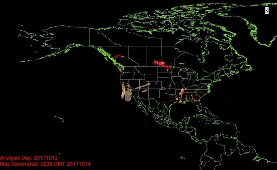
Our temperatures dropped on Friday the 13th, and, unfortunately for all, some of the smoke from northern California trekked across the western US and made visibility drop.  I clearly smelled the smoke for an hour or two outside.  As the sun set, the mountains were definitely obscured.  Figure 1 is a smoke analysis from NOAA showing the thin tongue of smoke that was headed our way.  It isn't very extensive and the next front should push it to the south on Saturday with our yet cooler and gustier air.

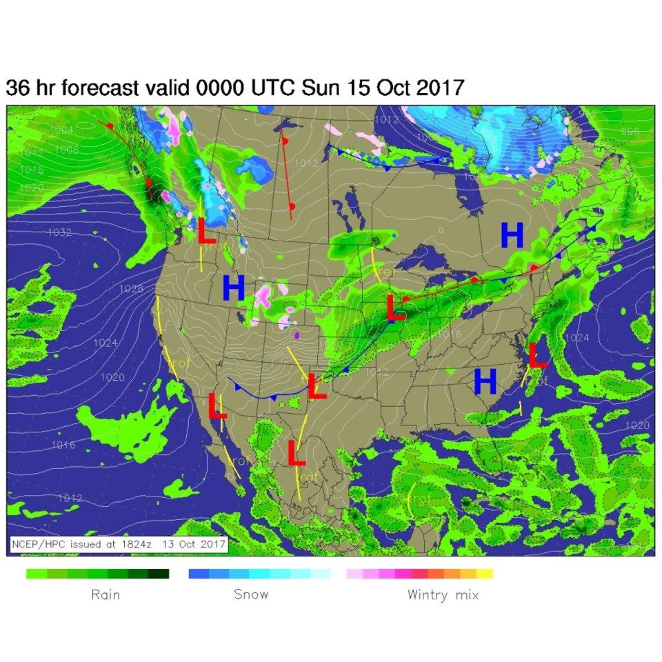
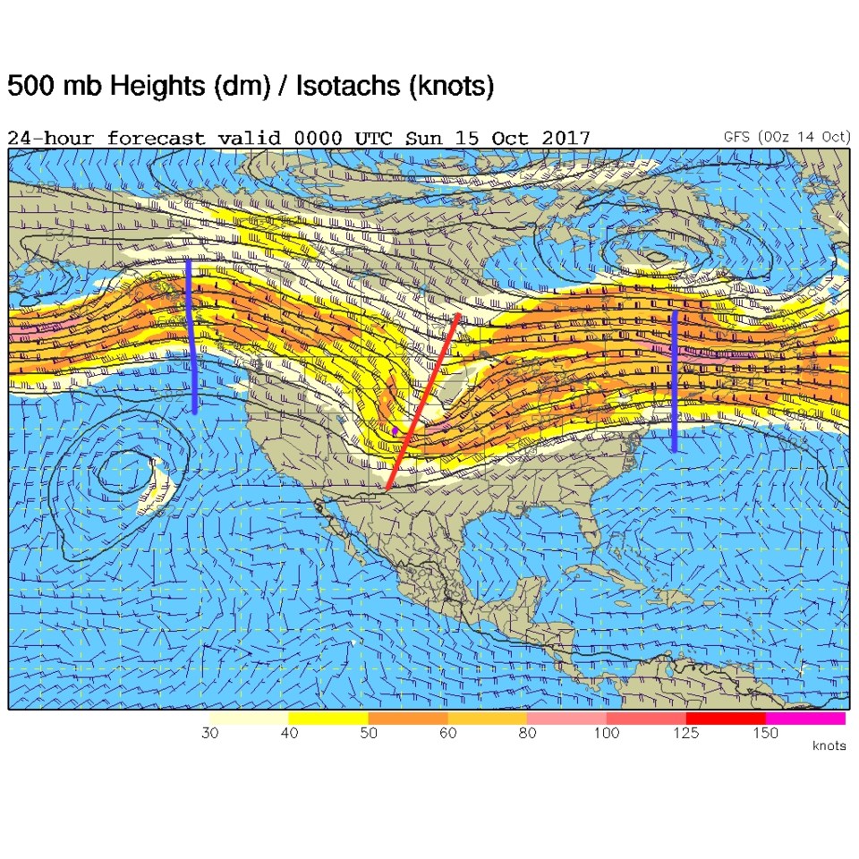
Figure 2 shows our front pushing far south of the state by Saturday PM. The tight lines (yellow) over Colorado means there is a strong pressure gradient.  That is where the winds come from. Figure 3 is the upper air chart at that time and the trough is just past us later Saturday.  The back side of a trough often has sinking air - so we won't see any rain chances at all by evening.

Figure 1: Actual Analysis from http://www.ospo.noaa.gov/data/land/fire/currenthms.jpg

Figure 2: The NCEP surface analysis forecast for Saturday PM.

Figure 3: The forecast 500mb upper air map for Sat PM. Troughs are red lines, ridges are blue lines.

In the longer range:

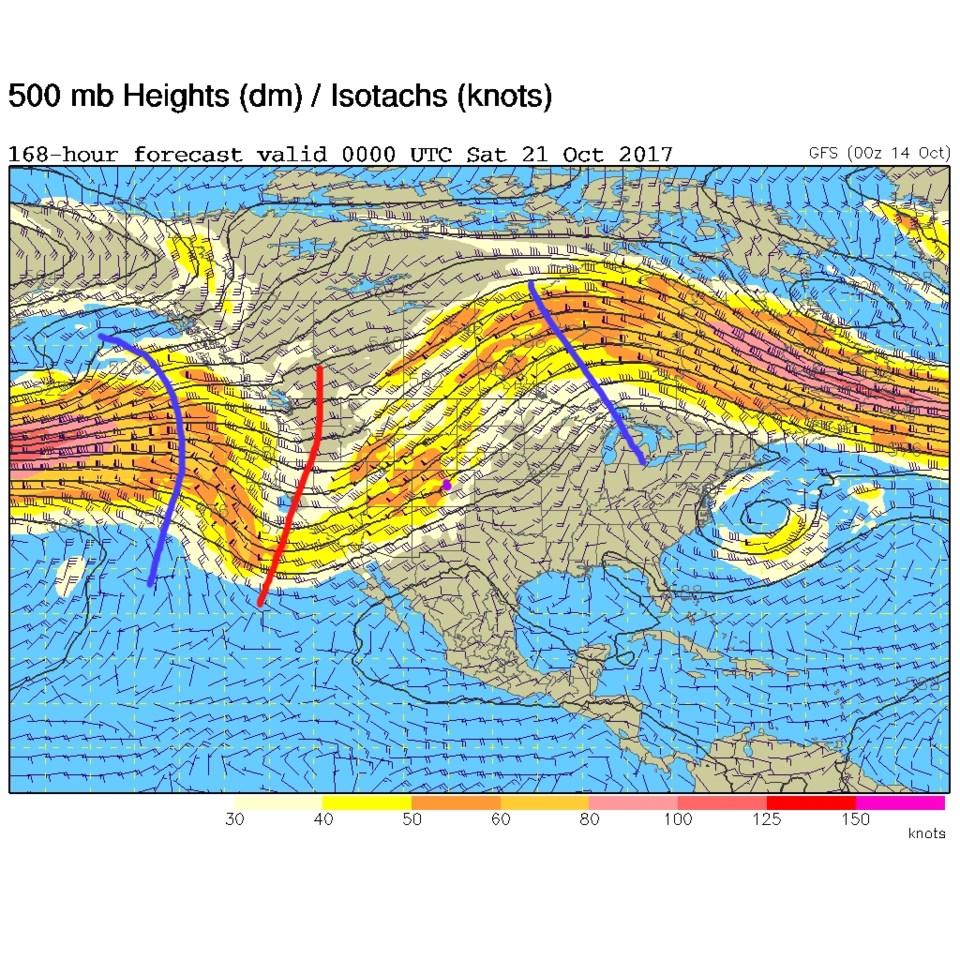
A ridge dominates the weather from Sunday to Thursday. By Friday this week, a much bigger west coast trough begins to approach (the distance between the blue ridge axes is narrower than the width of the U.S. - so these features will move to the east) giving us a chance of rain around Saturday - a week from now.  Mild weather is the story (non-story) for the week.

Figure 4: The forecast 500mb upper air map for Fri PM. Troughs are red lines, ridges are blue lines.

Current Weather

Clear

Clear

43°F

UV Index
0 Low
Pressure
29.93 Rising
Visibility
8 miles
Dewpoint
30 °F
Humidity
61%
Wind
NE 2.8 mph
Gust
6 mph
Wind Chill
42 °F

Hourly Forecast

Today
5 AM
37°F
Mostly cloudy
Today
6 AM
35°F
Mostly cloudy
Today
7 AM
38°F
Mostly cloudy
Today
8 AM
42°F
Mostly sunny
Today
9 AM
47°F
Mostly sunny
Today
10 AM
51°F
Mostly sunny
Today
11 AM
55°F
Mostly sunny
Today
12 PM
58°F
Mostly sunny
Today
1 PM
60°F
Partly sunny
Today
2 PM
62°F
Intermittent clouds
Today
3 PM
63°F
Mostly cloudy
Today
4 PM
64°F
Mostly cloudy

7 Day Forecast

Intermittent clouds

Thursday

64 °F

A blend of sun and clouds; breezy this afternoon


Mostly cloudy

Thursday Night

35 °F

Mostly cloudy


Partly sunny

Friday

68 °F

Increasingly windy with partial sunshine


Partly cloudy

Friday Night

38 °F

Partly cloudy


Partly sunny

Saturday

66 °F

Partial sunshine


Mostly clear

Saturday Night

41 °F

Clear to partly cloudy


Mostly cloudy

Sunday

78 °F

Rather cloudy and warmer; windy in the afternoon


Intermittent clouds

Sunday Night

43 °F

Partly cloudy; windy late


Mostly cloudy

Monday

60 °F

Mostly cloudy, breezy and cooler


Mostly cloudy

Monday Night

43 °F

Mostly cloudy


Sunrise and Sunset

Sunrise
5:58 AM
Sunset
7:57 PM

Based on AccuWeather data