Skip to content

The Next Storm/Next Snow Forecast Discussion from the Cherrywood Observatory – November 8, 2017

This content was originally published by the Longmont Observer and is licensed under a Creative Commons license.

Forecast Discussion:

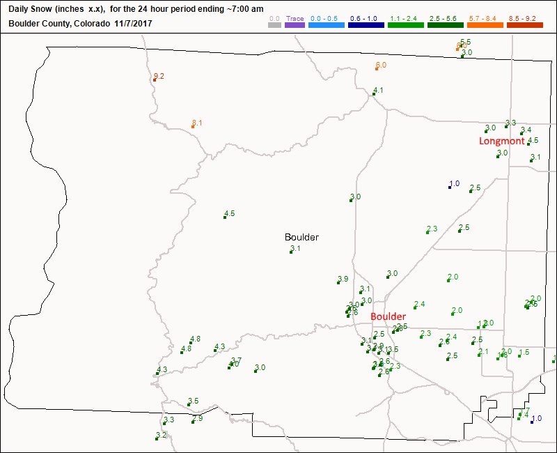
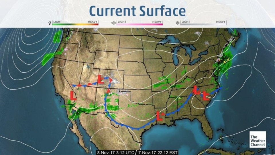
As this is being written, Tuesday later at night, a short wave is creating lift and a bit more snow for Colorado. The bonus graphic (Figure 6) shows that the morning front and first short wave gave our town 3-4" of snow, a bit more than I forecasted.  Figure 1 is the surface analysis from Tuesday PM - and the front is draped over the southwestern reaches of the state.  Snow is streaming off the front to the east.

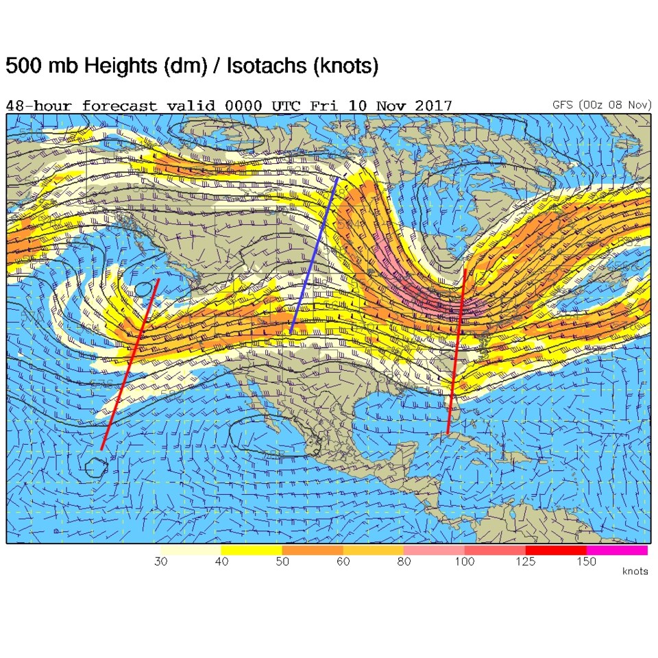
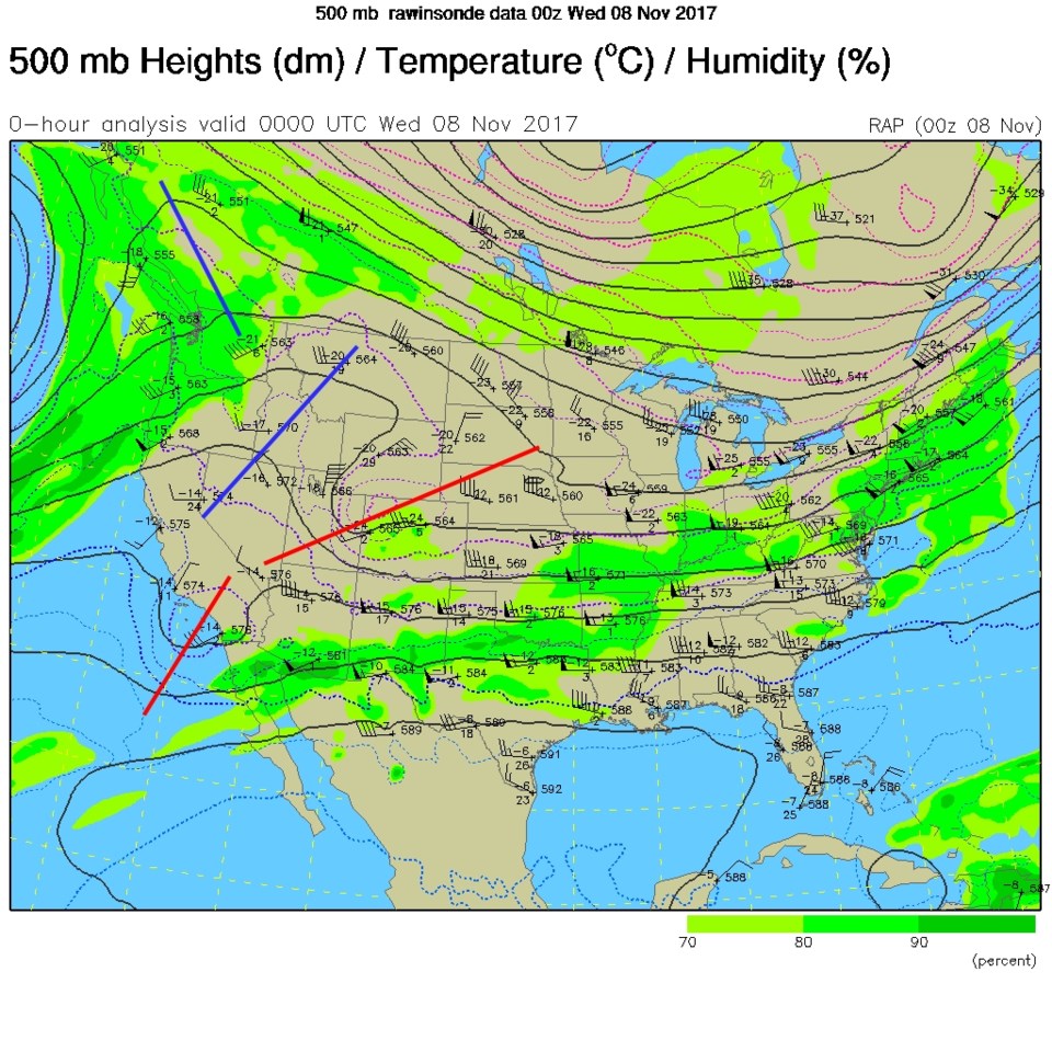
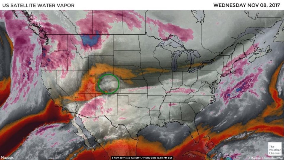
The 'short wave' mentioned above is visible in Figure 2 as the red line leaning over our state.  When it passes over, the precipitation chances will end before morning breaks on Wednesday. (But fog may break out too).  Figure 3 is the water vapor image (long time, no see) and that short wave is creating the visible patch of uplifted moist air circled in green.

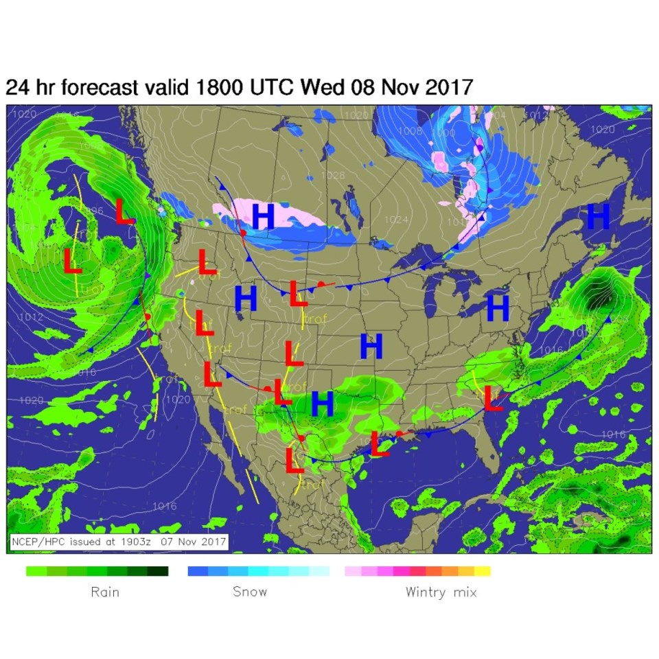
For midday Wednesday, Figure 4 shows that the front is long gone to the south and southeast into New Mexico and Texas leaving us high and dry (after that locally thick morning fog burns off).

Figure 1: Surface analysis map from Tuesday PM.

Figure 2: 500mb upper air analysis map from Tuesday PM.

Figure 3: Water Vapor satellite image from Tuesday PM (whites and purples are moist, browns, reds, and oranges are dry). The green circle is an area of lift Tuesday PM.

Figure 4: The NCEP forecast surface analysis map for Wednesday midday.

In the longer range forecast:

Ridging in the upper air pattern returns (Figure 5), and we get quiet and quite seasonal as far as temperatures go (just 5 degrees or so below normal). Right now, there is no significant snow or rain in the 10 day forecast.

Figure 5: the GFS forecast upper air 500mb analysis map for Thursday PM (troughs in red, ridge in blue).

Figure 6: The new snowfall from 7am MT Tuesday for Boulder county from CoCoRaHS.

Current Weather

Mostly sunny

Mostly sunny

74°F

UV Index
3 Moderate
Pressure
29.91 Falling
Visibility
10 miles
Dewpoint
42 °F
Humidity
31%
Wind
E 2.2 mph
Gust
9.3 mph
Wind Chill
74 °F

Hourly Forecast

Today
5 PM
75°F
Mostly sunny
Today
6 PM
72°F
Mostly sunny
Today
7 PM
69°F
Mostly sunny
Today
8 PM
66°F
Intermittent clouds
Today
9 PM
62°F
Mostly cloudy
Today
10 PM
58°F
Mostly cloudy
Today
11 PM
56°F
Mostly cloudy
Tomorrow
12 AM
53°F
Intermittent clouds
Tomorrow
1 AM
51°F
Partly cloudy
Tomorrow
2 AM
48°F
Mostly clear
Tomorrow
3 AM
46°F
Mostly clear
Tomorrow
4 AM
44°F
Clear

7 Day Forecast

Mostly sunny

Wednesday

76 °F

Mostly sunny, pleasant and warmer


Partly cloudy

Wednesday Night

41 °F

Patchy clouds


Mostly cloudy w/ t-storms

Thursday

75 °F

Turning cloudy, warm; breezy, a thunderstorm around in the afternoon


Thunderstorms

Thursday Night

49 °F

A thunderstorm in spots in the evening; otherwise, considerable cloudiness


Showers

Friday

70 °F

Mostly cloudy with a couple of showers


Thunderstorms

Friday Night

46 °F

Cloudy with showers and thunderstorms


Rain

Saturday

50 °F

Chilly with periods of rain


Rain and snow

Saturday Night

39 °F

Cloudy with rain, mixed with a little snow late


Mostly cloudy

Sunday

59 °F

Mostly cloudy with a stray thundershower in the afternoon


Partly cloudy

Sunday Night

36 °F

Partly cloudy


Sunrise and Sunset

Sunrise
6:08 AM
Sunset
7:49 PM

Based on AccuWeather data