This content was originally published by the Longmont Observer and is licensed under a Creative Commons license.
Forecast Discussion:
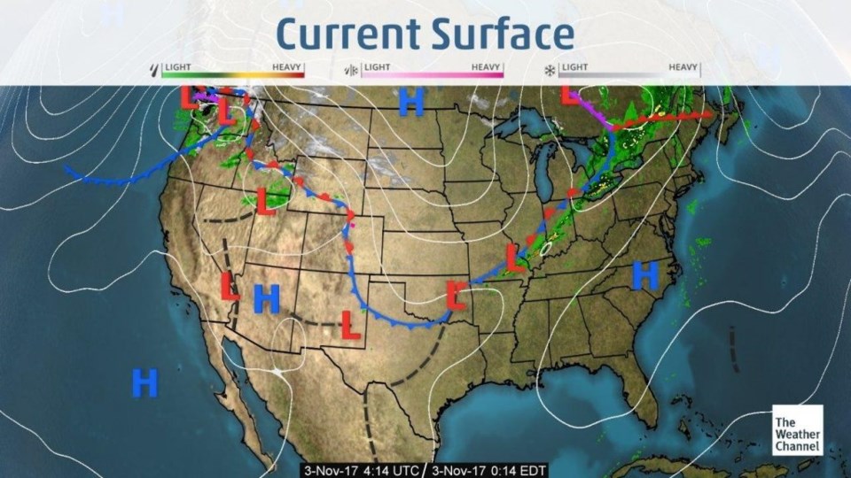
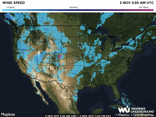
Figure 1 shows the front that pressed into Colorado on Thursday. That put low clouds and a few periods of mist in place for most of Thursday. Figure 2 shows that the wind speeds at the surface had dropped to much lower levels than the day before.
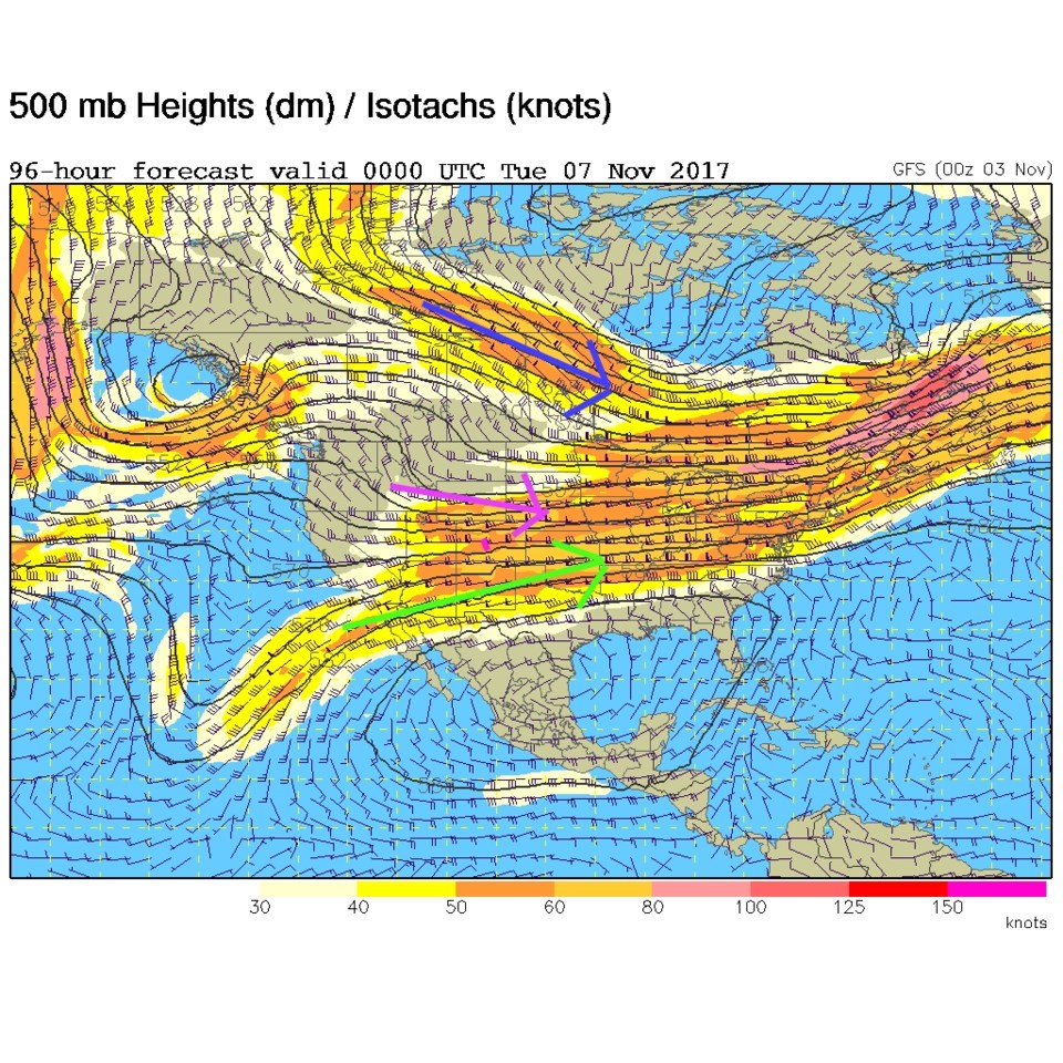
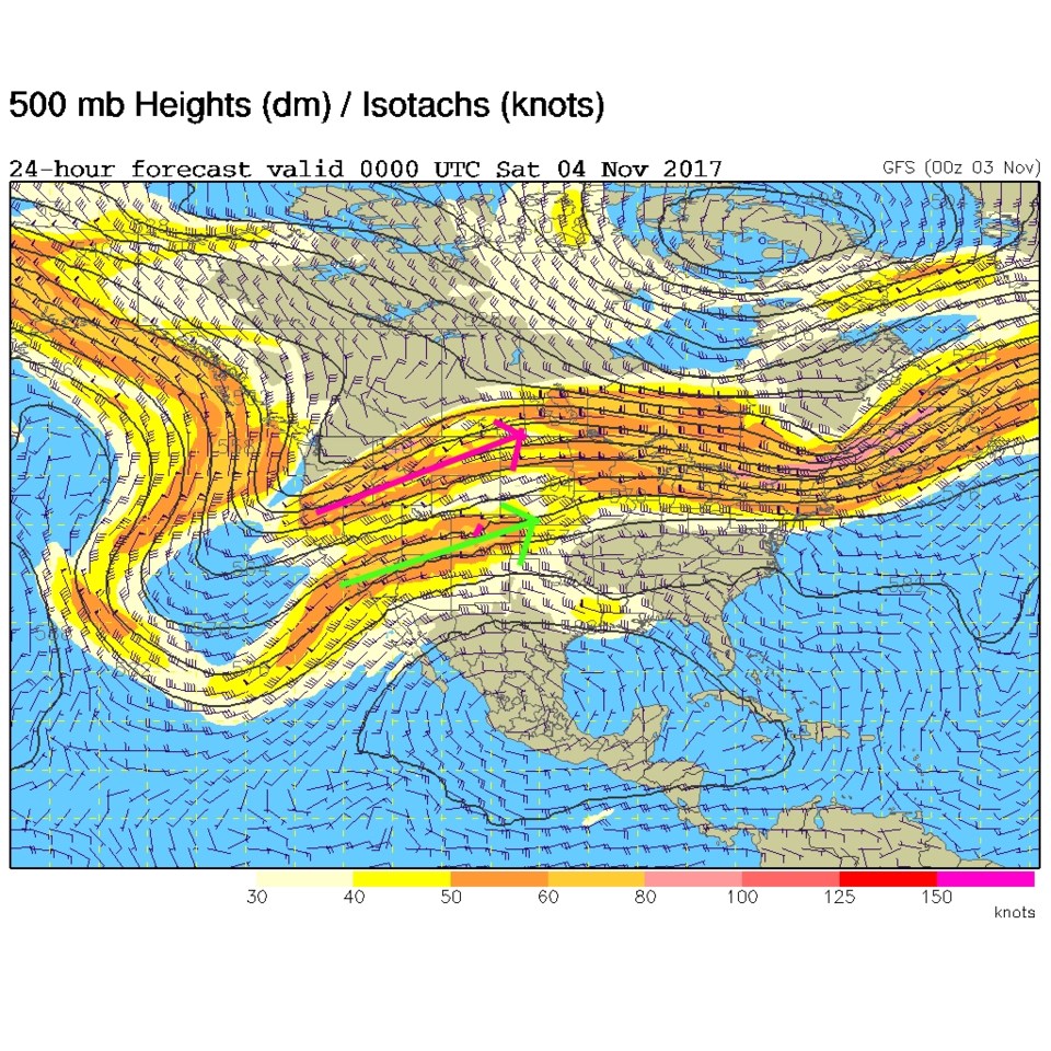
Still, the jet stream is nearby. The southern branch of the jet is overhead and the northern branch is a state further north (Figure 3). We expect the surface front to get pushed out and will see a return of strong surface westerlies that dump snow on the western slopes and create down slope winds and heating into Saturday.
The longer range forecast:
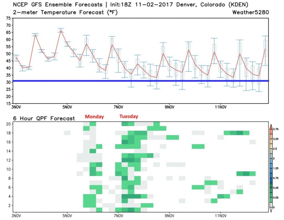
The weather5280.com GFS graph (Figure 4) shows the weekend warmth and the dropping of temperatures into early next week. Some models give us morning and evening snow chances on Tuesday, but this run of the GFS does not. Temperatures only approach freezing. Maybe local cooling in heavier precipitation at the end of the Tuesday rain chances will turn to snow. Figure 5 is the upper air map again for Monday PM and the jet streams have moved south... but there isn't a big trough rolling through. Other models have both lesser impacts and a more extended Sunday PM to Tuesday PM chance of rain. We'll have to wait until we get a bit closer to know for sure. Enjoy the warmth in the meantime, but tie down your lawn furniture and trash cans again.