Skip to content

The Next Storm/Next Snow Forecast Discussion from the Cherrywood Observatory – November 2, 2017

This content was originally published by the Longmont Observer and is licensed under a Creative Commons license.

Forecast Discussion:

Other than wind, we are between systems right now, there isn't much to dwell on, so I'll be brief.

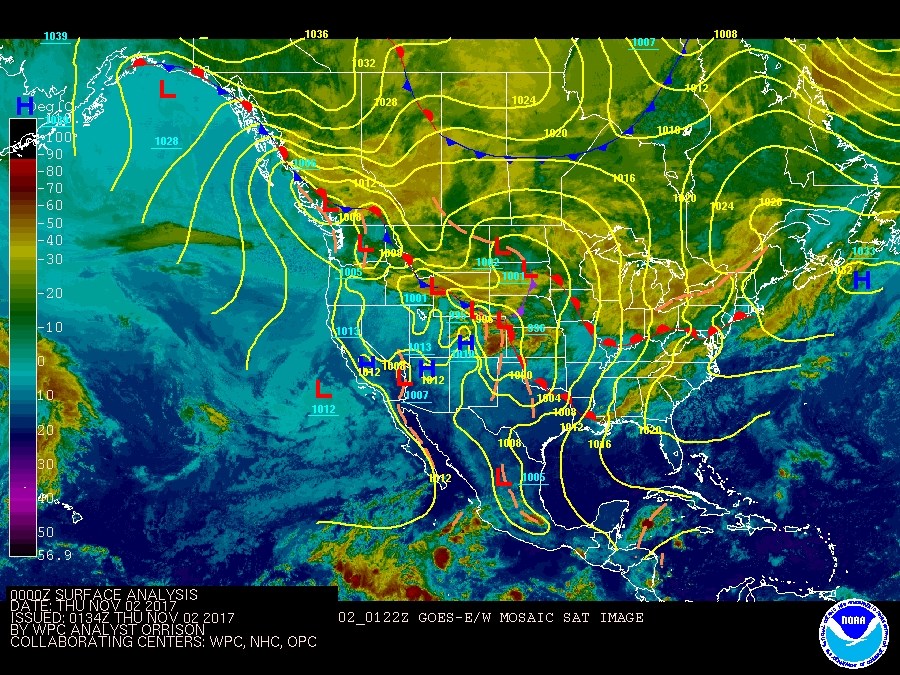
The infrared satellite image in Figure 1 shows the colder temperatures (yellows and greens in this image) and clouds north of the big frontal boundary draped across the continent.  We are 'just' south of that in warmer temperatures (more aqua, teal and blue in this image).

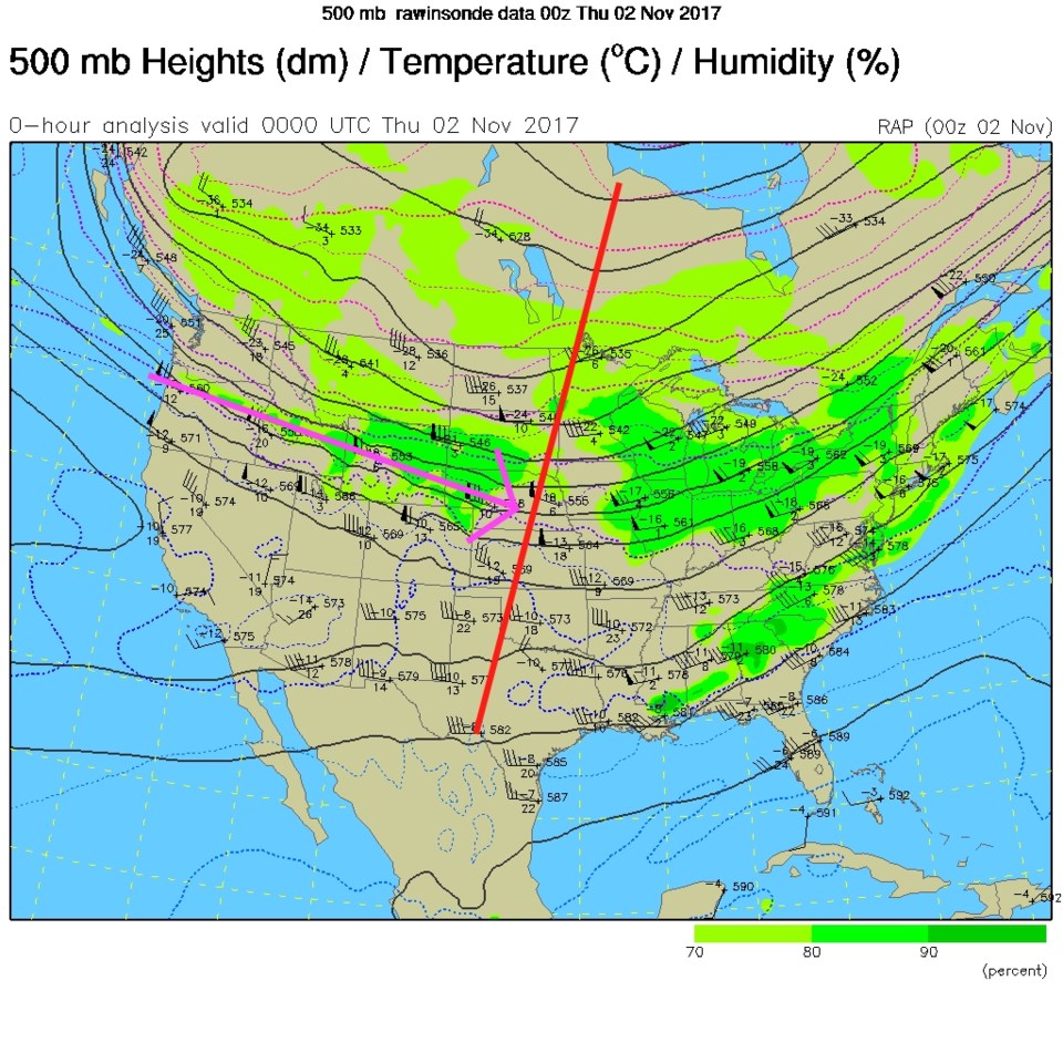
Figure 2 shows the broad trough with the center of the jet stream flow skirting north of the state.  Wind speeds today in some mountain passes and up in Wyoming topped 100mph.  There were high wind warnings up there today.  I didn't note it yesterday because Longmont only received enough wind to knock over trash cans now and then.

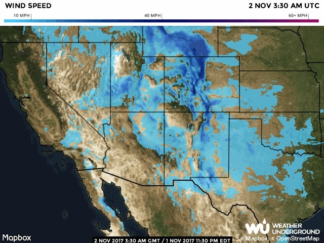
We warmed to 71F with the down-slope winds today.  This will occur now and then this week (with Thursday looking calmer and cooler with a weak cool front).  Figure 3 shows those mountain winds later on Wednesday.

Figure 1: The infrared satellite image with surface analysis Wednesday PM>

Figure 2: The 500mb upper air map for Wednesday PM.

Figure 3: The evening wind speed map for Colorado Wednesday PM.

In the longer range forecast:

We'll revisit the storminess and colder weather slated for the end of the weekend and beginning of next week as it gets closer.

Current Weather

Light rain

Light rain

36°F

UV Index
1 Low
Pressure
30.21 Steady
Visibility
6 miles
Dewpoint
33 °F
Humidity
91%
Wind
N 3.9 mph
Gust
6.7 mph
Wind Chill
33 °F

Hourly Forecast

Today
11 AM
37°F
Flurries
Today
12 PM
38°F
Intermittent clouds
Today
1 PM
39°F
Intermittent clouds
Today
2 PM
40°F
Cloudy
Today
3 PM
41°F
Cloudy
Today
4 PM
42°F
Cloudy
Today
5 PM
40°F
Cloudy
Today
6 PM
39°F
Rain
Today
7 PM
38°F
Rain
Today
8 PM
37°F
Cloudy
Today
9 PM
35°F
Flurries
Today
10 PM
35°F
Cloudy

7 Day Forecast

Rain and snow

Friday

42 °F

Chilly with some sun, then turning cloudy; a couple of showers of rain or snow this morning followed by a little rain this afternoon


Rain and snow

Friday Night

32 °F

Periods of snow; rain mixed in early, accumulating 1-3 inches; roads could be slippery


Flurries

Saturday

39 °F

A bit of morning snow with little or no accumulation; otherwise, cloudy and chilly; storm total snowfall 1-3 inches


Intermittent clouds

Saturday Night

31 °F

A shower in places in the evening; otherwise, partly cloudy


Partly sunny

Sunday

64 °F

Partly sunny, pleasant and warmer


Mostly clear

Sunday Night

41 °F

Mainly clear


Intermittent clouds

Monday

79 °F

Warmer with a blend of sun and clouds


Partly cloudy

Monday Night

36 °F

Partly cloudy


Mostly cloudy

Tuesday

64 °F

Mostly cloudy and cooler


Mostly cloudy

Tuesday Night

40 °F

Mostly cloudy


Sunrise and Sunset

Sunrise
6:15 AM
Sunset
7:44 PM

Based on AccuWeather data