Skip to content

The Next Storm/Next Snow Forecast Discussion from the Cherrywood Observatory – November 14, 2017

This content was originally published by the Longmont Observer and is licensed under a Creative Commons license.

Forecast Discussion:

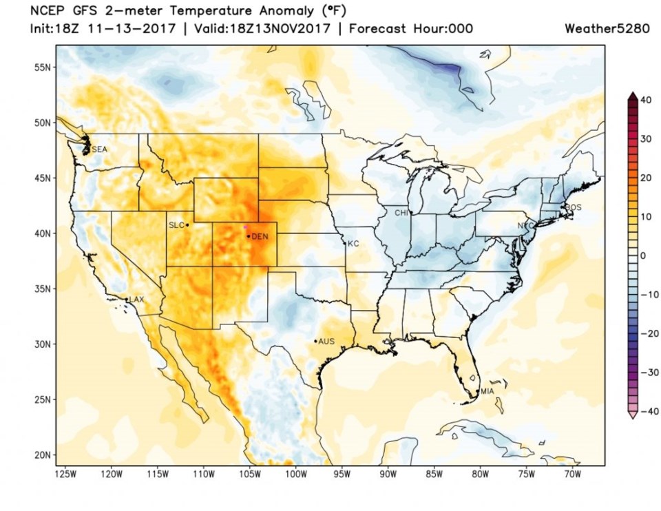
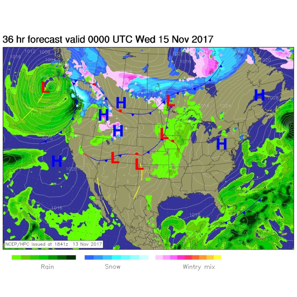
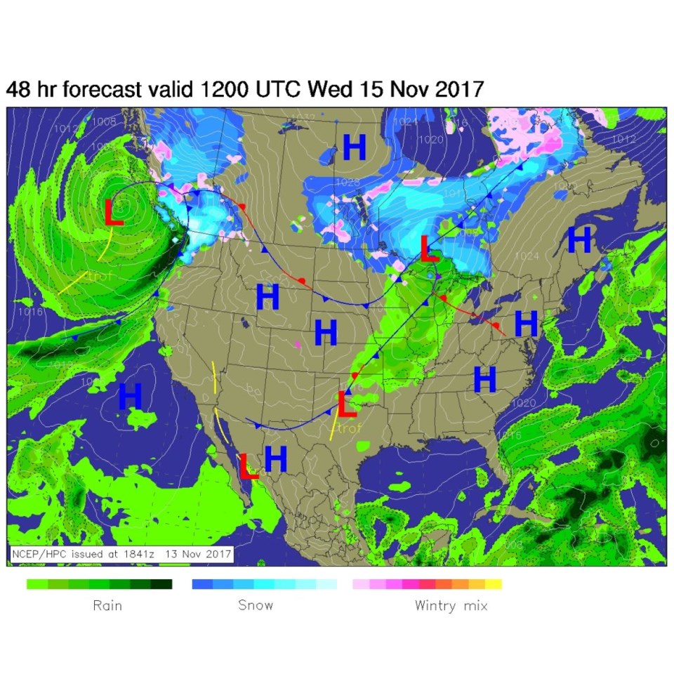
While incredibly awesome weather rolls on, we finally have a storm to focus on.  But first the amazing warmth Monday can be seen in Figure 1 - oranges are how 'above average' the temperatures were. Longmont is around 15F up.  We'll be nice again today (Tuesday) but a dry cool front is on the way.  Figure 2 shows the front just past Longmont 6pm Tuesday.  Figure 3 has the front far to the south by 6am Wednesday.  Note, there is no precipitation to be seen.

Figure 1: The departure from normal surface temperatures from Monday evening.

Figure 2: The NCEP surface analysis forecast for Tuesday PM.

Figure 3: The NCEP surface analysis forecast for Wednesday AM.

The longer range forecast:

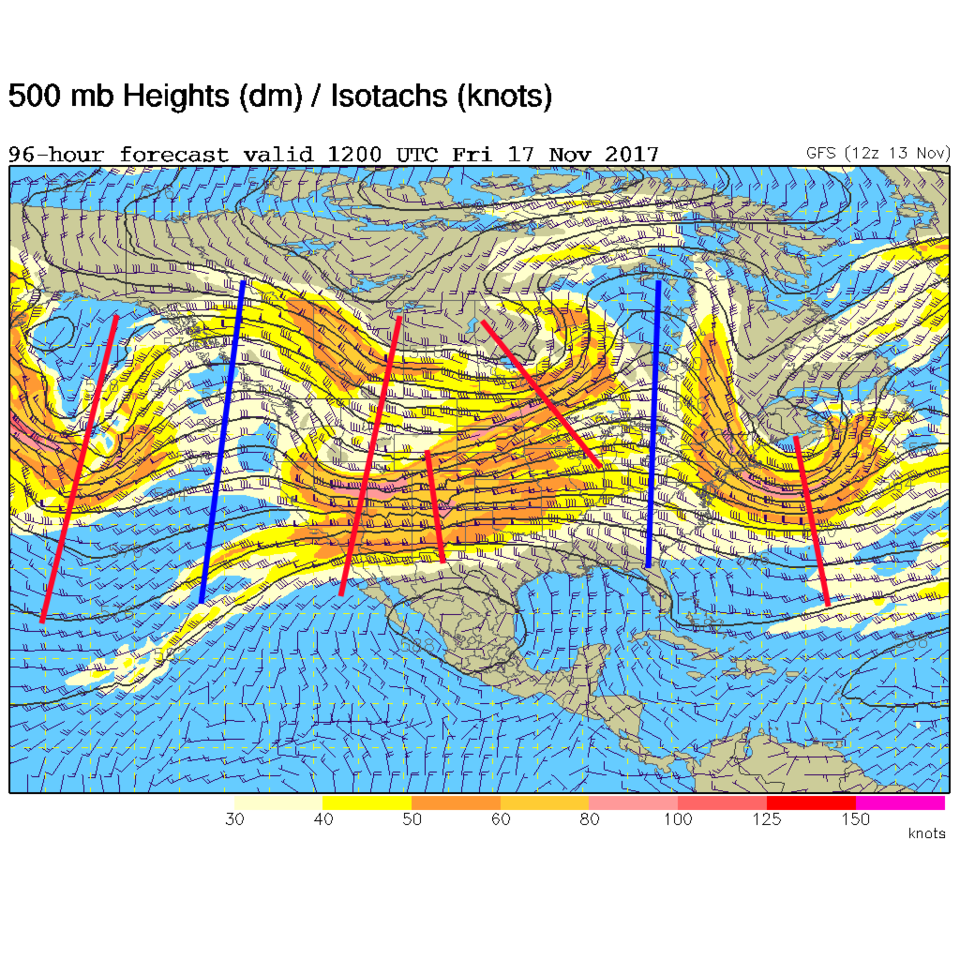
But there IS a storm coming.  It is still not impressive (for Longmont), but it is something! Figure 4 is the upper air map for Friday early morning. There is a broad trough over Colorado with embedded short wave troughs (red lines). The ridges are far to the west and east (blue lines.

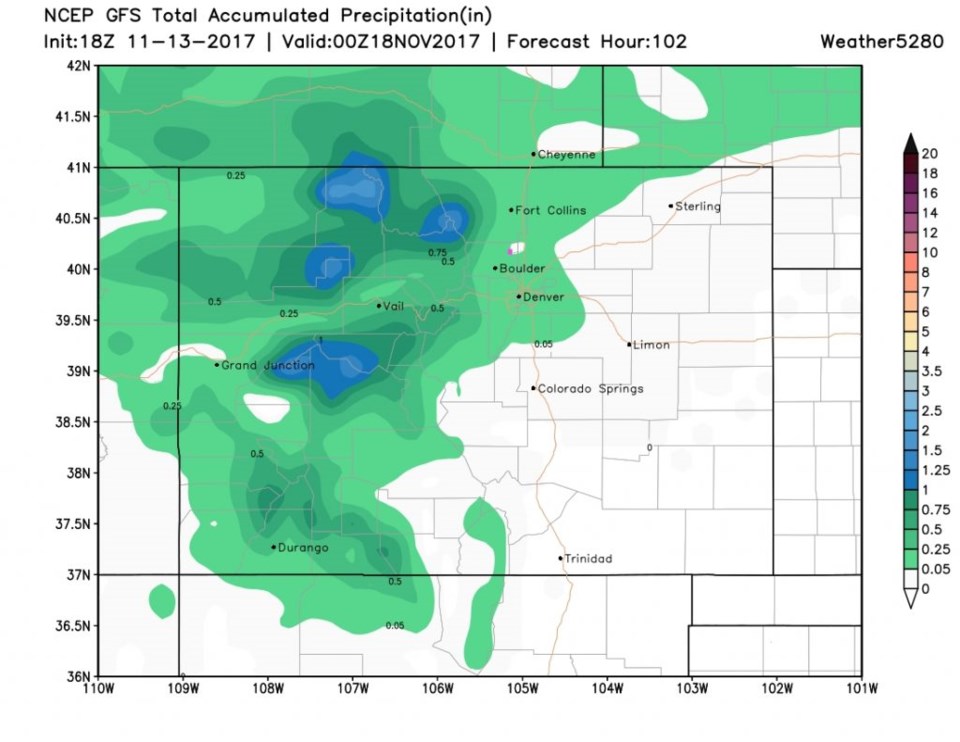
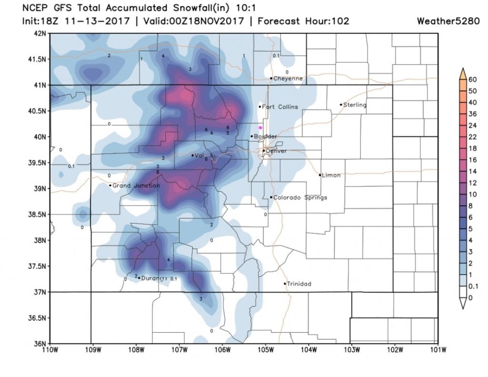
The GFS precipitation forecast (rain and melted equivalent of water from snow, ice etc.) in Figure 5 shows the mountains to our west getting some nice water.  Figure 6 shows the western slopes and north and central mountains getting some good snow... but Longmont (in this run) is on the edge of nothing - rain or snow.  The gap along I-25 is the result of down slope during the storm what will warm us to the edge of snow/rain AND inhibits precipitation.  Right now, Longmont only gets a trace of something wet Thursday PM into Friday AM, but we'll watch for changes as the week goes on.   Maybe you should go wash your car and leave it out at the end of the week... I'm just sayin'.

Figure 4: The GFS 500mb upper air analysis forecast map for Thursday PM/Friday AM.

Figure 5: The GFS forecast total precipitation map from Monday PM to Friday PM. Longmont = pink dot.

Figure 6: The GFS forecast total snow map from Monday PM to Friday PM. Longmont = pink dot.

Current Weather

Snow

Snow

34°F

UV Index
0 Low
Pressure
30.21 Falling
Visibility
1 miles
Dewpoint
31 °F
Humidity
90%
Wind
ENE 1.2 mph
Gust
2.8 mph
Wind Chill
34 °F

Hourly Forecast

Today
4 AM
34°F
Mostly cloudy
Today
5 AM
34°F
Mostly cloudy
Today
6 AM
34°F
Cloudy
Today
7 AM
35°F
Cloudy
Today
8 AM
34°F
Intermittent clouds
Today
9 AM
35°F
Intermittent clouds
Today
10 AM
36°F
Intermittent clouds
Today
11 AM
38°F
Intermittent clouds
Today
12 PM
40°F
Intermittent clouds
Today
1 PM
41°F
Intermittent clouds
Today
2 PM
42°F
Cloudy
Today
3 PM
43°F
Cloudy

7 Day Forecast

Rain and snow

Thursday

37 °F

Cloudy and much colder; snow showers in the morning, accumulating a coating to an inch followed by brief showers in the afternoon


Showers

Thursday Night

34 °F

Mostly cloudy with a brief shower or two late


Mostly cloudy w/ showers

Friday

43 °F

Chilly with some sun, then turning cloudy; a little rain this afternoon


Rain and snow

Friday Night

32 °F

Periods of snow; rain mixed in early, accumulating an inch or two


Flurries

Saturday

40 °F

A bit of morning snow with little or no accumulation; otherwise, cloudy and chilly; storm total snowfall an inch or two


Intermittent clouds

Saturday Night

31 °F

Partly cloudy


Partly sunny

Sunday

64 °F

Partly sunny, pleasant and warmer


Partly cloudy

Sunday Night

41 °F

Partly cloudy


Intermittent clouds

Monday

79 °F

Warmer with a blend of sun and clouds


Partly cloudy

Monday Night

36 °F

Partly cloudy


Sunrise and Sunset

Sunrise
6:17 AM
Sunset
7:43 PM

Based on AccuWeather data