This content was originally published by the Longmont Observer and is licensed under a Creative Commons license.
Forecast Discussion:
Welcome to the holiday season! It is a straight shot, through some turkey, to a Christmas Eve/Christmas Day snow forecast. Well that is some time away still...
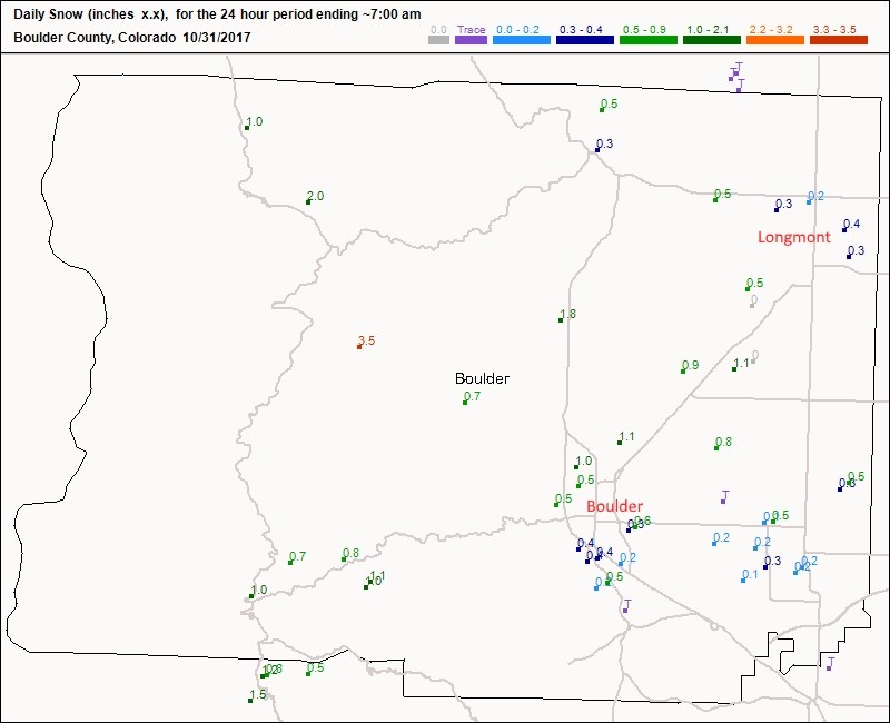
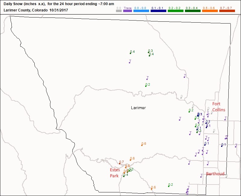
Halloween did see some measurable snow fall in the morning. That adds to our 10% statistic going forward. Figure 1 shows that the snow totaled about 1/4th to 1/2 inch across town. Boulder picked up 1/4th to 1" of snow. Figure 2 shows Estes Park received 1/4th to 3/4ths of an inch. Berthoud to Fort Collins picked up a Trace to 1/4th inch.
Halloween night was mostly clear; enough to show the Moon, a couple planets, and a double star, from the observatory. We had 140ish trick-or-treaters!
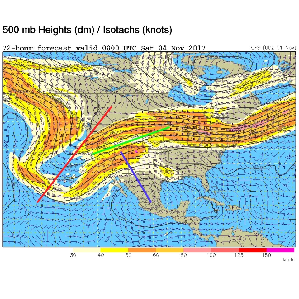
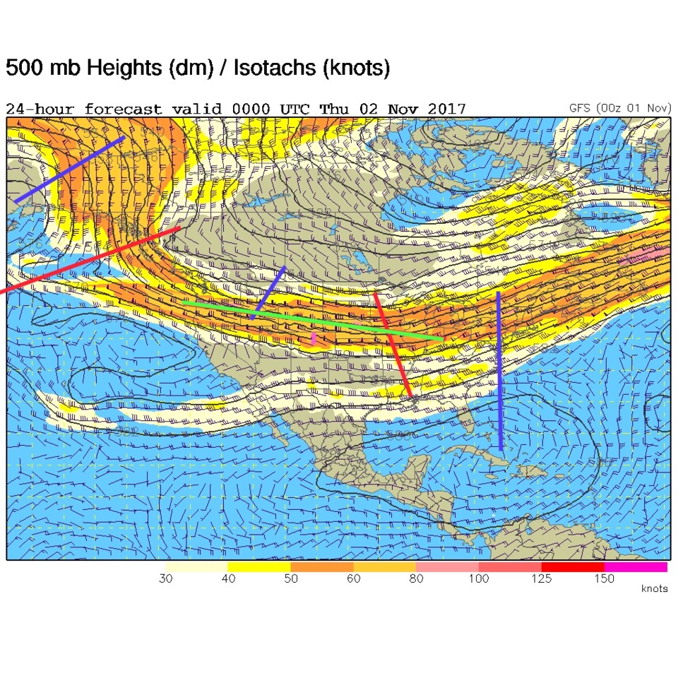
A real ridge doesn't establish itself over us, but the jet stream stays to our north (the green line is the center of the flow in Figure 3). So we stay somewhat seasonally warm. Various degrees of down-slope flow will warm us more than the upper air pattern would normally allow.
Longer range forecast:
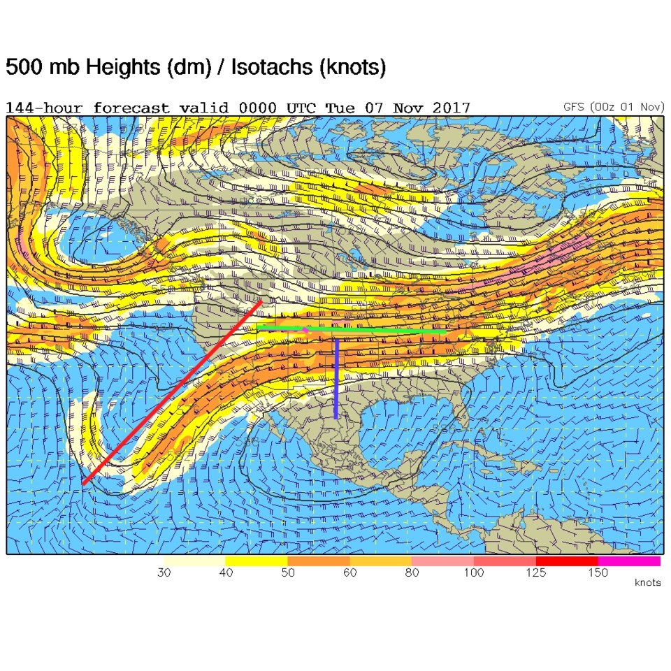
The trough way off in the Gulf of Alaska in Figure 3 builds southward off the West Coast of the U.S by the end of the week (Figure 4) but the center of the flow is still to our north (green line again). Figure 5, the jet stream/green line has finally drifted south cooling us down and the trough is closer increasing lift over the region and bringing us our next chance of rain and/or snow early next week. We'll watch all this as a quite week plays out.