This content was originally published by the Longmont Observer and is licensed under a Creative Commons license.
Forecast Discussion:
The mini storm on Friday brought a few inches of powder to the ski resorts making people happy and messing up some high country roads making people unhappy.
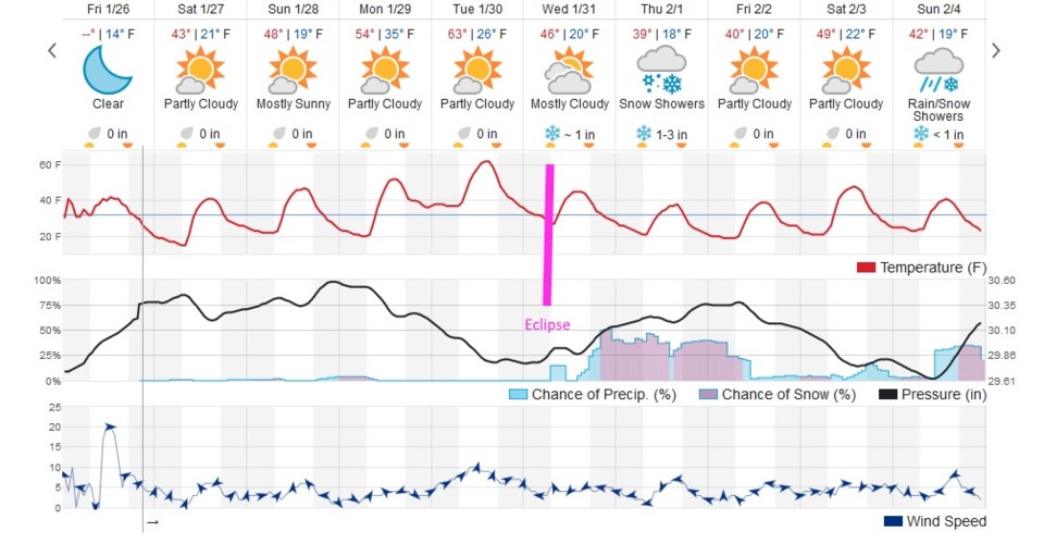
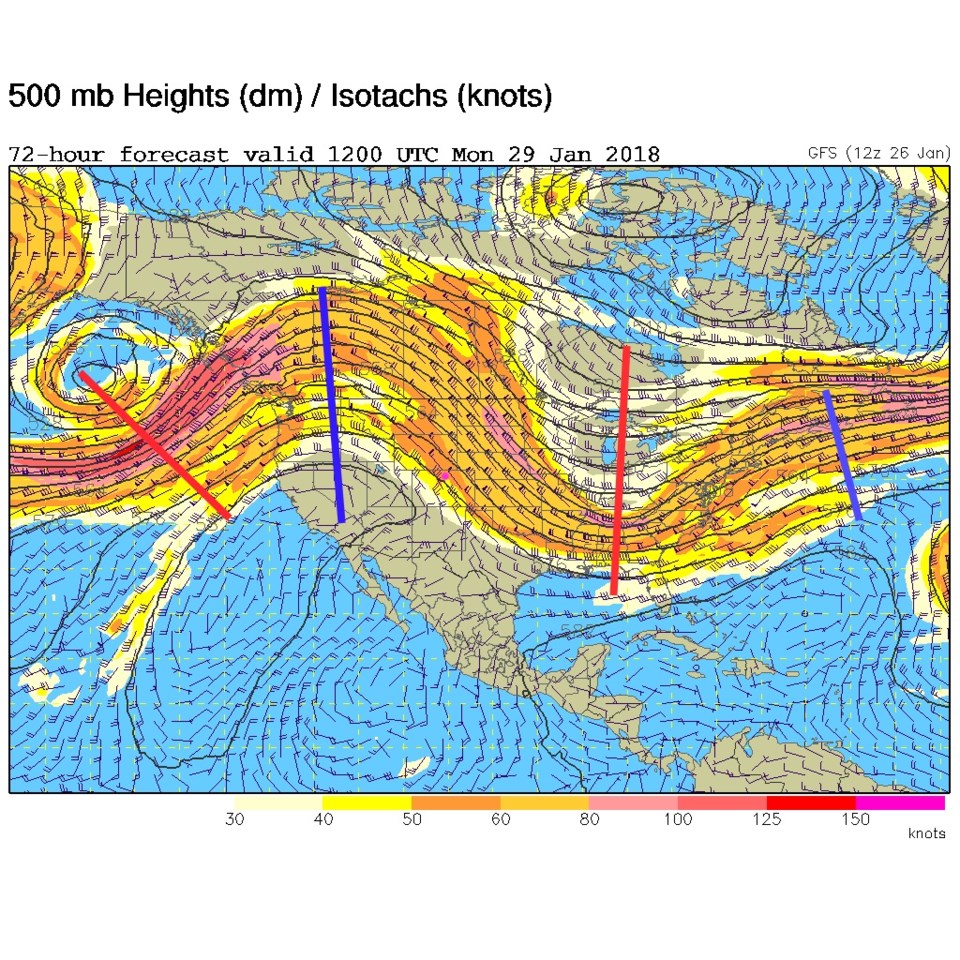
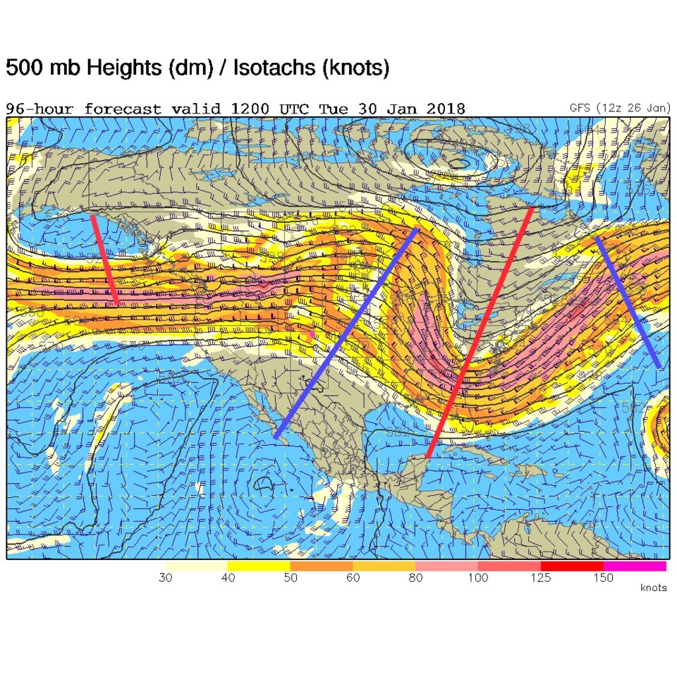
We sail into the weekend with near normal temperatures- then we climb to a week high temperature on Tuesday in the 60's (Figure 1). This heat up comes from westerly down slope flow and a big western ridge visible in the Monday upper air map (Figure 2), and the Tuesday upper air map (Figure 3). Then our next storm moves in, just in time for the total lunar eclipse predawn on Wednesday.
In the longer range forecast:
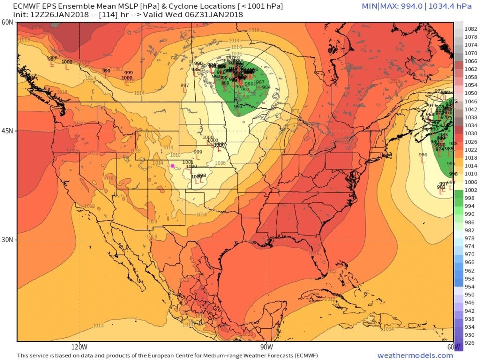
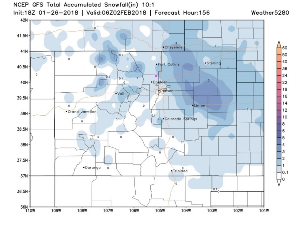
If you look back on the previous couple of day cyclone location maps for the morning of the eclipse, you'll notice that the ensemble runs are mainly putting the dominant low up in Canada, but there still is a front and low down in NE Colorado (Figure 4). The rain and snow chances for Wednesday and Thursday are still on the map (Figure 1) with Longmont maybe getting up to an inch of snow by later Thursday (Figure 5).
It looks to be a storm big enough to interfere with the eclipse, but not big enough to interfere with your drive to work.