This content was originally published by the Longmont Observer and is licensed under a Creative Commons license.
Forecast Discussion:
(Sorry for the delay today - grading and an observatory board meeting took my evening!)
Today and tomorrow we'll see 50's with clouds at times. Pretty quiet under our persistent western ridge.
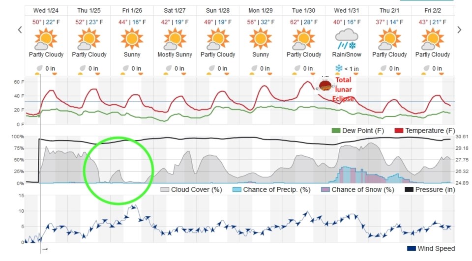
Our Thursday/Friday storm will give the northern mountains 2-3 inches of snow, even Boulder might see a dusting... but not much is on tap for Longmont (Figure 1 - green circle).
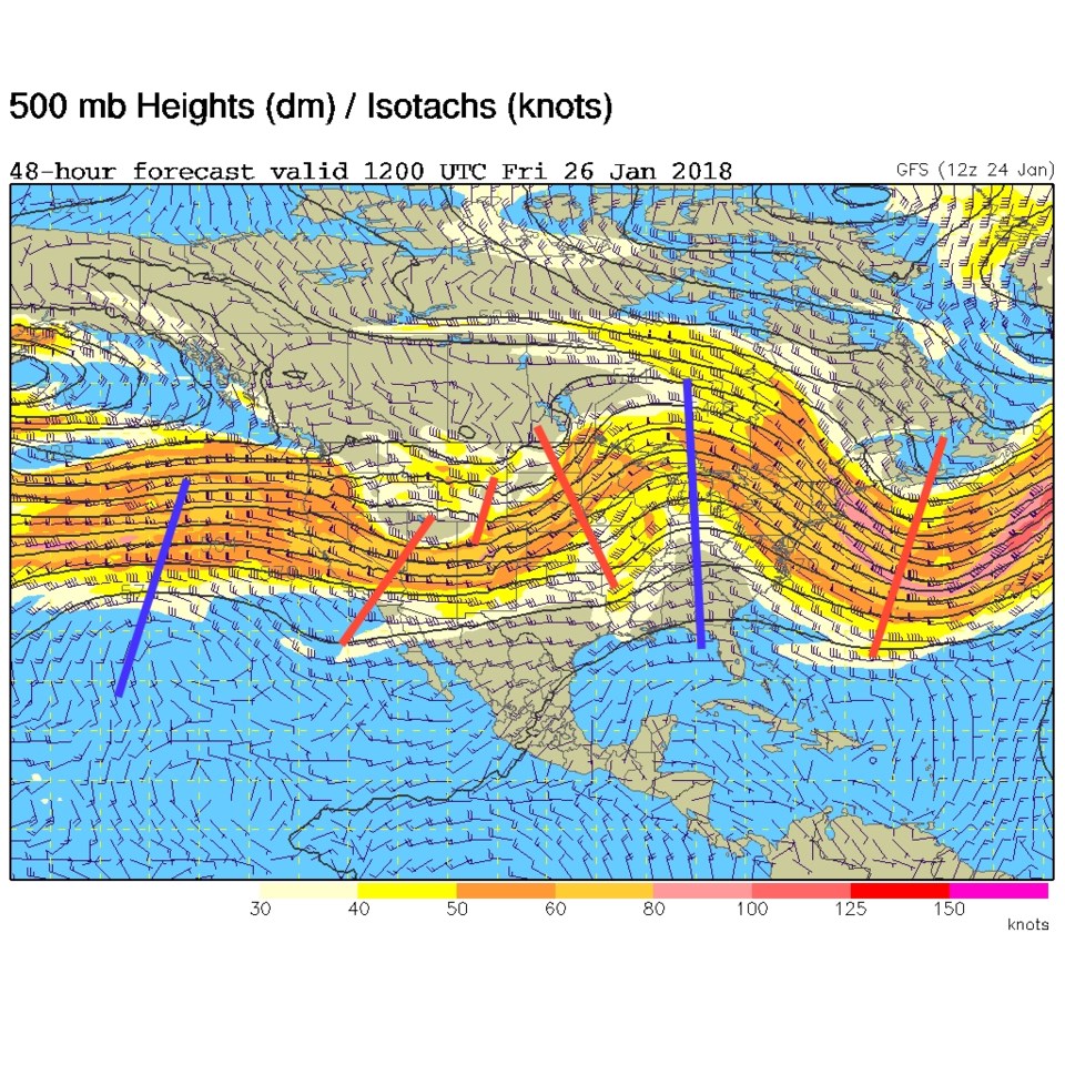
The trough-ing that moves in on Friday is pretty scattered and disorganized (the red dashes around Colorado in Figure 2). After that, we have a weekend with some clouds and near normal temperatures.
The longer range forecast:
Blue blood super-moon eclipse invitation.
We have a lunar eclipse coming for the early morning next Wednesday. You and your family are invited to come over to 507 Cherrywood Dr to the Cherrywood Observatory at 4:45am to 6 am (unless there is a thick overcast or if it is raining or snowing). We'll look at other deep sky objects and planets as well.
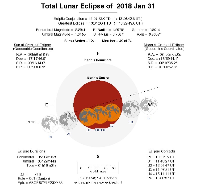
Figure 3 gives a graphical look at the times the moon will enter and exit the Earth's shadow. Note you do NOT need protective eye-wear to watch a lunar eclipse.
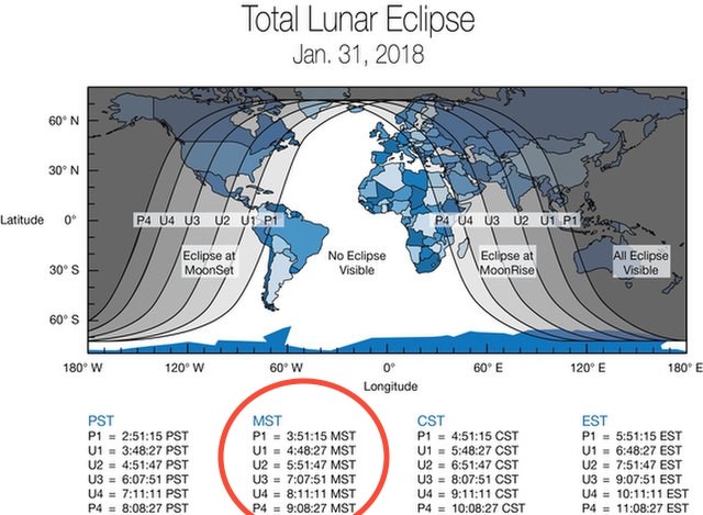
Figure 4 shows (in dark shades) the parts of the Earth that get to see the eclipse.
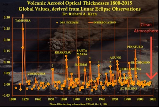
According to spaceweather.com, there have been very few large volcanic eruptions that shoot particulates and gasses into the stratosphere over the last few decades. Because of this (Figure 4) the atmosphere is clean and the eclipse should look more orange than 'blood' colored.
The last two full moons and this one are part of a triplet of super moons - where the moon is at the close point in its orbit occurring at or near the moment of full phase. So the moon will be about 13% larger and 25% brighter than your average full moon (until the eclipse hits).
Also a blue moon is, by current cultural definition, the second full moon in a calendar month. Our first full moon of the year was Tuesday January 2nd.
The times for the event:
Partial Eclipse begins 4:48am ( when it will be 25 degrees above western horizon)
Astronomical twilight ends 5:36am (when the dimmest stars begin to fade out in the east)
Totality begins 5:42am (when the moon is 14 degrees above western horizon)
Nautical twilight ends 6:08am (when all but the brightest stars have faded out)
Mid eclipse 6:30am (when the moon is 6 degrees above western horizon)
Civil Twilight ends 6:40am (car headlights are no longer needed)
Sunrise 7:09am
Moonset 7:13am
The weather for the event:
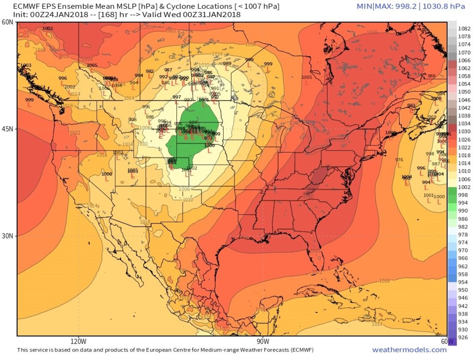
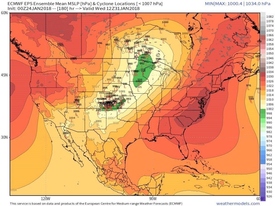
Figure 1 seems to show our next snowstorm/rain chances arrive after midnight Wednesday. Figure 5 and 6 are ensemble model runs showing where the surface Low pressure system is expected, and it is moving right over northeastern Colorado. Don't come over if it is thickly overcast or raining/snowing. Just stay warm in bed.