This content was originally published by the Longmont Observer and is licensed under a Creative Commons license.
In Brief:
Thursday was one more quite warm day. A trough (in the upper atmosphere) kicked down a weak front in the afternoon cooling us a couple of degrees for Friday. Another front cools us about 8-10F Friday going into Saturday. There are small rain chances/thunder shower chances Thursday, Friday, and Saturday afternoon's. Next week we hover around 80F (still above normal for these dates) with a better rain chance mid-late next week.
Forecast Discussion:
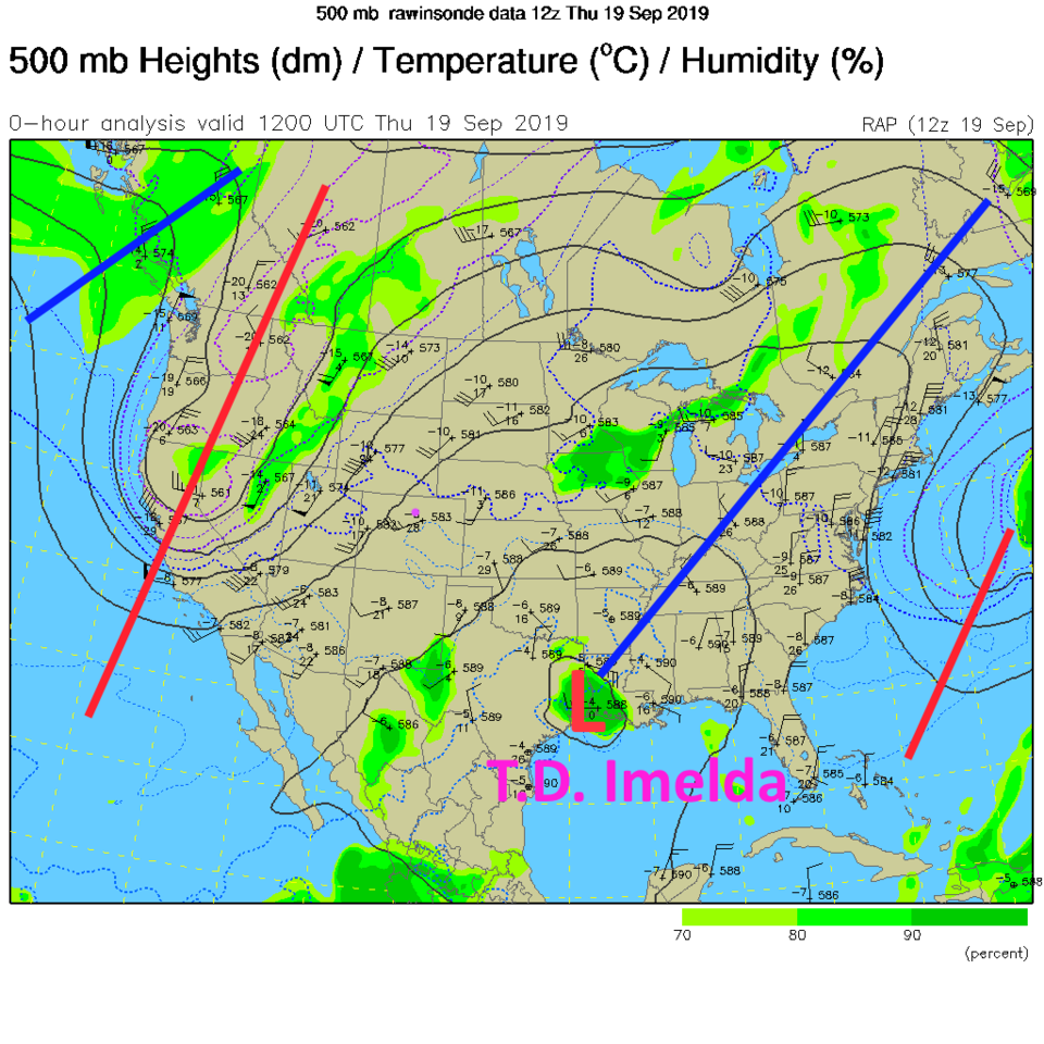
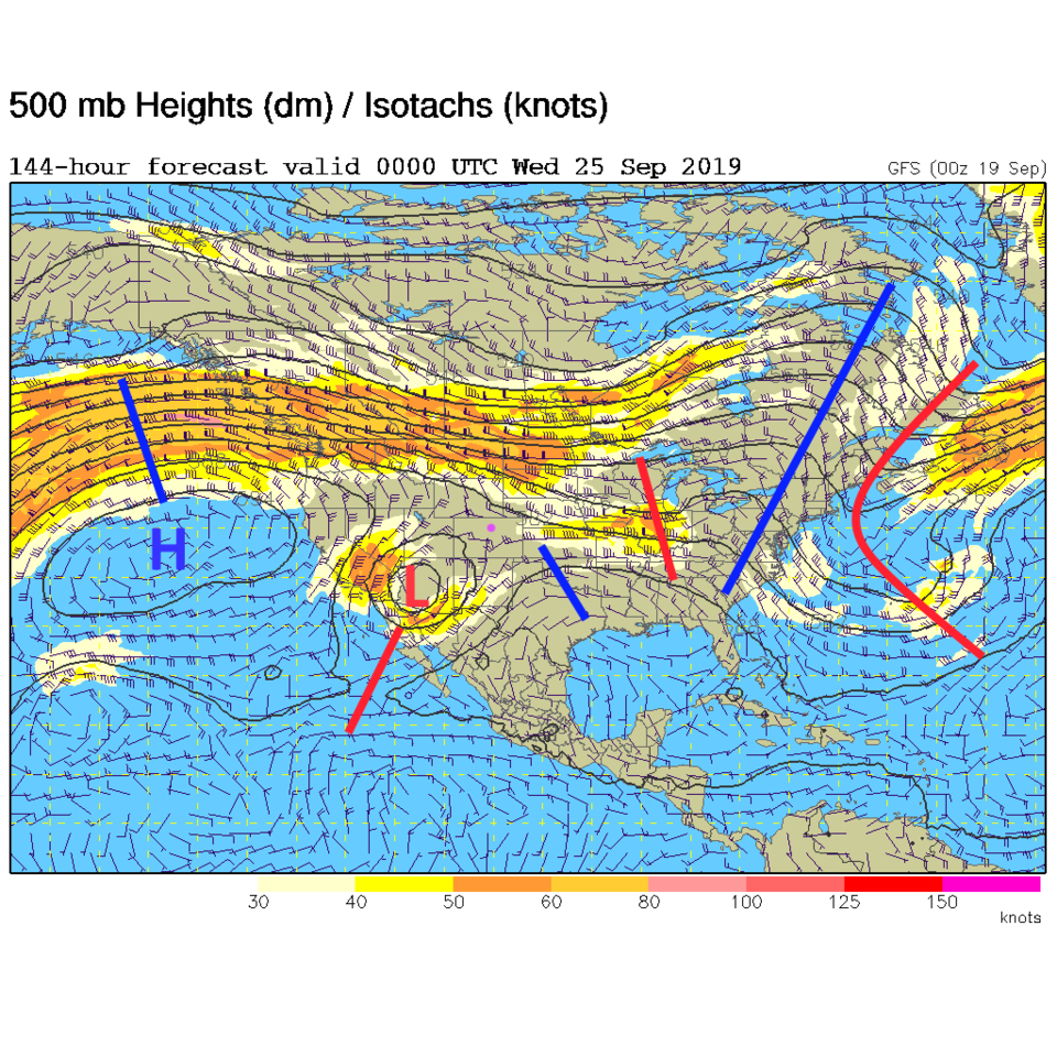
Taking a look at the at the current (Thursday) upper air map, a trough is moving into the western states (Figure 1). Since the wavelength is shorter than the nation is wide (about 3000 miles) - the dip in the jet stream flow will move eastward (it will be progressive). In this figure, you can see the low for tropical depression Imelda (lighter winds than a tropical storm) dumping rain in SE Texas under a big ridge (it is strange to see a ridge sticking out of a Low!).
By Friday morning, the next front is oozing in from the northwest. Thursday to Friday we'll have pretty strong, mostly dry, southwest flow over the state. Imelda has drifted mainly northward in this time.
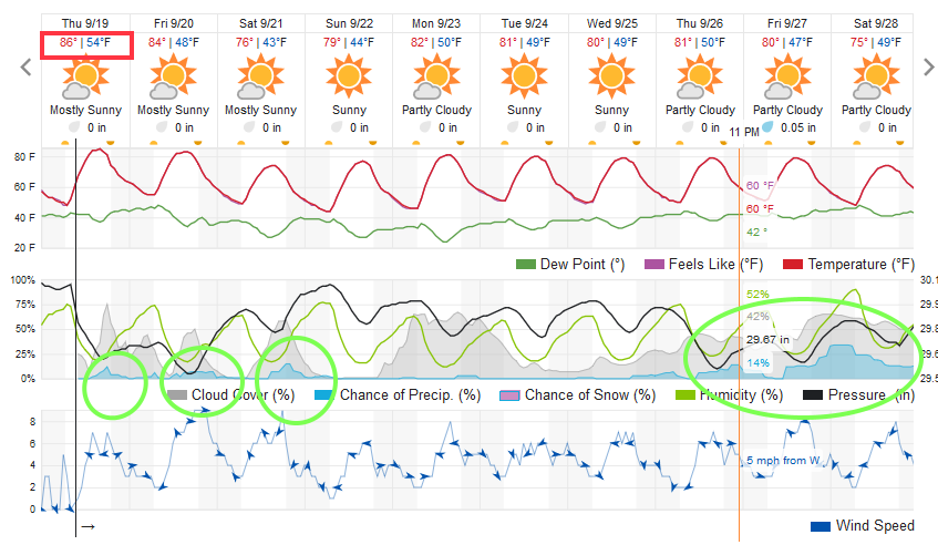
There are afternoon rain chances with the approaching trough (cool air aloft) and "some" moisture in the lower atmosphere Thursday, Friday and Saturday (with cooler moist post-frontal flow in place over NE Colorado - Figure 3 on Saturday).
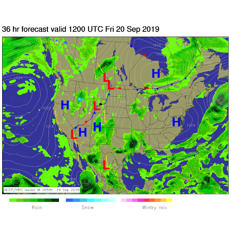
The Friday/Saturday front will be the main cool down - it will be driven by the passage of the west coast trough (Figure 4).
The Longer Range Forecast:
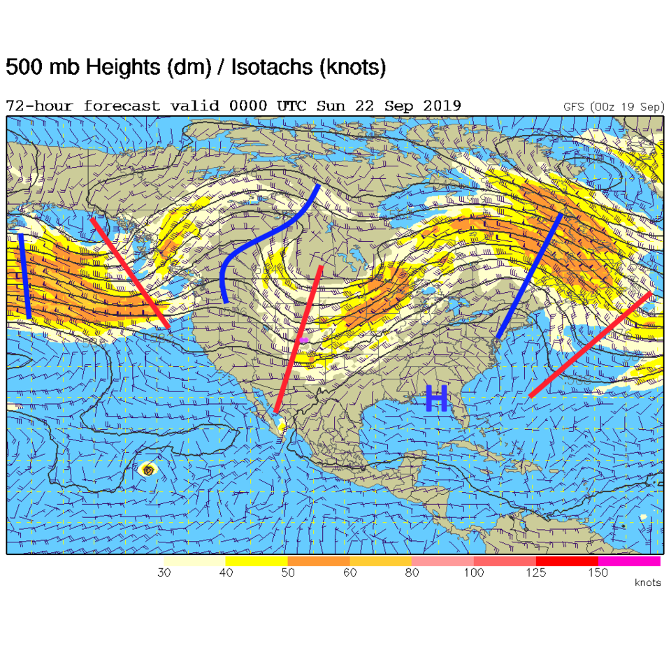
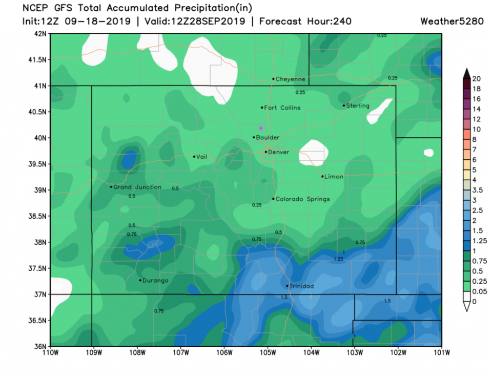
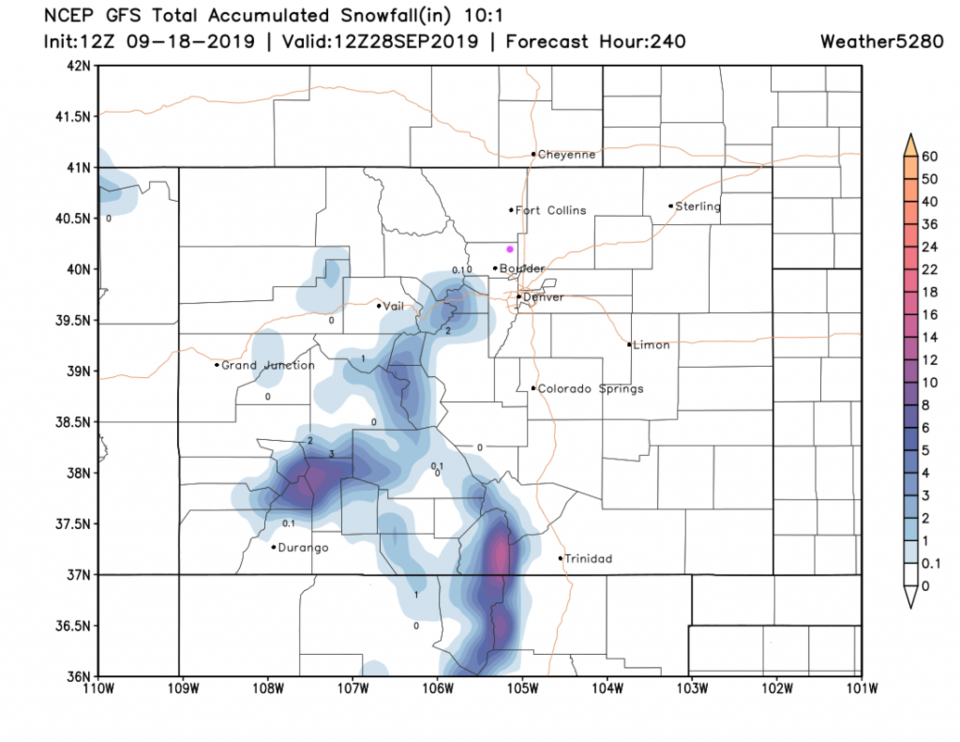
The ridge to the west moves in Sunday/Monday warming us to the low 80'sF (Figure 4). The models are disagreeing on what will happen next week (Figure 3). The weatherunderground model has backed way off on mid-week rainfall, but the GFS has a cut off low headed for the four corners area (maybe a bit south) which could give southern portions of the state some nice rains (Figure 5). Over the next 10 days, the GFS (having removed the giant blob of rain near the Four Corners area, then the blob of rain along the Front Range foothills that we saw in recent discussions) now puts a swath of 1"+ rainfall across the southern counties (Figure 6). The GFS now puts down snow in the central and southern mountains over the next 10 days (Figure 7) and removes the foot+ we saw up north. It is a tough time for the models!
Note, the date for the average first freeze for Longmont is 9/27. On Figure 3, it is clear that is not going to happen this year.
Note also, the first day of astronomical Fall is almost here. It will occur Monday, September 23, 2019 at 1:50 am MDT. From Figure 3 - it will feel somewhat like Fall - as it should.