This content was originally published by the Longmont Observer and is licensed under a Creative Commons license.
In Brief:
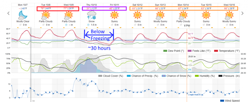
We have two more warm/hot (for this time of year) days to go - Tuesday and Wednesday. A very power front blasts down the Front Range around 5pm Wednesday and the temperatures drop. Rain will form behind the front and change quickly to snow. The Longmont snow total (ignoring melting) will be about 1-3 inches. Banding of snow could double this range if we are 'lucky.' We'll spend about 30 hours below freezing dropping to a low Friday AM of 13F or lower. We will be about 33F below normal on Thursday. We snap back to the 60'sF for the weekend and beyond.
Forecast Discussion:
What a beautiful day Monday was. It will be more beauty-fuller Tuesday and the first half of Wednesday. Some locations will approach 80F around the Plains with dry winds creating some fire danger in the mountains.
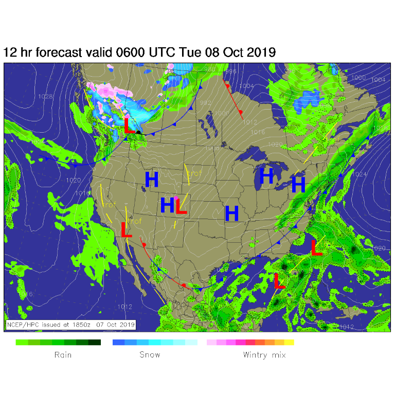
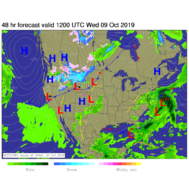
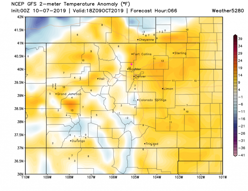
Our next storm is visible gathering its icy clutches in western Canada (Figure 1). By Wednesday AM the front has blasted down through most of Wyoming (Figure 2). We'll be some 12-15F above normal Wednesday before the cold air gets here (Figure 3). Can you see the front entering at the top of the graphic?
The Longer Range Forecast:
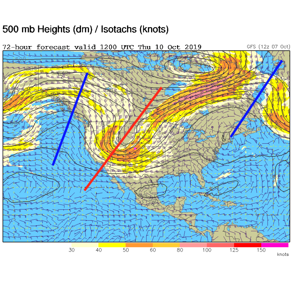
This big storm is powered by an amazing trough - red line in Figure 4. The front arrives around 5pm Wednesday followed by a brief chance of rain before the change over to snow occurs. Some folks along I25 may see snow first (Figure 5). We should see about 30 hours with temperatures below freezing from Thursday early morning to midday Friday.
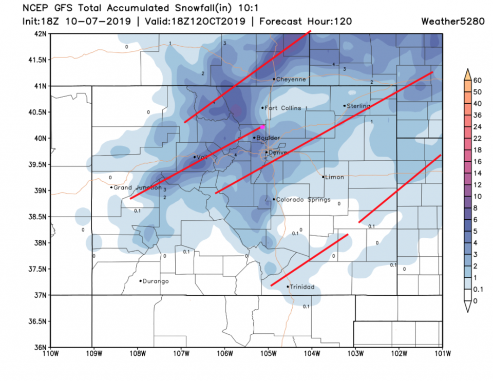
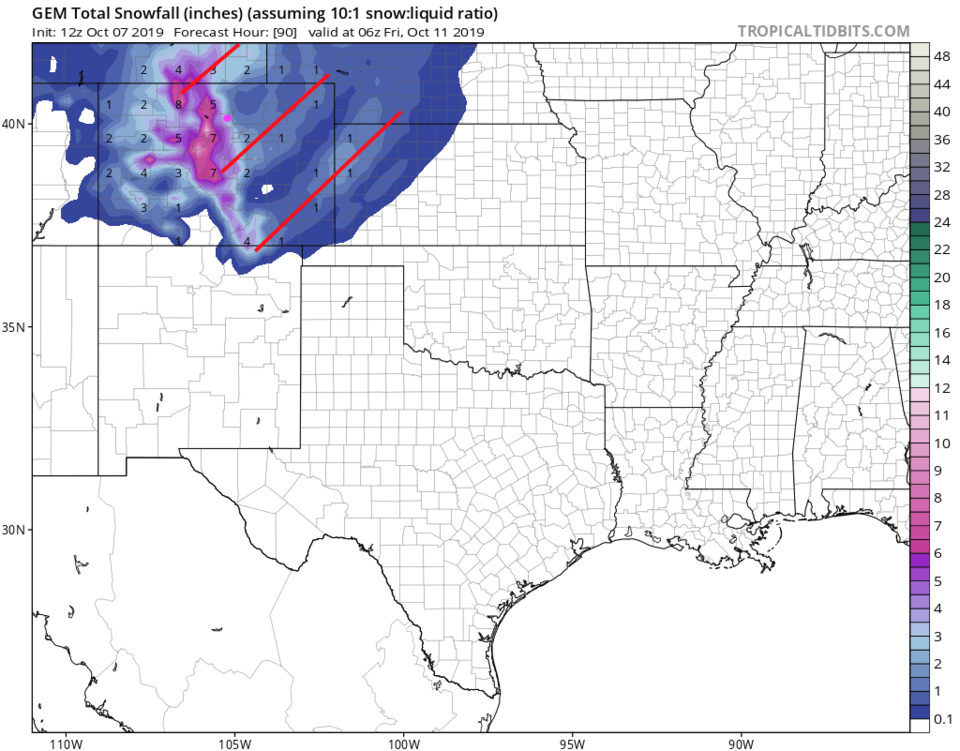
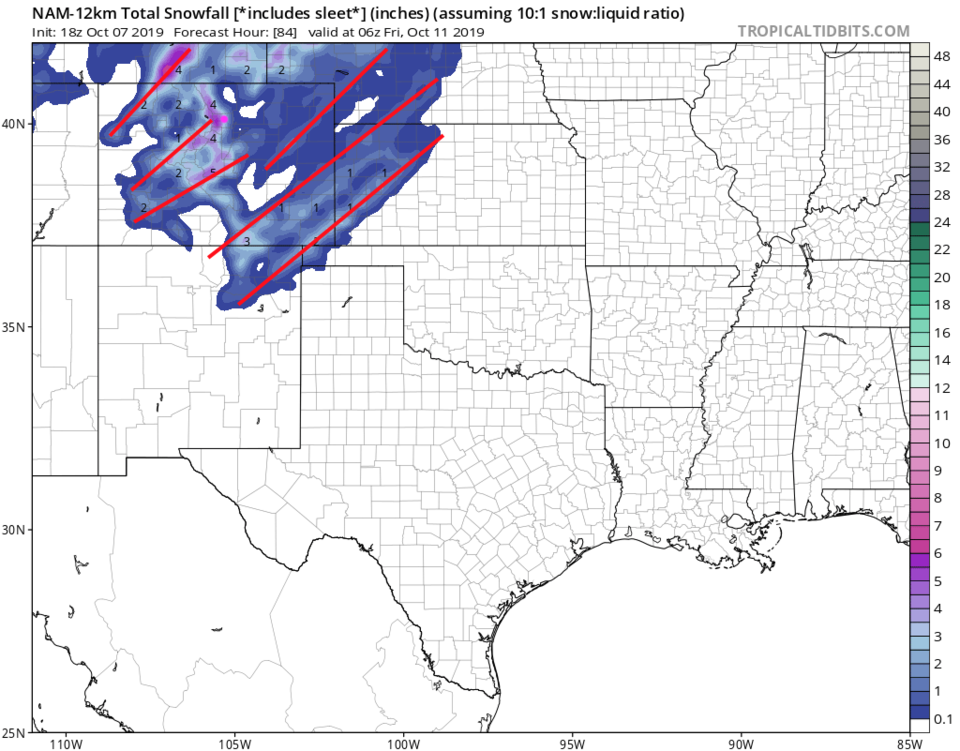
With the jet stream roaring overhead - there will be snow bands forming. The computer models pictured won't get the exact location of the banding right (thin red lines I've added), but the approximate spacing and existence of banding is well indicated.
The GFS - Figure 6 gives us about 2-3 inches.
The GEM - Figure 7 gives us about 2-3 inches.
The NAM - Figure 8 gives us about 2.5-3.5 inches.
Weatherunderground.com gives us 1-2 inches.
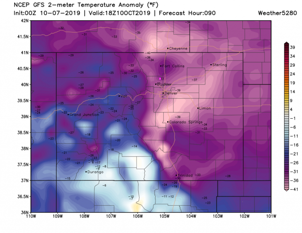
A part of the story that can't be ignored is the bitter cold. By far the coldest we've felt in a long long time. Friday AM could be in the single digits on locations in the Plains and up in the mountains. We should be about 30-35F below normal on Thursday alone (Figure 9). Get everything ready!