This content was originally published by the Longmont Observer and is licensed under a Creative Commons license.
Forecast Discussion:
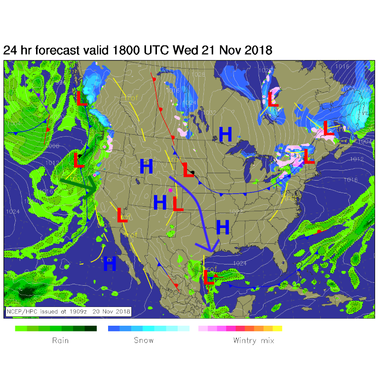
The cold air is plunging south of the U.S. into the tropics (blue arrow). Moisture is finally pouring in from the Pacific into California that should douse a lot of fire activity (but, as we know well here, flooding and mud slides in burn scars will be a problem - Figure 1 green arrow).
For Thanksgiving Eve today, the high will be 62°F and the low 25°F with very light winds and mostly clear skies.
For Thanksgiving, the high will be 56°F with a low of 36°F with stronger westerly breezes and mostly cloudy skies.
The longer range forecast:
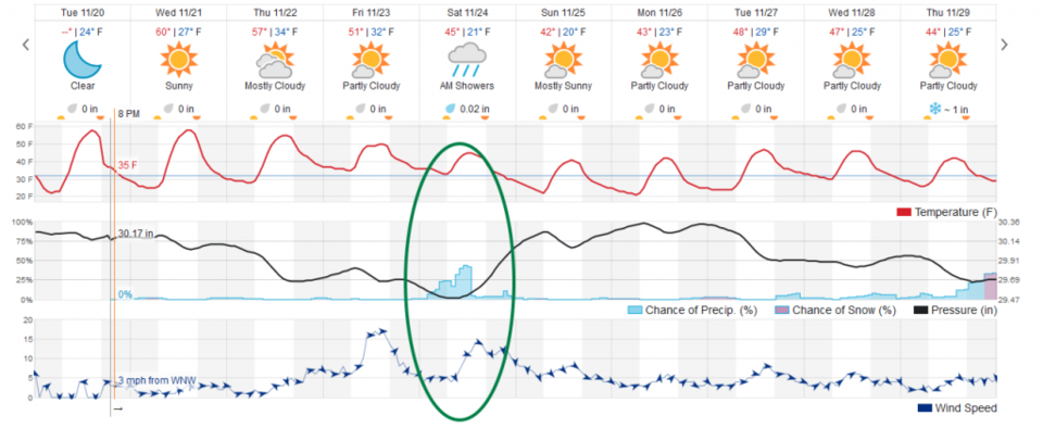
The weekend storm (in most models) is quite minimal now (Figure 4) for us, even if the mountains get some nice snow. (The European model still has a stronger storm with a low south of the state.)
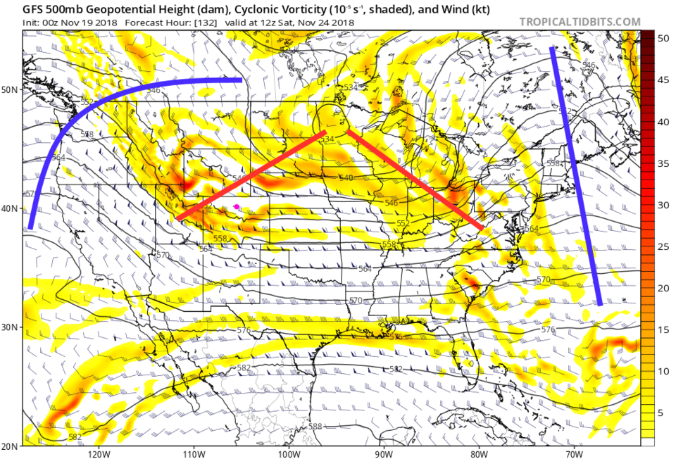
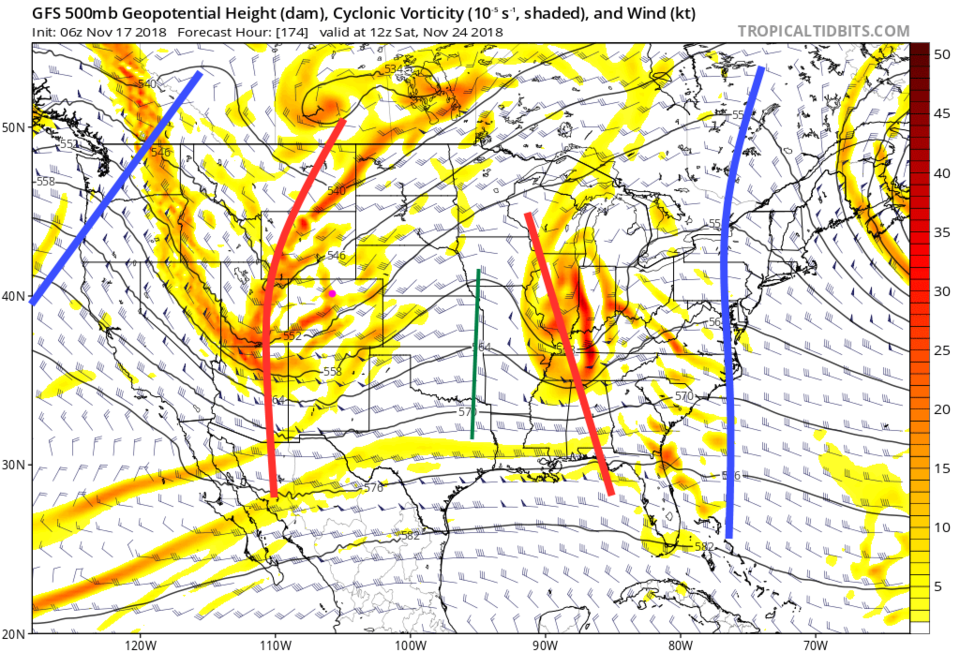
To see the interesting model change from two days ago (when it looked like a lot of snow was coming - Figure 3) and the forecast for the exact same time from today (Figure 2). In Figure 2, the center of the nation has a broad, less focused, area of lowered heights. There is a trough back in Utah and Wyoming, but it is pretty shallow compared to the overall flow. In Figure 3, from two days ago, that trough was much deeper and stronger, extending all the way down into Mexico.
Figure 4, then, shows a small chance of rain with not-so-cold temperatures (some warming from down slope flow may be at play as well, limited precipitation amounts too). We do remain chilly in the 40's F for highs into the next week. It will begin to feel a lot like Christmas.