This content was originally published by the Longmont Observer and is licensed under a Creative Commons license.
In Brief:
The next storm arrives today (Wednesday). Loads of moisture is being pumped into the desert southwest with flash flood watches across Arizona and Utah. We'll see an extended period of chilly showery and snow-flurriey weather with roughly three peaks of precipitation Wednesday afternoon, Thursday midday, and overnight Thursday into Friday. Daytime temperatures will rise to or above freezing each day and nighttime temps will only be in the lower 20'sF. Even with some models putting down 5+ inches of snow, it will melt, be affected by rainfall, and come down very light most of the time. After that we return to seasonal normals until a minor storm hits Monday night and Tuesday morning (Thanksgiving Day looks to be chilly and dry - cold turkey -get it?).
2pm 11/20 Update:
Most models have shaved off another inch of snowfall in northern Colorado (especially in the northern mountains). This storm will also impact a rare possible meteor outburst. For 15-40 minutes on either side of 9:50pm MT Thursday November 21, up to 400 meteors per hour (6-7 a minute) might be seen flashing up out of the eastern sky from the Alpha Monocerotide meteor shower. You need to go to a very dark location to see this (get all cities behind you to the west). You may see some of the Leonids going on at the same time. The Alpha Monocerotide shower usually only creates 4 meteors per hour (ZHR).
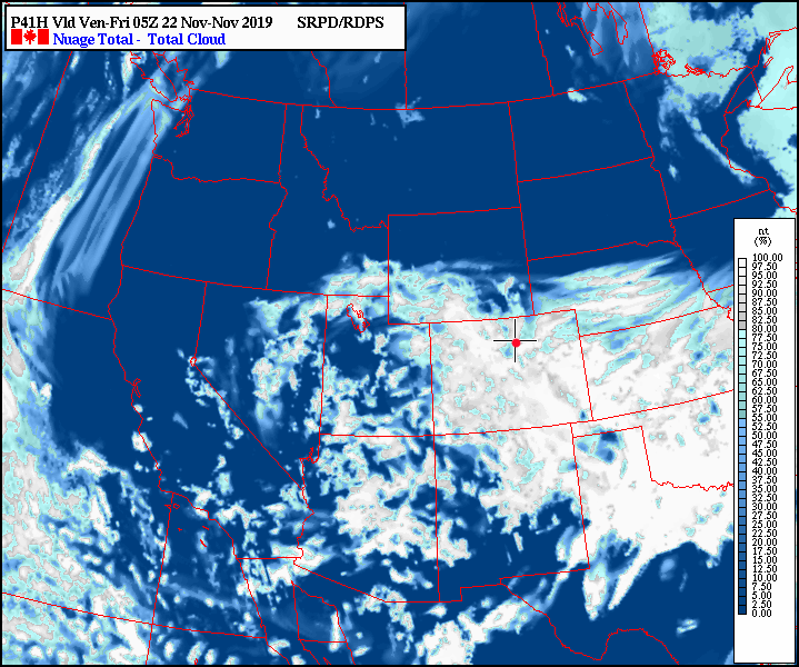
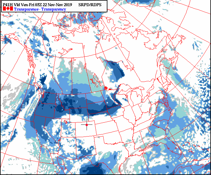
Figure 3 update is the total cloud cover and Figure 4 update is the atmospheric transparency. If you want to see this (possible) event - you'd need to travel up into southeastern or the eastern border of Wyoming. At least the moon won't be an issue!
End 2pm 11/20 Update.
8am 11/20 Update:
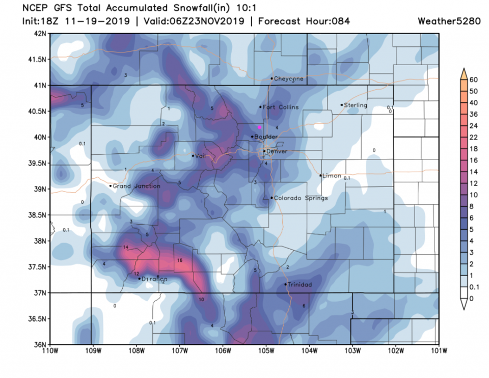
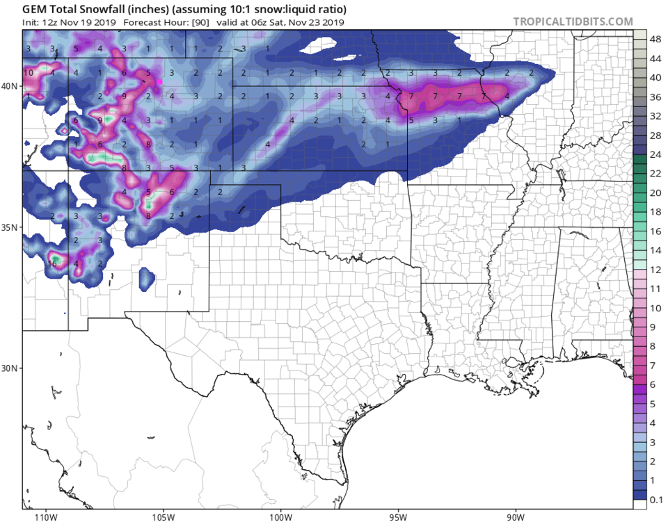
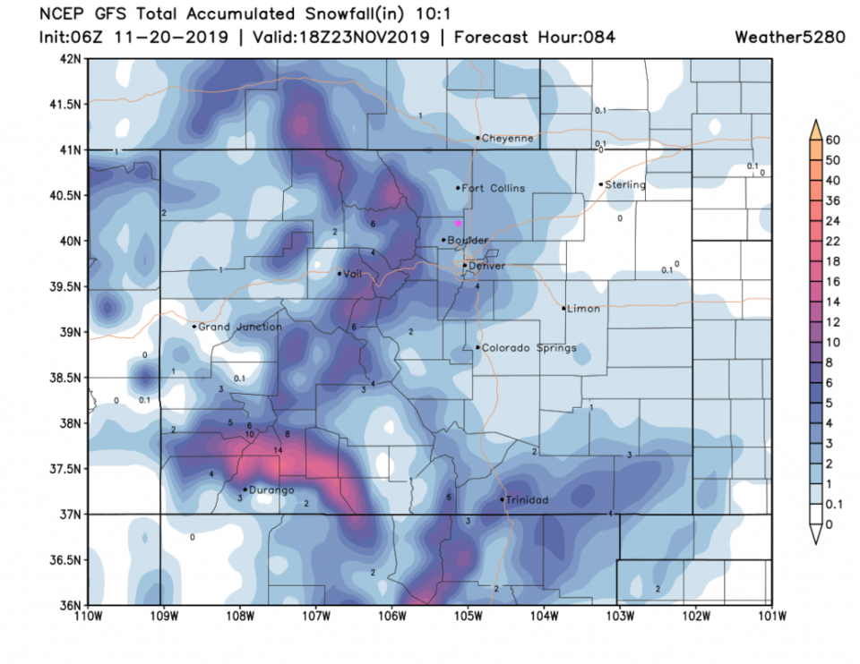
The forecasted pattern of upper air support ejecting from the desert southwest has changed this morning. It looks more like the better rain/snow chances will come in two time periods, rather than three (see below). Figure 1 shows that this afternoon and into the evening will be our first hit of rain, changing to snow around sunset, then to all snow for the rest of the evening. There is a residual chance of snow (rain in the day?) until Thursday PM when the next portion of the trough passes over. The GFS has backed off, by about 1-2 inches, in the snowfall predicted (Figure 2). The NAM and GEM have also shaved off 1-2 inches from the graphics shown below (new maps not shown).
The initial wind shift is knocking on our door from the north. The colder air is still up in Wyoming marching southward.
End 8am 11/20 Update.
Forecast Discussion:
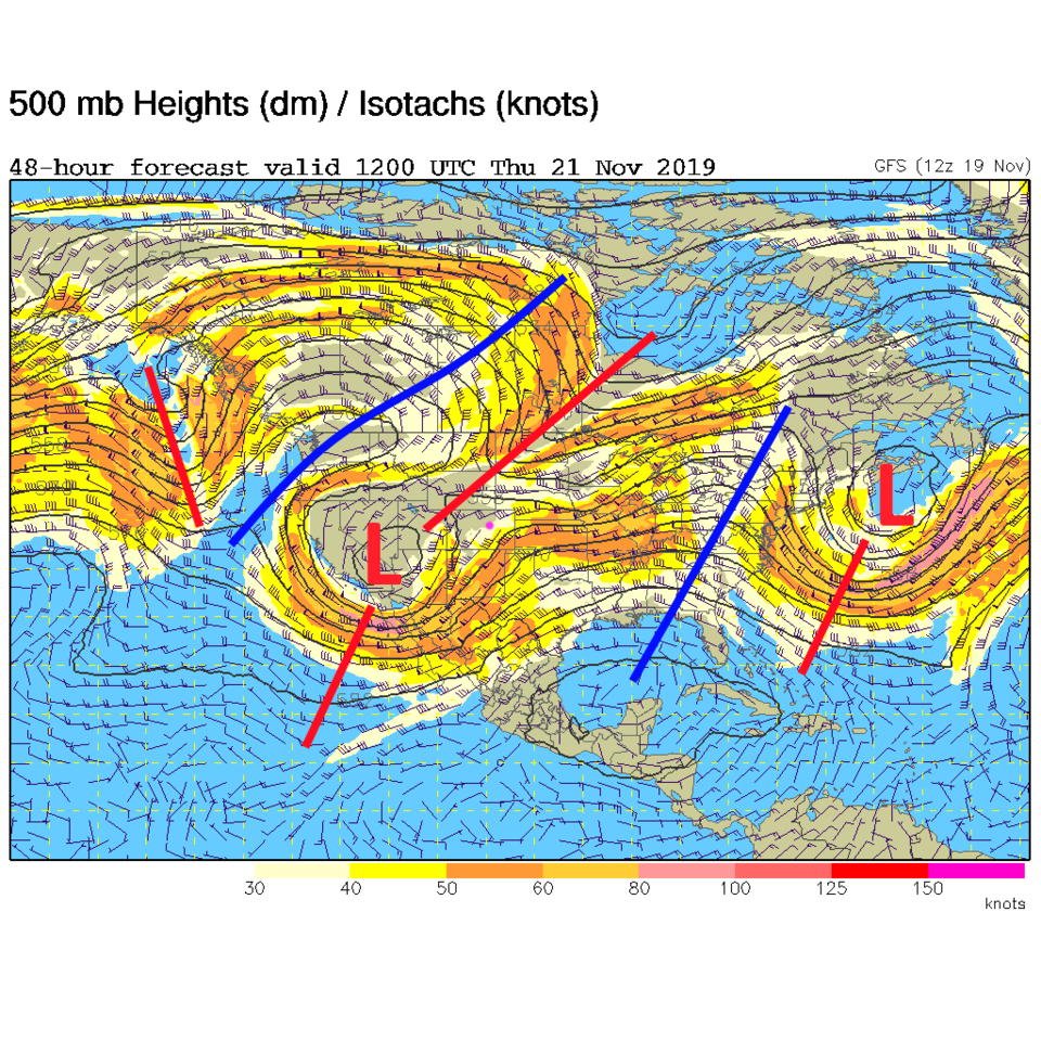
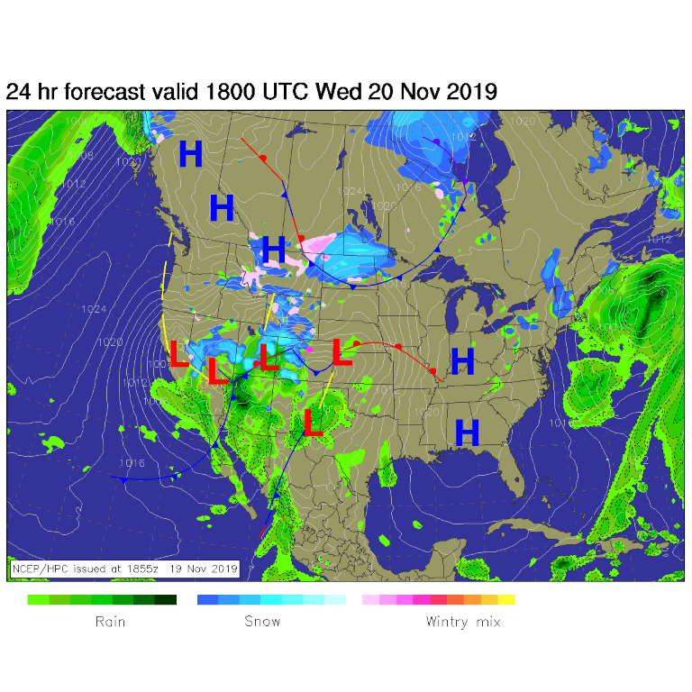
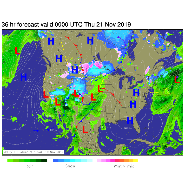
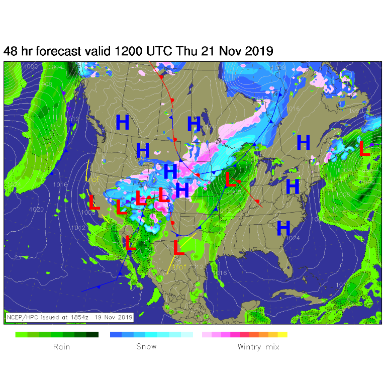
Here we go again! More winter. It won't be bad; just wet and chilly for a couple of days. The face of this storm is the big trough with embedded cut-off low sitting overhead (Figure 1). You can watch the storm move in via this sequence of forecast surface maps; Figure 2 noon Wednesday (about when the precipitation begins to fall - as rain at first); Figure 3 just after sunset Wednesday (by when the precipitation should have turned to all snow); Figure 4 just before sunrise Thursday (as the snow and cold continues).
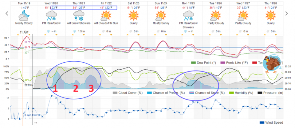
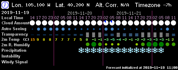
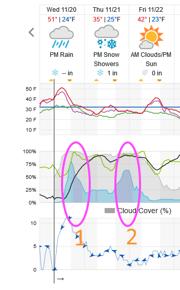
Figure 5 shows three pulses of peak precipitation chances occurring Wednesday afternoon/evening, midday Thursday, and overnight Thursday into Friday morning. These are created by passing upper air short waves or the formation of and passage of cutoff low centers. The GFS based 7Timer (Figure 6) shows precipitation falling from 2pm Wednesday to 5am Friday (but it should not be snow the entire time).
Note that daytime temperatures will probably rise above freezing every day through this long stormy event and precipitation rates should be pretty light most of the time (Figure 5).
Snowfall Roundup:
Weatherunderground.com's model Figure 5 - we get 1-2 inches of snow.
The GFS gives us 3-4 inches (an increase over previous day's runs- Figure 7).
The GEM gives us 3-5 inches (also an increase - Figure 8).
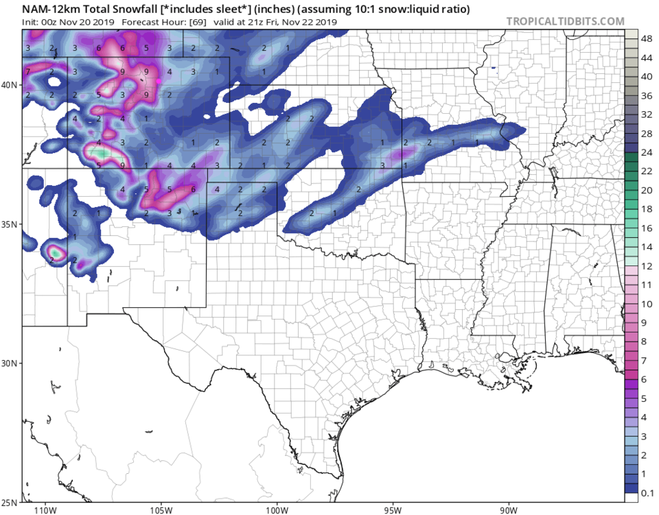
The NAM gives us 5-7 inches (a whopping increase - Figure 9).
This is snow that falls - NOT snow that builds up necessarily - again due to warm ground temperatures, rain before, and maybe during the event, and warm daytime temperatures.
The Longer Range Forecast:
The normal high is now about 52F - which is how we'll spend our dry Saturday and Sunday (a good commute to Grandma's house, if she lives near Colorado - Figure 5). There is another minor storm Monday/Tuesday we'll have to watch (I'll be covering it on vacation to AZ).
Thanksgiving Day sneak-peek:
It still looks cold for Thanksgiving with highs around 40F and lows around 20F - but dry.