This content was originally published by the Longmont Observer and is licensed under a Creative Commons license.
In Brief:
With a stunningly beautiful Saturday unfolding and with Sunday not looking bad either, the next cold front rolling in around sunset Sunday will be a brief cold slap in the face for Monday. Freezing rain and maybe about an inch snow (give or take) will make Monday very slippery. It is also looking bad for those wanting to see the Transit of Mercury from NE Colorado. :-( We return to seasonable and dry weather after that.
Forecast Discussion:
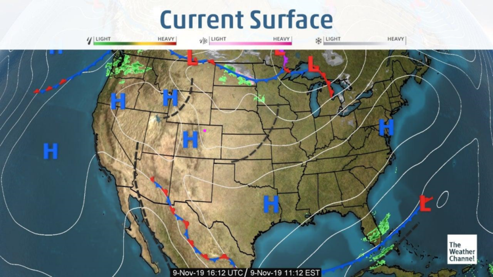
The closest precipitation is two states away as a warm wonderful high pressure system dominates (Figure 1). I'd say stop reading and get out and take a walk, but you do need to keep an eye on the next storm.
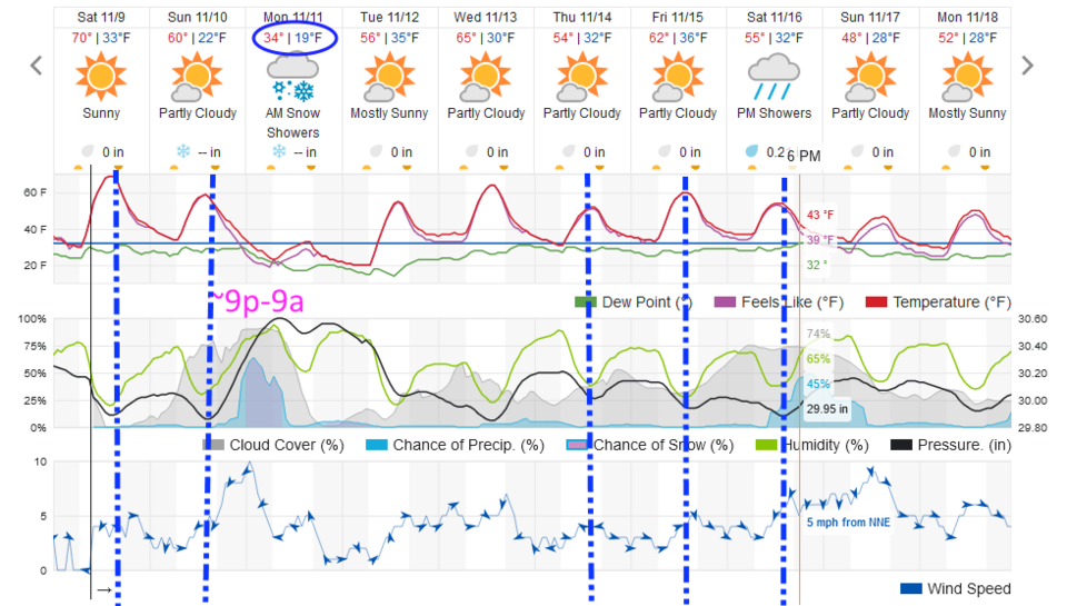
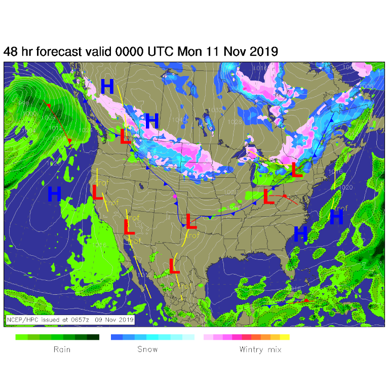
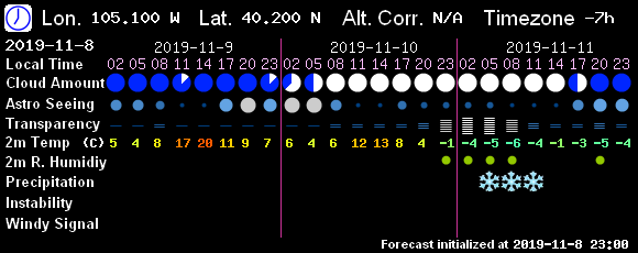
We will have a weak front come through this afternoon (the first dot/dash blue line in Figure 2) that starts our next cool down. Sunday will only reach lower 60'sF (but will still be very nice - above average for this time of year which is a high of 57F and a low of 34F). The main front slams through around 4-5pm Sunday and comes in dry and windy (Figure 3).
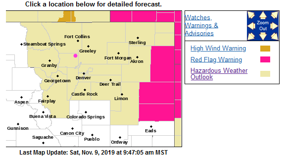
To alert everyone, the National Weather Service has issued a hazardous Weather Outlook (Figure 4):
This hazardous weather outlook is for northeast and north central
Colorado.
.DAY ONE…Today and Tonight No hazardous weather is expected through tonight.
.DAYS TWO THROUGH SEVEN…Sunday through Friday
After mild temperatures and dry conditions Sunday, a strong cold
front will push onto the northeast plains late Sunday afternoon
and Sunday night. Drizzle along with areas of freezing drizzle
can be expected Sunday evening with light snow for the overnight
period into Monday morning. Snow will gradually diminish late
Monday morning with clearing skies Monday afternoon and
Monday night. There is also the possibility for areas of fog
across the plains late Monday night into Tuesday morning. Much
warmer for Tuesday through Friday with dry conditions.
.SPOTTER INFORMATION STATEMENT…
Spotter activation will not be needed today or tonight.
Snowfall Roundup:
The weatherundeground model gives us frozen precipitation, but doesn't print out a measurable amount of snow (Figure 2).
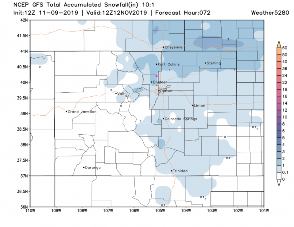
The GFS (Figure 6) gives us about 1/2-1 inch.
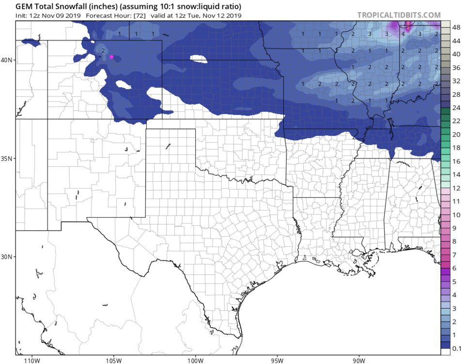
The GEM (Figure 7) gives us about 1/2-2 inches.
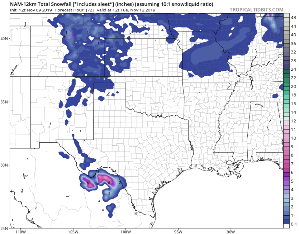
The NAM (Figure 8) gives us about 1-2 inches.
Note, freezing drizzle will have a greater impact on travel with the main period of precipitation occurring between 9pm and 9am (Figure 2).
The Longer Range Forecast:
We warm right back up Tuesday as the ridge returns on Tuesday to normal temperatures.
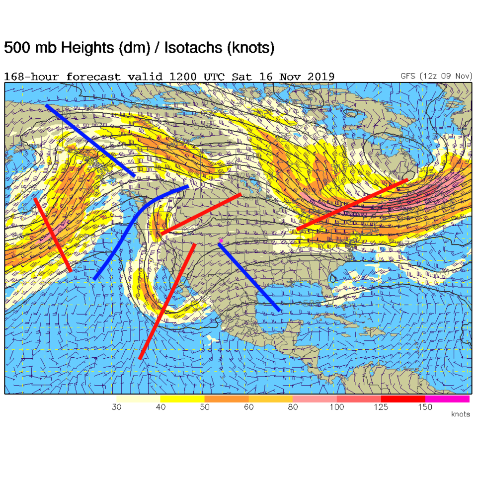
Our next storm comes in after three minor-ish cool fronts roll through Thursday, Friday and Saturday. The third will be powered by upper level troughs coming into phase Saturday (Figure 9) and should create another chance of rain/snow/ice.
Transit of Mercury Invitation:
You may still stop by at the Cherrywood Observatory between 7am and 11:04am Monday to safely view the planet Mercury cross the face of the sun (a tiny dot moving very slowly) but the weather conditions are looking worse and worse. Figure 5 shows total cloud cover until 2pm, after the event. I'll post an update when other cloud model data comes in (but Figure 2 makes the clouds look bad all morning as well).