This content was originally published by the Longmont Observer and is licensed under a Creative Commons license.
In Brief:
As thunderstorms begin to roll off the mountains again, Tuesday afternoon, we are looking forward to about 3 days of rain (and snow in the morning Thursday and Friday). The weekend is now looking a lot drier with a return of 70'sF by Sunday.
11:30am Wednesday Update:
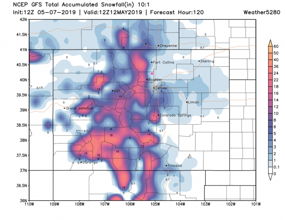
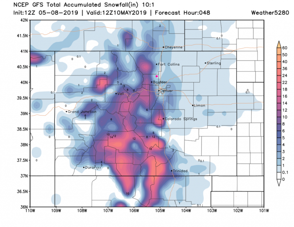
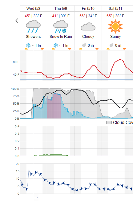
Some TV outlets are suggesting up to 3 or 4 inches of snow around here, which might be a bit extreme - but it is looking like temperatures will be a bit lower leading to a longer period of snow from tonight into Thursday morning. The GFS (Figure 2 update) gives us a 1-2 inches of snow over the next 48 hours. The weatherunderground.com model (Figure 3 update) gives us an inch tonight and another in the morning. Note snow may continue to fall through midday. I expect most of the accumulation to occur on cool surfaces like grass and bridges/overpasses. The rain should change to snow around 9-10pm. The Friday AM snow is now looking less like a 'thing.'
For comparison, Estes Park is receiving snow now and could see 6-10 inches over the next couple of days. Boulder (so close to us!): 2-6 inches.
End 11:30a Update.
2pm Tuesday Update:
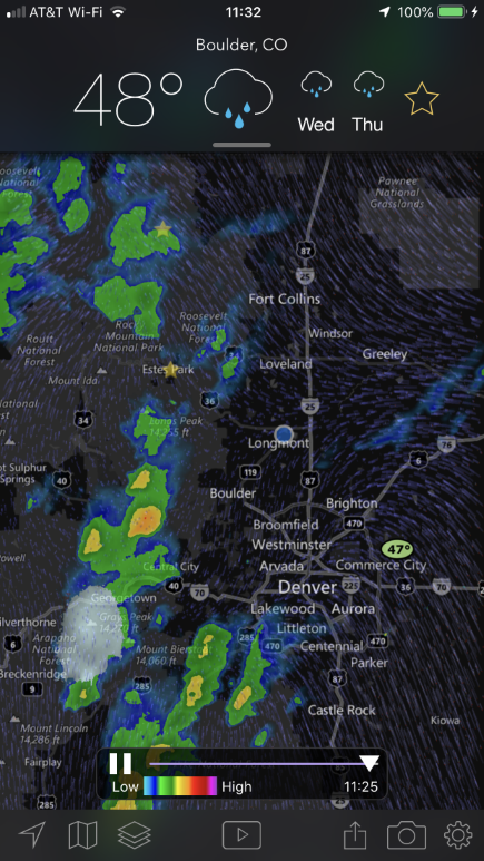
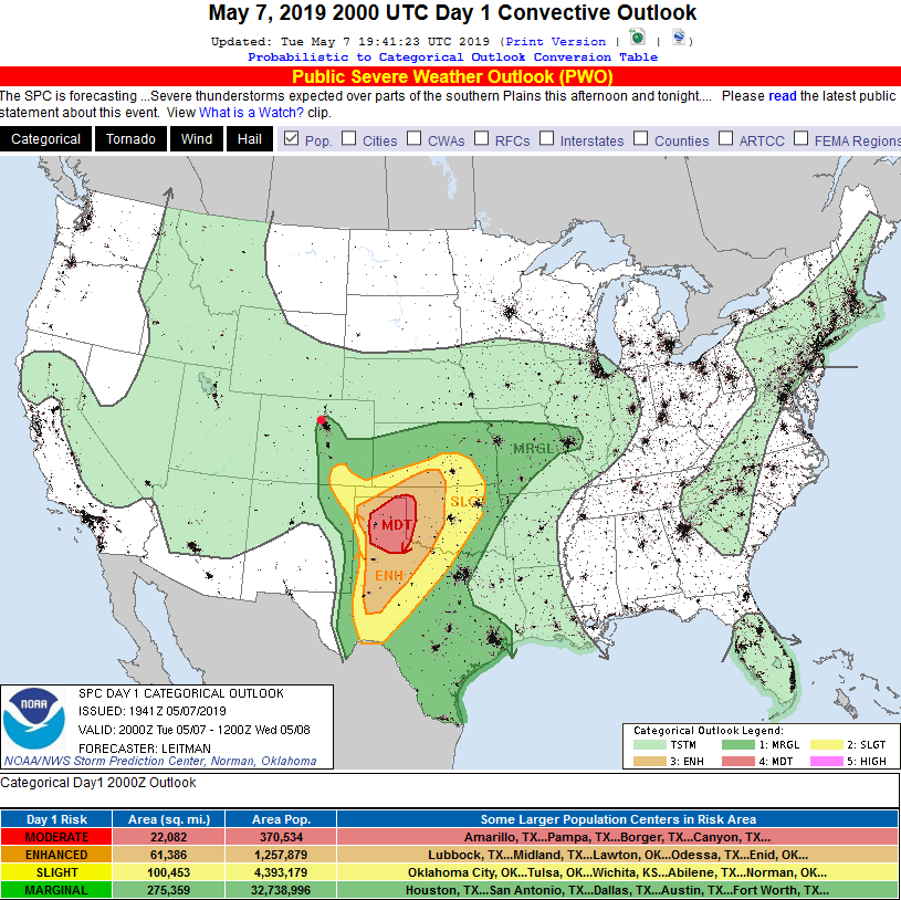
The Storm Prediction Center has expanded the marginal risk of severe weather to the northwest of its earlier limits to just include Longmont (and maybe up to Berthoud and over to Boulder) - Figure 1 update. The primary risk is for land-spout tornado-like activity and strong damaging winds with a few of the stronger thunderstorms this afternoon.
End 2pm Update.
Forecast Discussion:
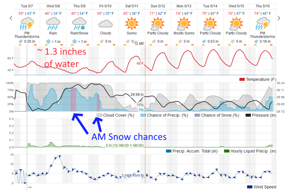
The storm system is now impacting the state with increasing rain chances between now and Friday morning. There were swaths of small hail in places near I-25 Monday evening. Today's storms are now forming in the Foothills (Figure 1). Tonight should be pretty wet with about 1/4th inch of rainfall (Figure 2).
The Longer Range Forecast:
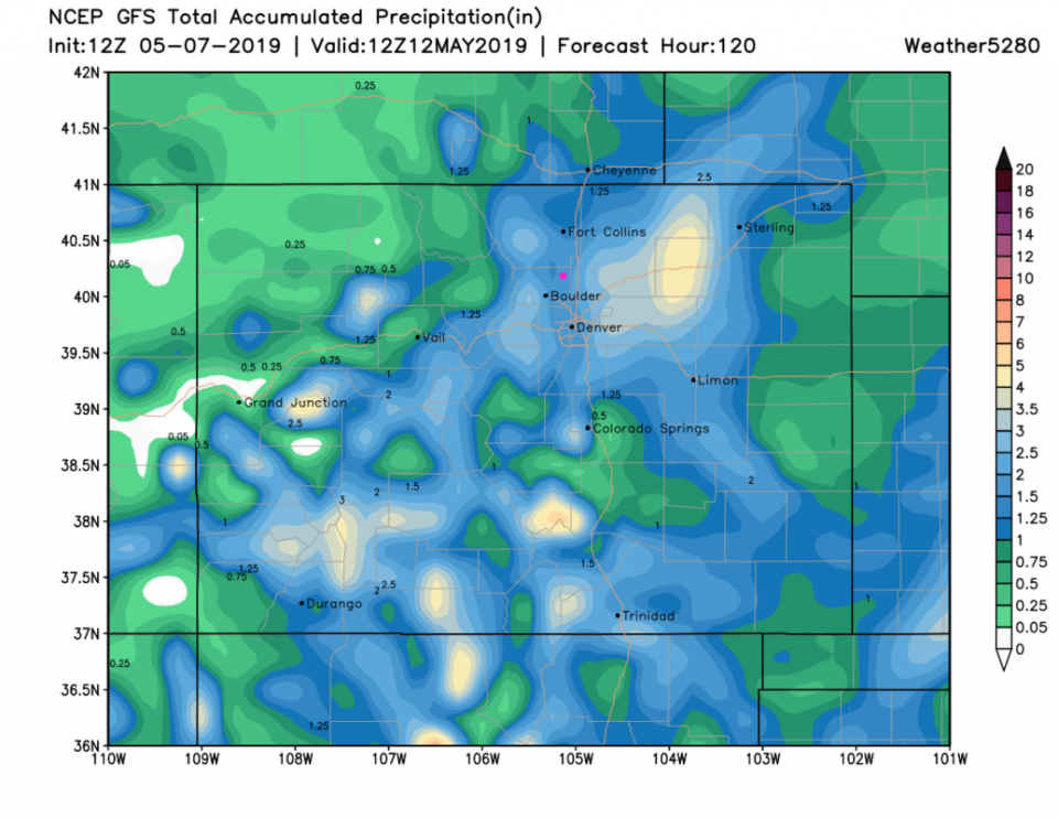
Wednesday and Thursday and early Friday morning will be dominated by high chances of rainfall (Figure 2). The weatherunderground.com model has trimmed back water expectations to about 1.3 inches of the wet stuff. The GFS (Figure 3) also puts us between 1.25 and 1.5 inches of water. It is nice when different sources agree (though the GFS might be 'in the mix' of what the weatherunderground.com model uses - I can't tell - they don't always agree).
We don't drop below freezing, but it will be cold enough for snow Thursday AM and Friday AM. The weatherunderground.com model gives us a coating of snow Thursday AM and Friday AM (Figure 2) and the GFS (Figure 4) gives us between 1/10th inch of snow and 1 inch of snow over the next 5 days.