Skip to content

Next Storm/Next Snow Forecast Discussion from the Cherrywood Observatory – May 4, 2019

This content was originally published by the Longmont Observer and is licensed under a Creative Commons license.

In Brief:

Beautiful warm weather is the only story through Monday. Then a trough and cold front move in. We cool 20-30F starting Tuesday and rain (and possible snow) continues off through next weekend - and beyond.

Forecast Discussion:

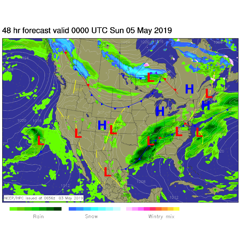
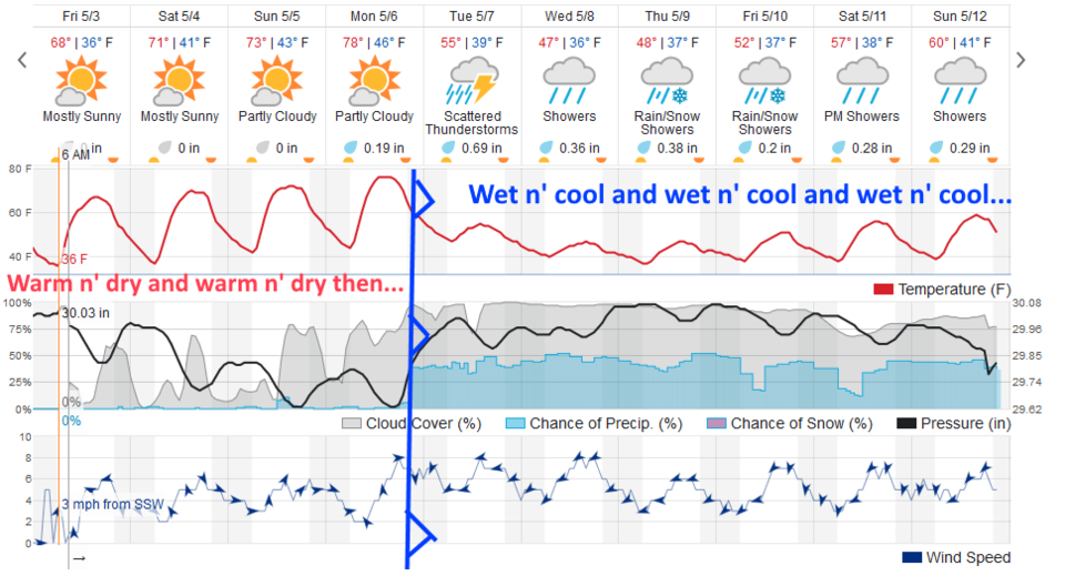
High pressure at the surface (Figure 1) and a ridge aloft (not shown) mean mostly clear skies and warm temperatures in the 70'sF this weekend (Figure 2). This is an excellent time to get out and play.

The Longer Range Forecast:

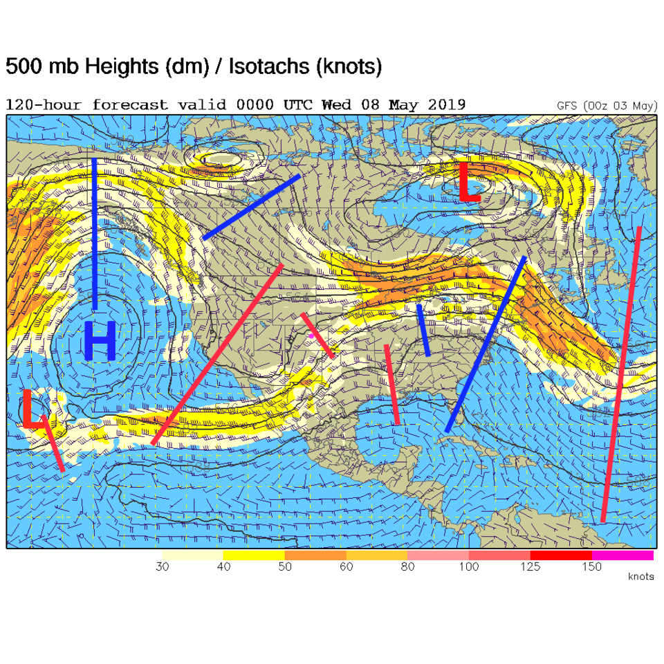
As advertised for days now, a strong cold front (blue front line in Figure 2) arrives Monday afternoon/evening. The trough is so large that it has other troughs in it (Figure 3). This is a big, slow-to-change pattern change. Temperatures drop and mountain snows resume. Higher elevations will see a foot or more before next weekend.

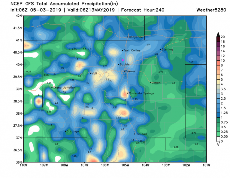
From Tuesday to Sunday, the weatherunderground.com model (Figure 2) gives Longmont about 2 1/4 inches of rain. The GFS (Figure 4) now gives us 2 inches (a big jump up again after yesterday's run, more like the output a day before). The GFS still doesn't give us snow, but the GEM still has about 1-2 inches over this time period (not shown). We'll keep tracking rain and snow totals as the weekend passes.

Figure 1: The forecast surface map for Saturday PM from NCEP.
Figure 2: the graphical forecast for the next 10 days for Longmont, CO from weatherunderground.com
Figure 3: The 500mb forecast upper air analysis for Tuesday PM. Pink dot is Longmont. Red lines are troughs, blue lines are ridges.
Figure 4: the forecast accumulated precipitation map from the GFS and weather5280.com for Colorado,over the next 10 days.


Current Weather

Cloudy

Cloudy

49°F

UV Index
0 Low
Pressure
29.62 Falling
Visibility
8 miles
Dewpoint
43 °F
Humidity
80%
Wind
SW 2.2 mph
Gust
4.9 mph
Wind Chill
49 °F

Hourly Forecast

Today
5 AM
51°F
Cloudy
Today
6 AM
51°F
Cloudy
Today
7 AM
52°F
Cloudy
Today
8 AM
55°F
Cloudy
Today
9 AM
60°F
Cloudy
Today
10 AM
62°F
Thunderstorms
Today
11 AM
65°F
Cloudy
Today
12 PM
68°F
Cloudy
Today
1 PM
67°F
Thunderstorms
Today
2 PM
70°F
Mostly cloudy
Today
3 PM
68°F
Mostly cloudy
Today
4 PM
67°F
Mostly cloudy

7 Day Forecast

Thunderstorms

Friday

70 °F

Mostly cloudy with a couple of thundershowers


Thunderstorms

Friday Night

45 °F

Cloudy with a couple of thundershowers


Rain

Saturday

48 °F

Chilly with periods of rain and a thunderstorm; travel in the foothills and mountains will be slippery due to snow


Rain and snow

Saturday Night

39 °F

Cloudy with rain, mixed with a little snow late; travel in the foothills and mountains will be slippery due to snow


Mostly cloudy

Sunday

59 °F

Mostly cloudy and warmer


Partly cloudy

Sunday Night

36 °F

Partly cloudy


Partly sunny

Monday

71 °F

Partly sunny, pleasant and warmer


Partly cloudy

Monday Night

45 °F

Partly cloudy


Mostly sunny

Tuesday

73 °F

Mostly sunny, breezy and pleasant


Partly cloudy

Tuesday Night

43 °F

Partly cloudy


Sunrise and Sunset

Sunrise
6:06 AM
Sunset
7:51 PM

Based on AccuWeather data