This content was originally published by the Longmont Observer and is licensed under a Creative Commons license.
In Brief:
A cold front moves in today around noon and stalls for a bit east-west over Denver. North of this boundary, where more moisture will reside, severe weather is possible midday into the afternoon. Large hail and a few tornadoes are possible north of Denver including the northern mountains.
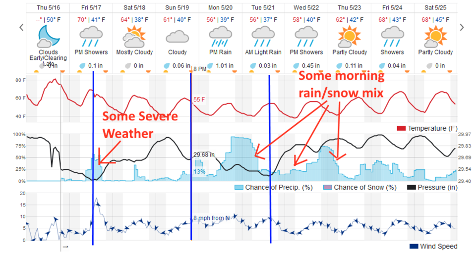
The next week will be about 30F cooler than this week with rain Monday through Friday totaling to about 1 to 1.5 inches with a snow rain mix possible Tuesday/Wednesday/Thursday mornings.
2:30pm Update:
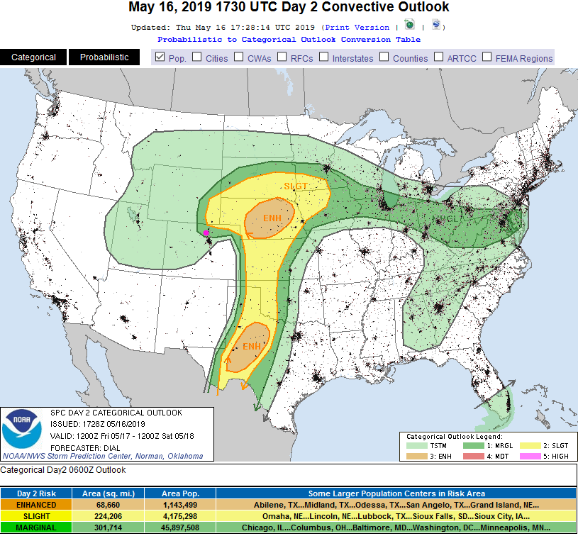
We've already pea sized hail today, around 1pm. The SPC has slightly expanded the slight (2 on a scale of 1-5 severe weather risk) to just include Longmont for the next few hours. It is rumbling a lot outside. Figure 2 update. There is a severe thunderstorm watch for eastern Longmont and points east and north.
End 2:30pm Update.
8:30 am Update
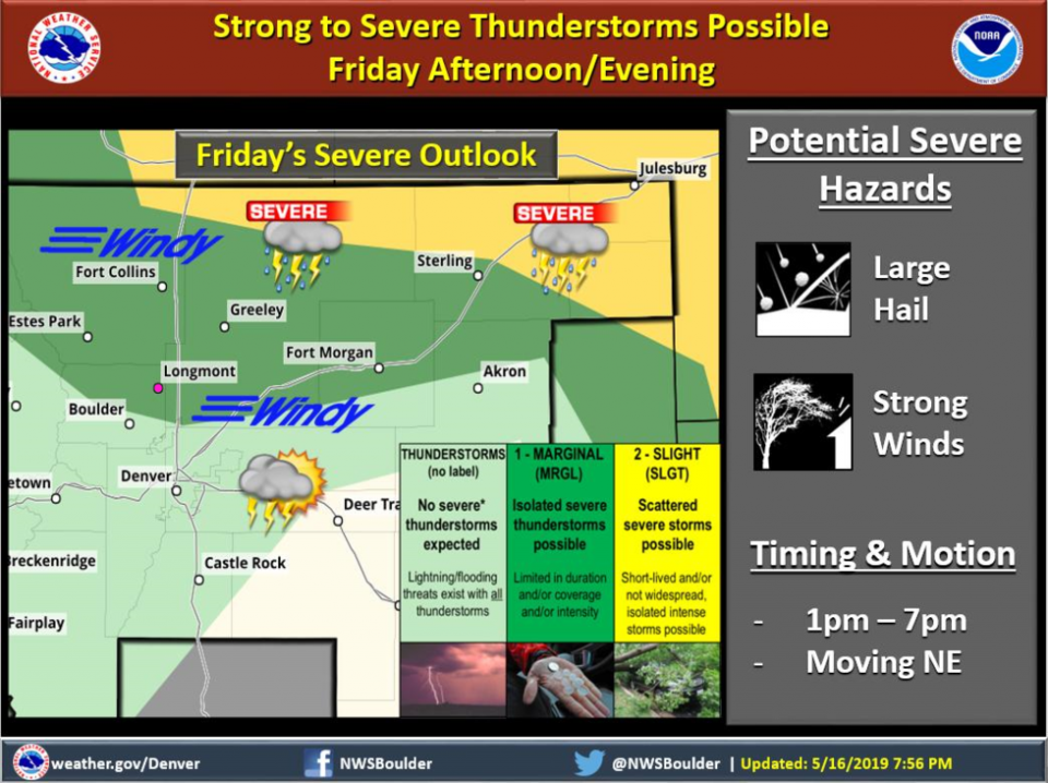
The NWS Boulder posted a special graphic forecast for the storms that will be moving in later today (Figure 1 update). Winds will be out of the south before storms form then blow briskly from the west afterwards with lowering temperatures.
To keep up with weather changes and watches/warnings, don't forget you can run apps like Storm Shield, RainAware, Dark Sky, WeatherBug, Wunderground (the weatherunderground.com app), MyRadar, and Radar Scope and watch weatherunderground.com. The apps listed here will put up notifications when watches and warnings are issued. Some of these listed do have a minimal cost associated with them. If you have some you like, list them in the comments below!
End 8:30am Update.
Forecast Discussion:
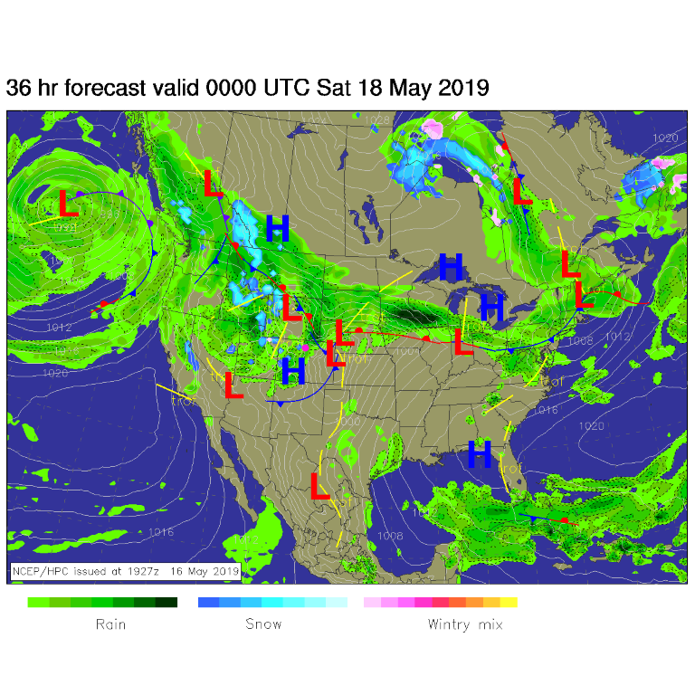
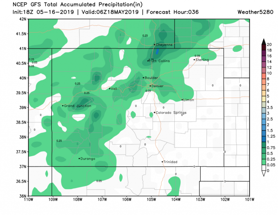
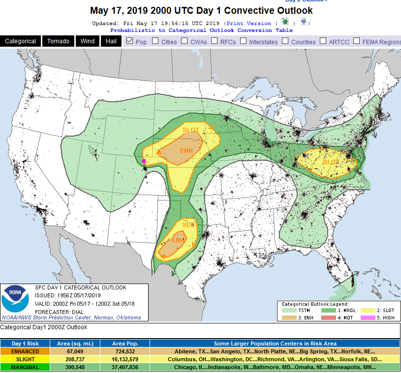
The front arrives today cutting off a warm morning and putting a chill in the air. Airflow north of the front, that will slow around Denver, will bring in easterly winds and some Great Plains moisture (our missing ingredient for severe weather in the current set up). The front will slide slowly out of the state to the south by evening (Figure 1). The front is marked in blue in time on Figure 2 with maybe 1/10th of an inch of rain in thunderstorms (Figure 1) to maybe 1/4th of an inch (Figure 4). If you get a direct hit by a storm, you might get 2x to 3x that amount.
With this moisture, severe weather is possible north of Denver and up into the northern mountains. A Marginal Risk (1 on a scale of 1 to 5, where 5 is means the severe weather is most likely and most severe). There is a Slight risk (2 on a scale of 1-5) in the northeast corner of our state. Large hail and a few tornadoes are the primary threat. Keep an eye on the dark skies!
The Longer Range Forecast:
This is the beginning of a cool, wet/damp week with additional fronts arriving Sunday night and Tuesday afternoon (Figure 2). It will be cold enough that we might see snow mixed in with the rain Tuesday, Wednesday, and Thursday mornings in Longmont.
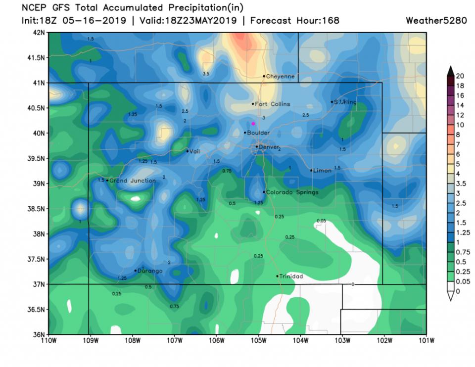
Monday through Friday will see 1 to 1.5 inches of rain according to weatherunderground.com. The GFS gives us 2 to 2.5 inches of water over the next 7 days (Figure 5). Remember, it has been too bullish on rainfall totals many days out, but we do seem to get at least 1/2 of what it estimates.
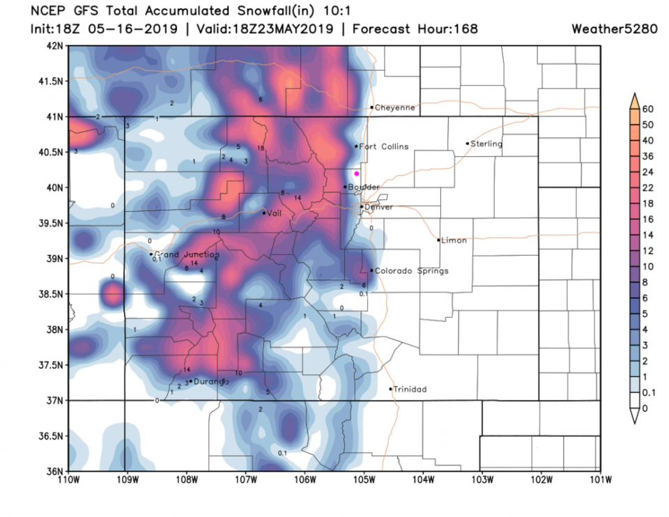
As for snow from the GFS (Figure 6), the mountains pick up a foot or two of new snow. Some snow even falls over western Denver, Boulder, Loveland and Fort Collins over the next 7 days. We can't erase the s-word (snow) from our language yet.