This content was originally published by the Longmont Observer and is licensed under a Creative Commons license.
In Brief:
We reach the 80'sF for highs over the next 3 days. There is a small chance of afternoon showers/thunderstorms rolling off the mountains in the afternoon (as we have seen for a few days already).
A big trough moves in again for Friday - kicking off thunderstorms and cooling us to the 60'sF into next week.
Forecast Discussion:
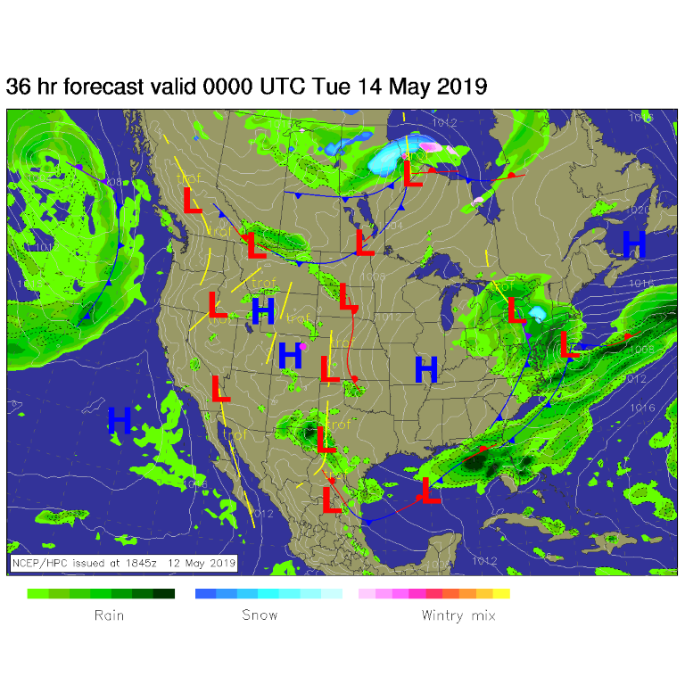
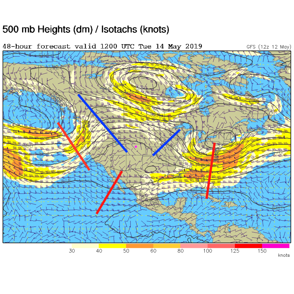
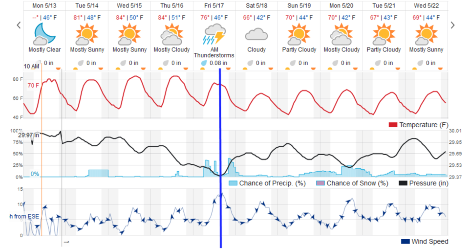
High pressure at the surface (Figure 1) and overhead in the jet stream level (Figure 2) means we warm up. With daytime heating, moisture, and ripples in that upper level flow - we may see afternoon thundershowers the next couple of days. Each day hits the 80'sF (Figure 3). This will feel warm.
The Longer Range Forecast:
The next big trough (not shown) moves in on Friday. We might see severe storms nearby (we won't know more until closer to the week end -blue line -Figure 3). We cool about 15-20F starting Saturday and continuing on to mid-week next week.
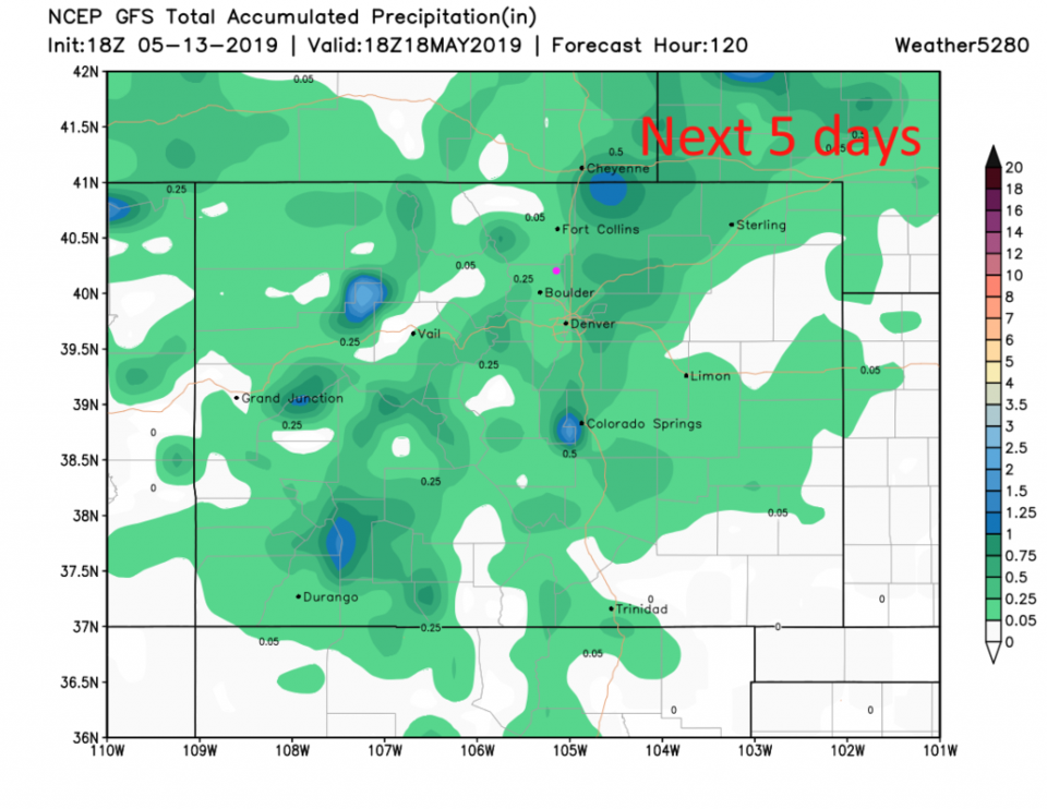
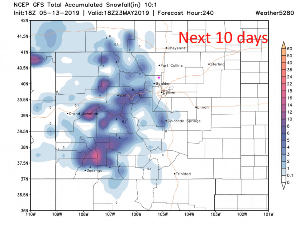
Not a lot of water seems in the offing though. The GFS gives us under 1/4th inch over the next 5 days (Figure 4). Over the next 10 days, snow remains in the mountain and may dust Boulder - but not Longmont (Figure 5). More later!