This content was originally published by the Longmont Observer and is licensed under a Creative Commons license.
In Brief:
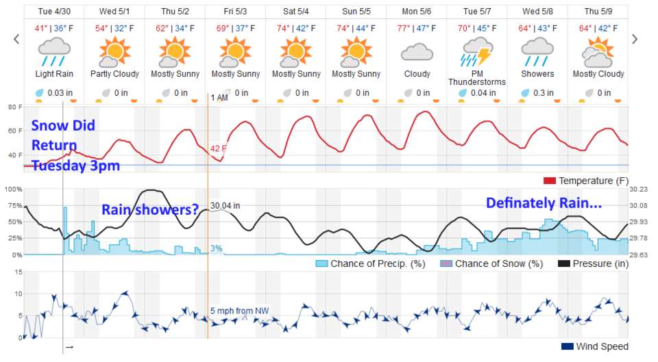
The storm system is slow to pull out. Rain showers (and snow showers) are possible through Thursday evening, but chances diminish each day as temperatures rise. We have a warm dry weekend ahead followed by a return of rain and thunderstorms next week.
Snow Reports:
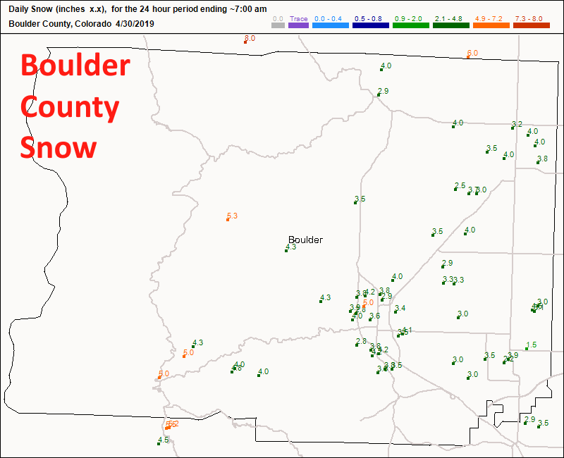
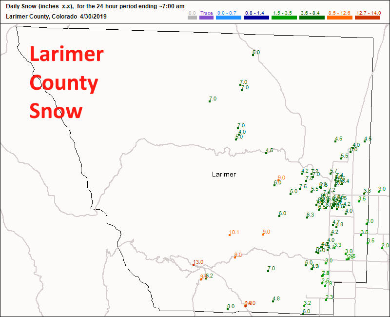
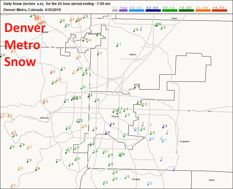
Before we get to the discussion, let's look at what happened with the snow across the region. I called for 2-5 inches of snow. Longmont received about 3-4 inches (Figure A). Boulder saw 3-5 inches. Ft. Collins saw 3-7 inches (east to west across town). Estes park picked up 6-13 inches. Wow (Figure B). Denver saw just a trace in the east to 5 inches in the foothills (Figure C).
Forecast Discussion:
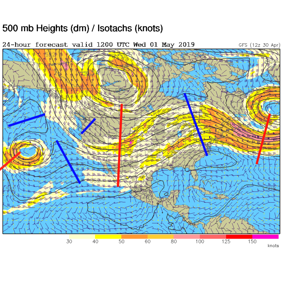
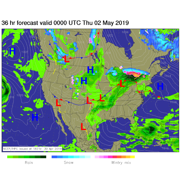
Our next wave came through Tuesday afternoon, but it did start as snow rather than rain (temperatures were at 41° F - it just want's to make me look bad!). There is a wide trough across the west with ripples traveling over the state on northwest flow for another couple of days (Figure 1). For Wednesday, the front is draped south of the state with more mountain showers and a few showers out on the Plains (Figure 2).
The Longer Range Forecast:
The longer range forecast has the trough replaced by a ridge for the weekend (not shown) that is, in turn, replaced by another big trough next week (not shown). Enjoy this weekend and have your umbrella ready for thunderstorms on Tuesday with rain in the days beyond that (Figure 3). Might we get our first severe weather of the year along I-25 next week?!?!