This content was originally published by the Longmont Observer and is licensed under a Creative Commons license.
Forecast Discussion:
With this next system approaching this afternoon, I'm posting early. Again.
This system is quite similar to the mid-week storm. Another good coating of snow hits the Western slopes and high mountains while some rain (this time) and snow and ice sweeps the I-25 corridor briefly.
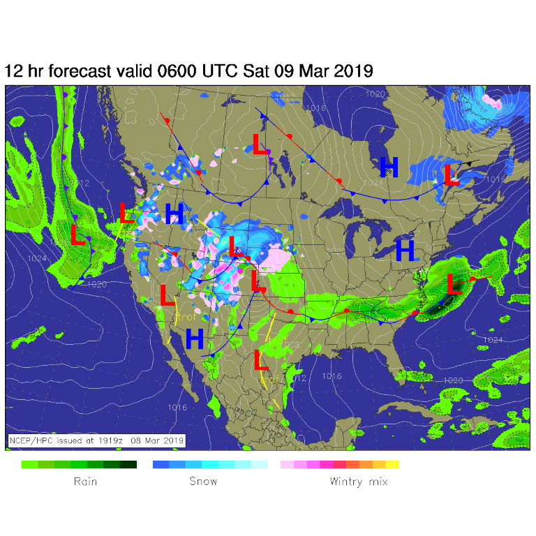
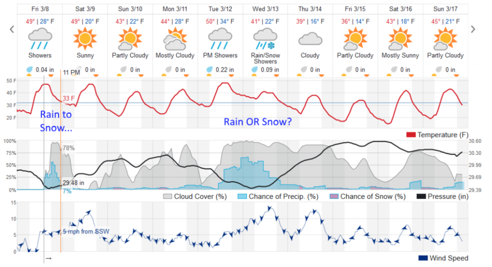
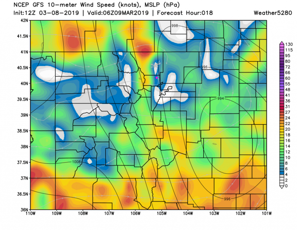
You can see the system in the surface map for early Saturday morning - Figure 1. Near the end of the precipitation, around midnight, temperatures are still just a bit above freezing. It still may put down snow and ice where heavier precipitation comes down (Figure 2). Winds will make it feel colder and will make Saturday morning uncomfortable. Figure 3 shows gusty winds scraping the foothills overnight up to about noon Saturday (also visible in the winds graph at the bottom of Figure 2). (Note, even a few thunderstorms are possible anywhere over Colorado too!)
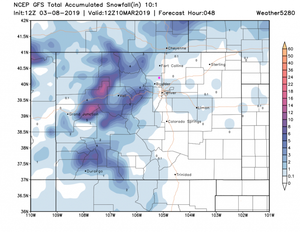
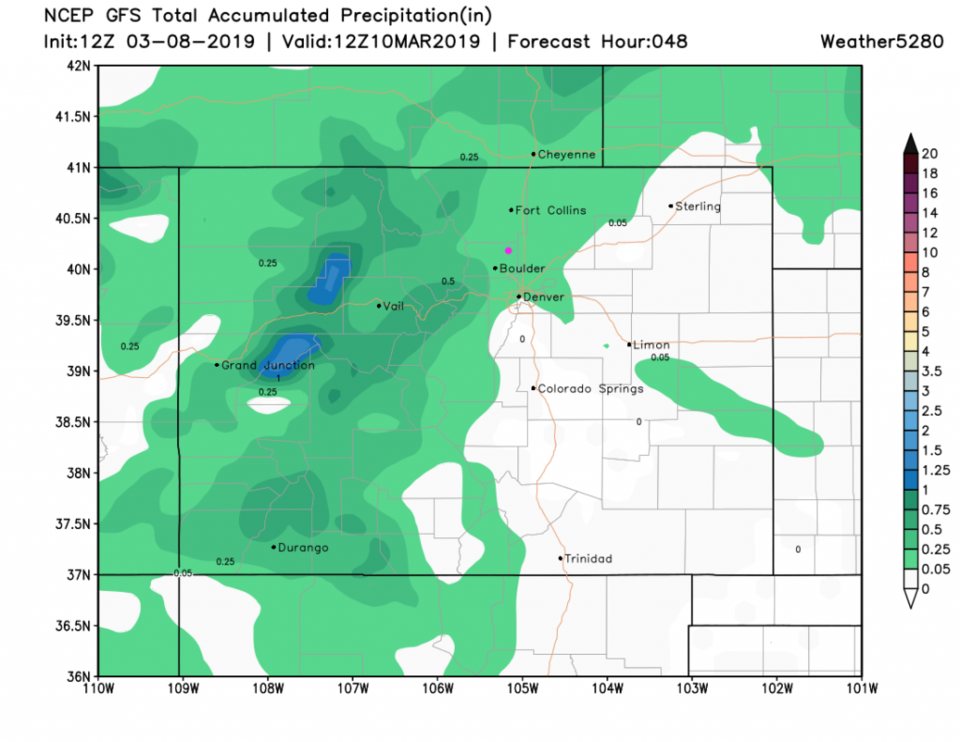
Figure 4 suggests a coating to an inch of snow IS possible (I'd vote for the coating to 1/4 inch end, personally, for Longmont). Figure 5 shows us getting .05 to 0.25 inch of rain with this system.
The longer range forecast:
Winds calm down and we have a mild dry weekend later Saturday. The Tuesday/Wednesday storm is all over the place in the models. One model run gives us a bunch of rain (like the weatherunderground.com model does in this instance - Figure 2). Others give us a big March winter storm with blizzard conditions out on the eastern Plain. Others give us nothing but gusty winds and cloudy skies. You'll have to come back to find out more!