Skip to content

Next Storm/Next Snow Forecast Discussion from the Cherrywood Observatory – March 25, 2019

This content was originally published by the Longmont Observer and is licensed under a Creative Commons license.

Forecast Discussion:

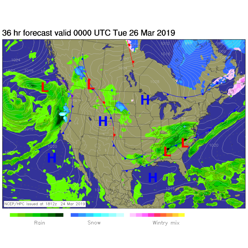
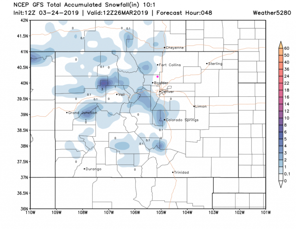
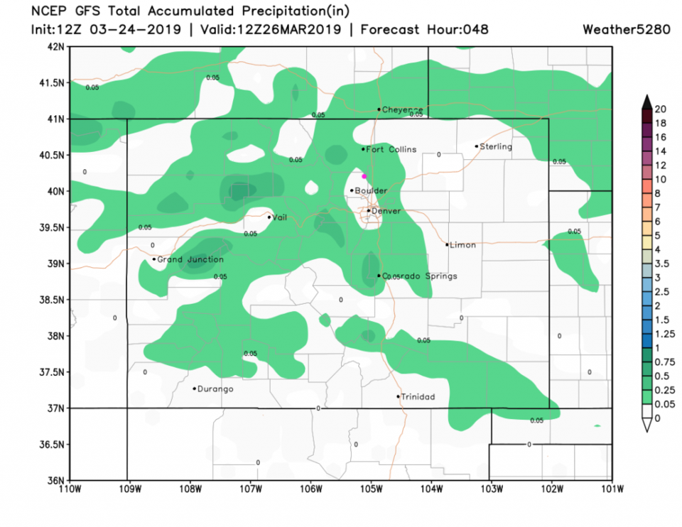
It really seems that Spring arrived with the calendar date/astronomical start of Spring. Today, there is cooler air out on the Plains (and some fog maybe pushing west of I-25 in the morning - Figure 1). Over the next 48 hours the mountains (and maybe Boulder) gets a dusting of snow - Figure 2. Figure 3 is the water content (rain and snow) - there are just light showers around over this time. The rain chances fade out after about 6 am today.

The longer range forecast:

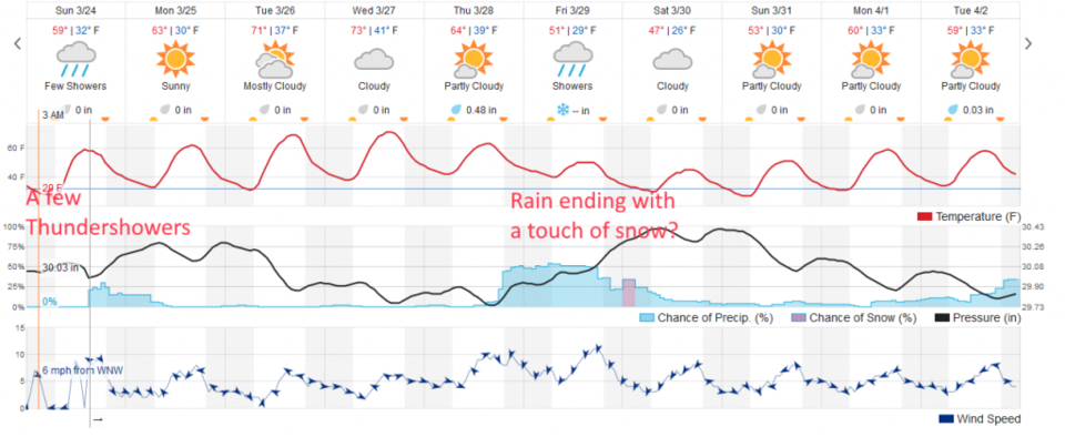
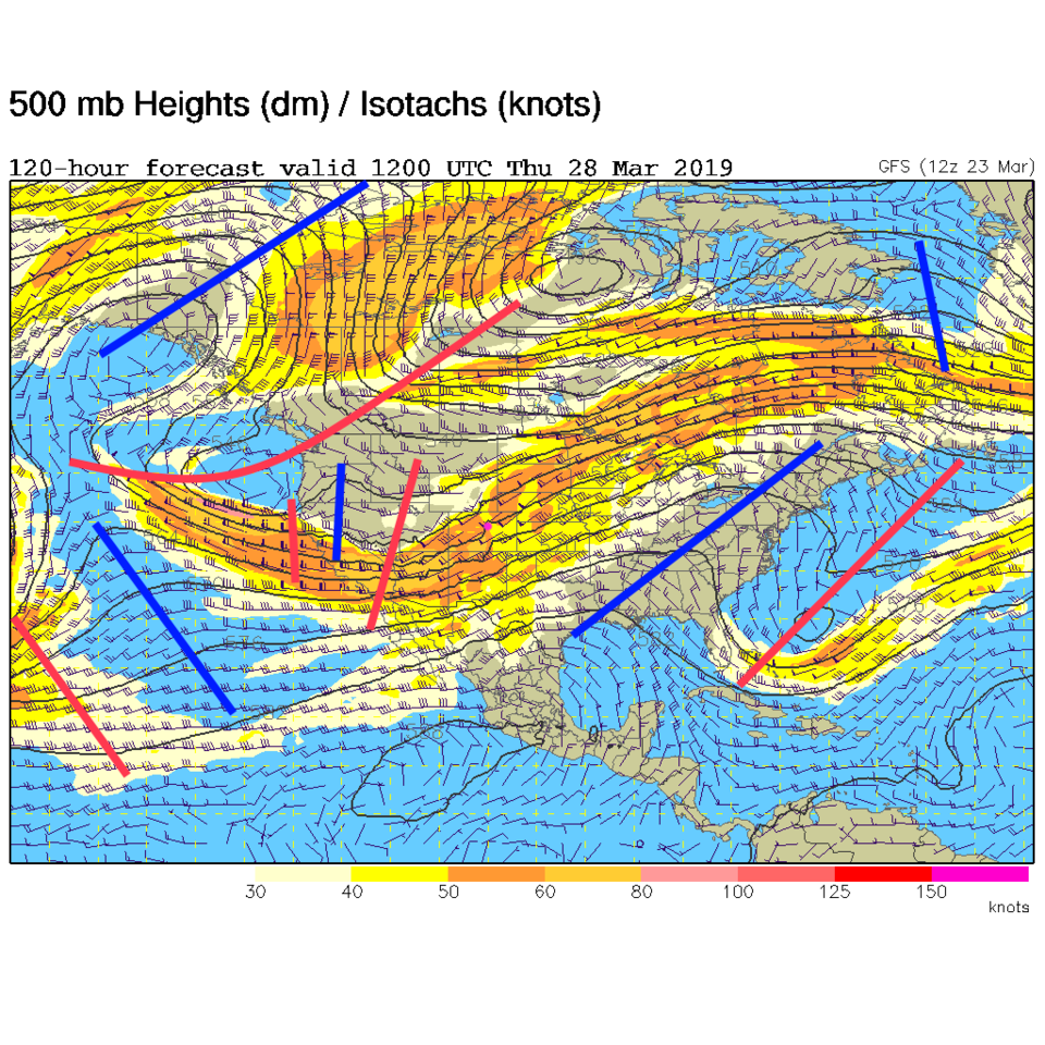
Look at the 70's F Tuesday and Wednesday as a big ridge slides past us. Warm and dry (Figure 4). Another trough approaches from the west later in the week (Figure 5). Temperatures drop to normal then below normal on Saturday. A healthy chance of rain begins Thursday am and continues through early Saturday morning. Models are divided on how much cold air comes in, but present consensus is that there will be some snow at the end of the storm.

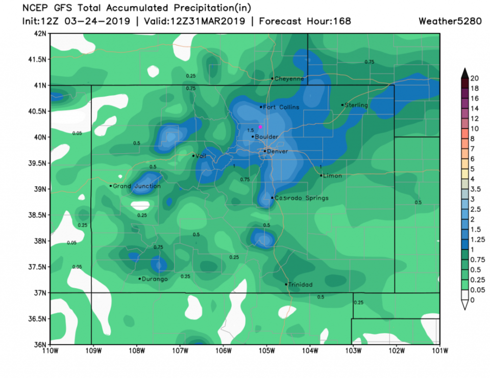
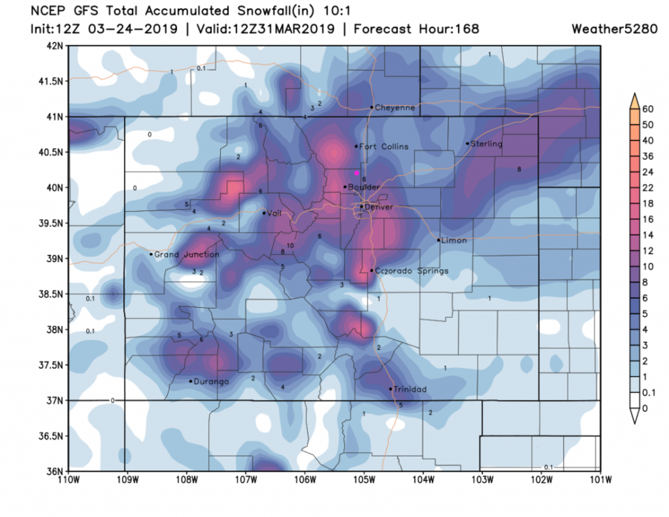
Between now and Sunday, the GFS dumps 1.5 inches of rain on us (Figure 6). It also gives us about 5 inches of snow at the later, colder, part of the storm (it is more bullish than the weatherunderground model) -Figure 7. We have something to watch this week!

Figure 1: The forecast surface map for Monday PM from NCEP.
Figure 2 : the forecast accumulated snow map from the GFS and weather5280.com for Colorado, through Tuesday noon.
Figure 3 : the forecast accumulated precipitation map from the GFS and weather5280.com for Colorado, through Tuesday noon.
Figure 4: the graphical forecast for the next 10 days for Longmont, CO from weatherunderground.com
Figure 5: The 500mb forecast upper air analysis for Thursday AM. Pink dot is Longmont. Red lines are troughs, blue lines are ridges.
Figure 6 : the forecast accumulated precipitation map from the GFS and weather5280.com for Colorado, through Sunday AM.
Figure 7 : the forecast accumulated snow map from the GFS and weather5280.com for Colorado, through Sunday AM.

Current Weather

Mostly cloudy

Mostly cloudy

54°F

UV Index
3 Moderate
Pressure
29.88 Steady
Visibility
7 miles
Dewpoint
46 °F
Humidity
76%
Wind
N 1.1 mph
Gust
2.8 mph
Wind Chill
54 °F

Hourly Forecast

Today
9 AM
59°F
Intermittent clouds
Today
10 AM
64°F
Partly sunny
Today
11 AM
69°F
Partly sunny
Today
12 PM
73°F
Intermittent clouds
Today
1 PM
77°F
Intermittent clouds
Today
2 PM
76°F
Cloudy
Today
3 PM
75°F
Cloudy
Today
4 PM
73°F
Cloudy
Today
5 PM
70°F
Cloudy
Today
6 PM
68°F
Cloudy
Today
7 PM
65°F
Cloudy
Today
8 PM
62°F
Thunderstorms

7 Day Forecast

Mostly cloudy

Thursday

77 °F

Turning cloudy; warm


Thunderstorms

Thursday Night

47 °F

A thunderstorm in spots this evening; otherwise, considerable cloudiness


Thunderstorms

Friday

69 °F

Mostly cloudy and not as warm with a couple of thundershowers


Thunderstorms

Friday Night

44 °F

Cloudy with a couple of thundershowers


Rain

Saturday

46 °F

Chilly with periods of rain and a thunderstorm


Rain and snow

Saturday Night

39 °F

Cloudy with rain, mixed with a little snow late


Mostly cloudy

Sunday

59 °F

Mostly cloudy and warmer; a stray afternoon thundershower


Partly cloudy

Sunday Night

36 °F

Partly cloudy


Mostly sunny

Monday

71 °F

Mostly sunny and warmer


Partly cloudy

Monday Night

39 °F

Partly cloudy


Sunrise and Sunset

Sunrise
6:07 AM
Sunset
7:50 PM

Based on AccuWeather data