This content was originally published by the Longmont Observer and is licensed under a Creative Commons license.
10 PM Update Saturday 3/23:
The previously described short wave will be rolling over the state today (Sunday) kicking off a chance of rain and thunderstorms, some containing small hail, mainly after 5pm Sunday and ending by 11pm. A little taste of Spring weather now that Spring has started - and before the 70'sF hit later this week. I'll have my camera with me for any thunderheads that form... (Note, presently, severe weather is not expected in Colorado.)
End 10pm Update 3/23
Forecast Discussion:
I'm barreling down the interstate typing on a wifi hotspot from the back seat. But we're getting an update done!
We drove through a blinding (but geographically small) snow storm near Flagstaff Thursday PM. That storm system hit Colorado on Friday and even produced a significant land spout near Eads. What excitement!
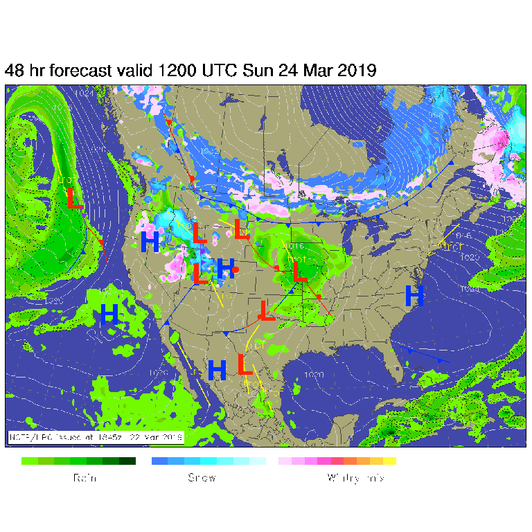
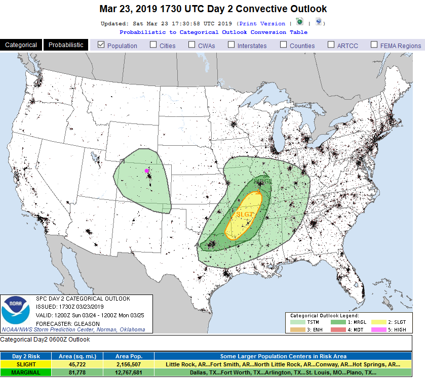
Figure 1 shows (by Sunday morning) that we are between systems, but another low is dropping moisture to the west of our state. Try as I could, my graphics program would not save the (even flattened) trough and ridge lines in Figure 2, but the big picture is the large ridge in the west with an active southern branch of the jet stream bringing many small ripples of energy over the state. That means mountain snows and rain showers on the plains. And a warming trend.
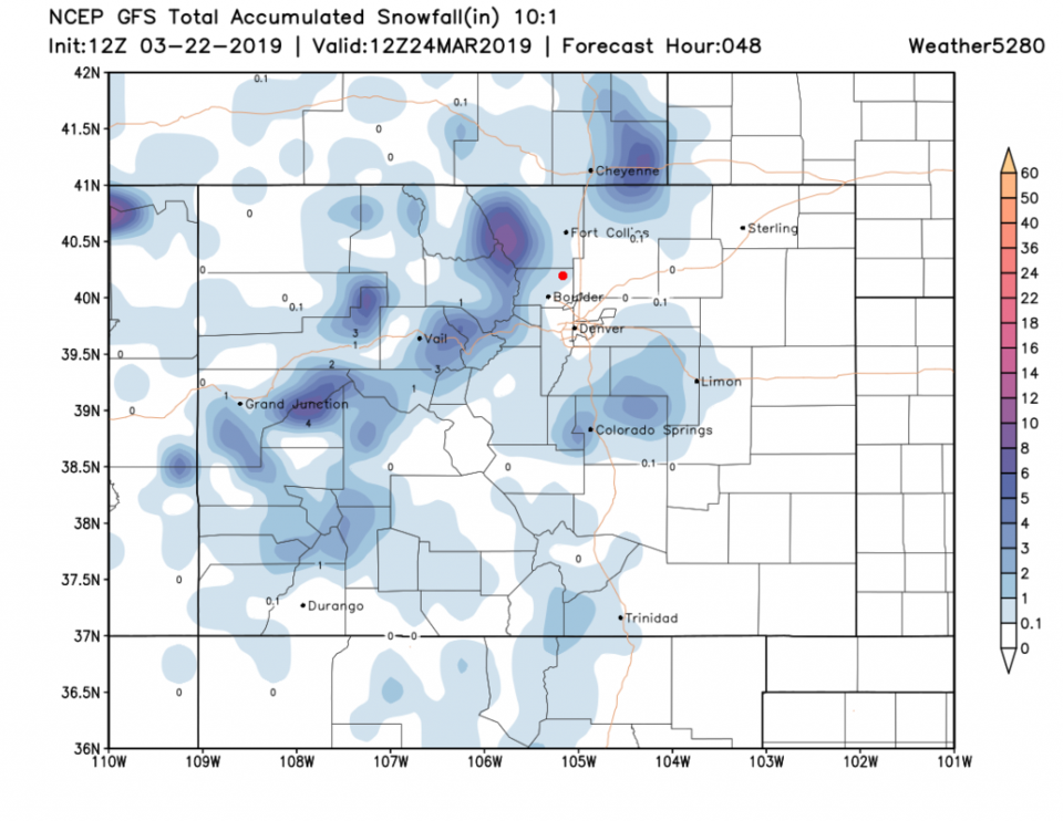
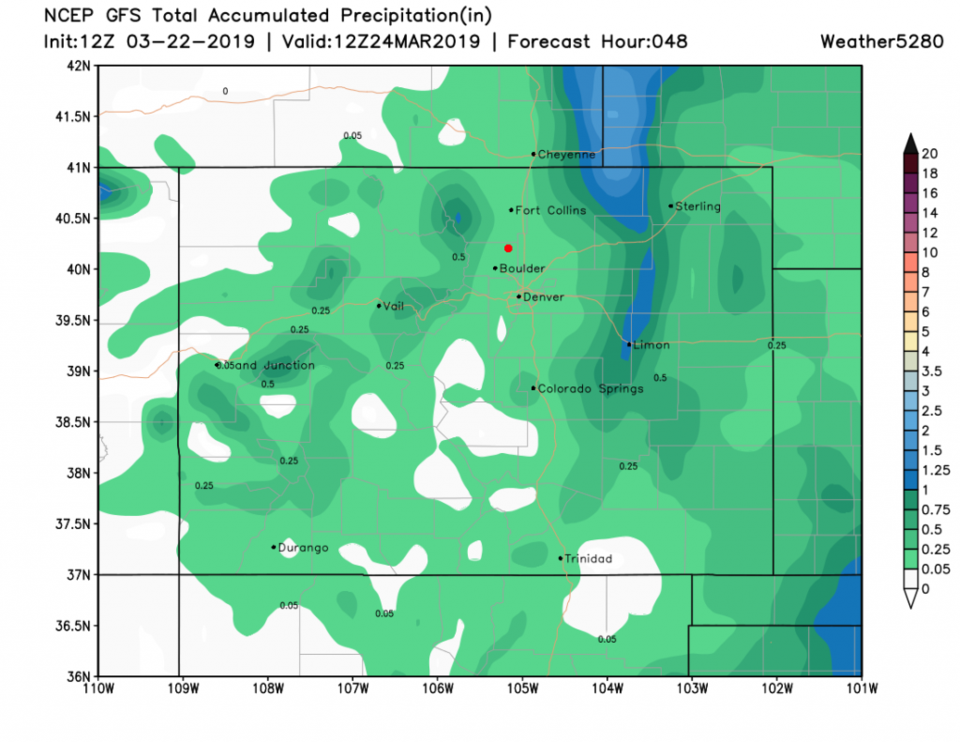
Over the next 48 hours, we'll see a dusting or coating of snow near Longmont with night time precipitation. We might pick up up to 1/4th of an inch of water during that time (Figures 3 and 4).
The longer range forecast:
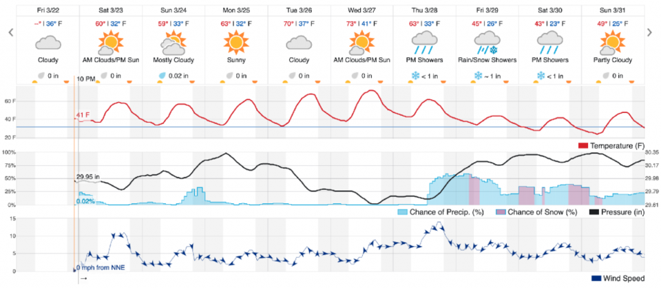
That ridge takes hold and we rocket to the 70'sF by mid-week. Oh that will feel good - even Phoenix wasn't that warm this week. Out further in the week, we have indication of a big trough returning and more rain and snow with cooler temperatures, but we'll look at that when I return to normal forecasting duties in a couple of days.