This content was originally published by the Longmont Observer and is licensed under a Creative Commons license.
Forecast Discussion:
Happy Spring! Spring begins today at 3:58 PM MDT
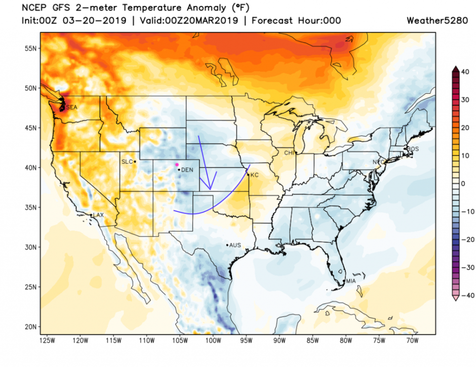
The cool air that pushed trough yesterday, dropping showers that evaporated before reaching the ground, is entering Texas and Oklahoma (clearly visible in Figure 1). A ridge overhead gives us beautiful (almost spring-like) weather today. Enjoy.
The longer range forecast.
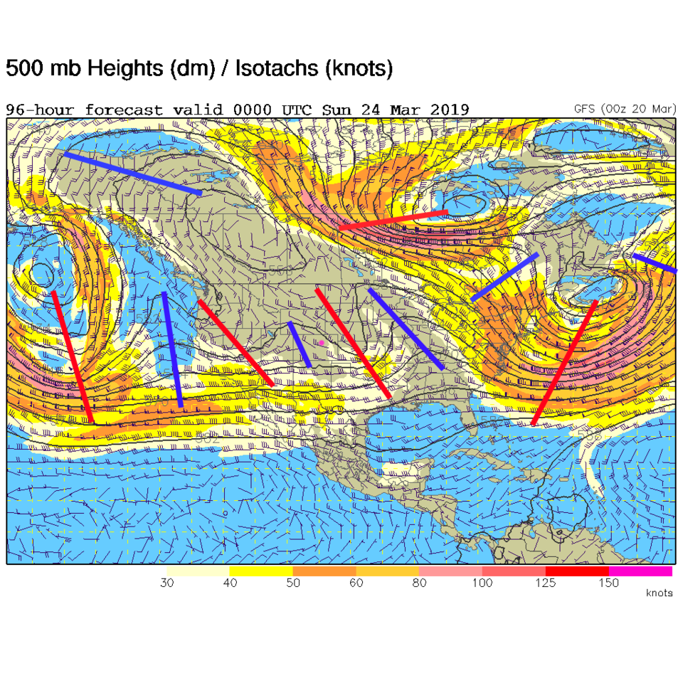
The weather changes as troughs begin to crash into our state by the end of the week - lead by the cut off low that will put more rain down in the desert (it is REALLY green in the deserts of AZ right now - with wildflower blooms going on) and snow in the mountains. By Saturday, a number of short waves will pass over the state creating, first, mountain snows, low land rains, then some snow chances as each trough drags a bit of cool air in (Figure 2 and Figure 3).
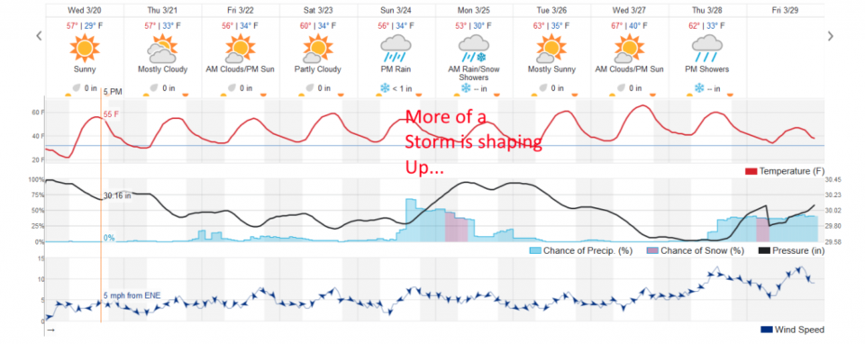
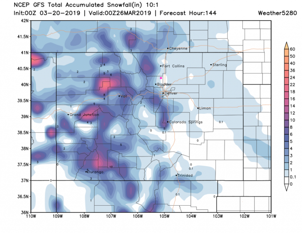
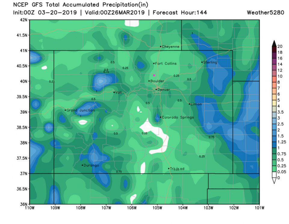
From Figure 3, we have rain showers beginning Sunday and continuing to Tuesday AM. By Monday PM, Longmont might see a coating to a 1/2 inch of snow (Figure 4) and 1/10th to 1/4th inch of water (Figure 5). We'll keep an eye on it as the week progresses.
Since I'll be traveling back Thursday and Friday - I might have to post another double day post then to insure against a no-internet day. It is just not ubiquitous yet!