This content was originally published by the Longmont Observer and is licensed under a Creative Commons license.
Forecast Discussion:
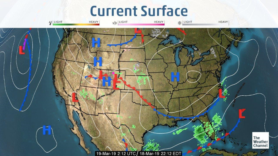
With a front draped nearby and a small ripple in the upper atmosphere interacting with it, we do have light snow showers in the mountains (yes again) and some sprinkles coming out on the Plains/I-25 Monday evening. This is a very small scale system hitting areas around town this evening. It is nice that the weather is somewhat unpredictable (ripples in the upper atmosphere like to do this in northwest flow). You can barely make out the streak of showers around and east of the pink dot north of the low and front in northern Colorado (Figure 1) currently (Monday PM).
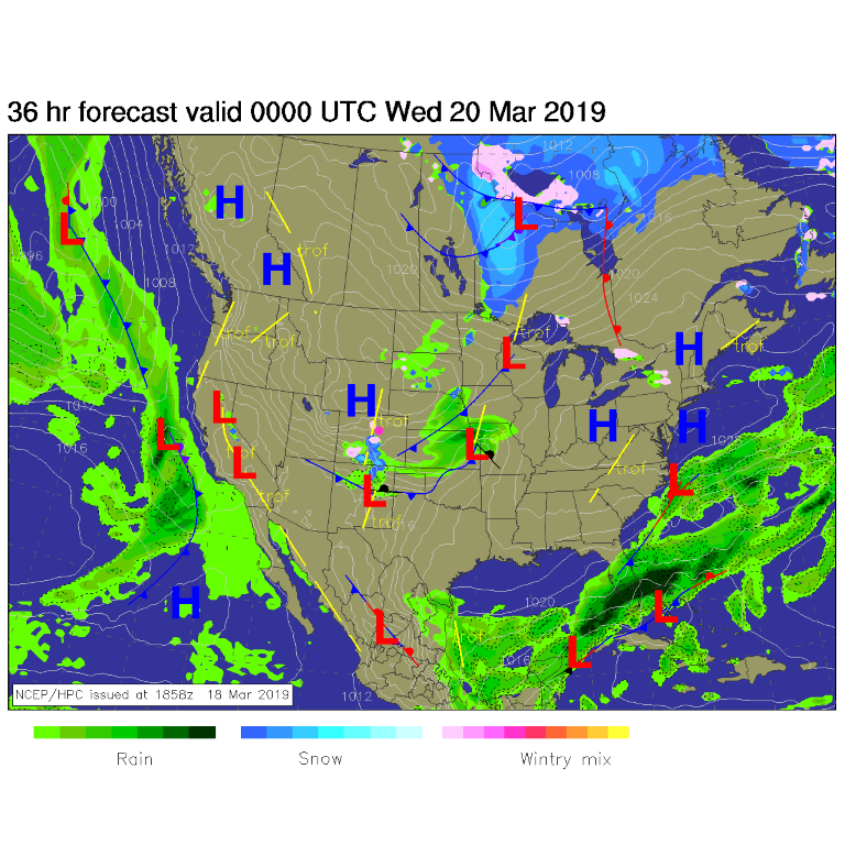
Tuesday, the convergence zone with the front sags south leaving us in cool air for another day (Figure 2). Light mountain snow showers continue.
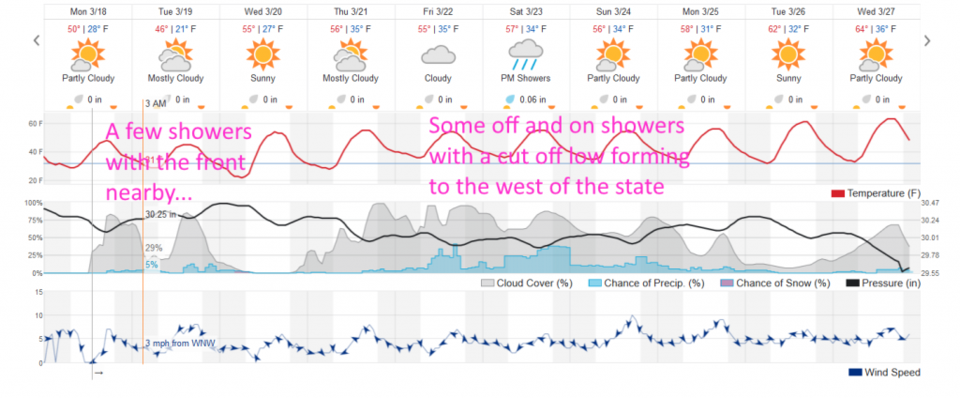
After this system clears, we warm to the 50's F Wednesday (Figure 3).
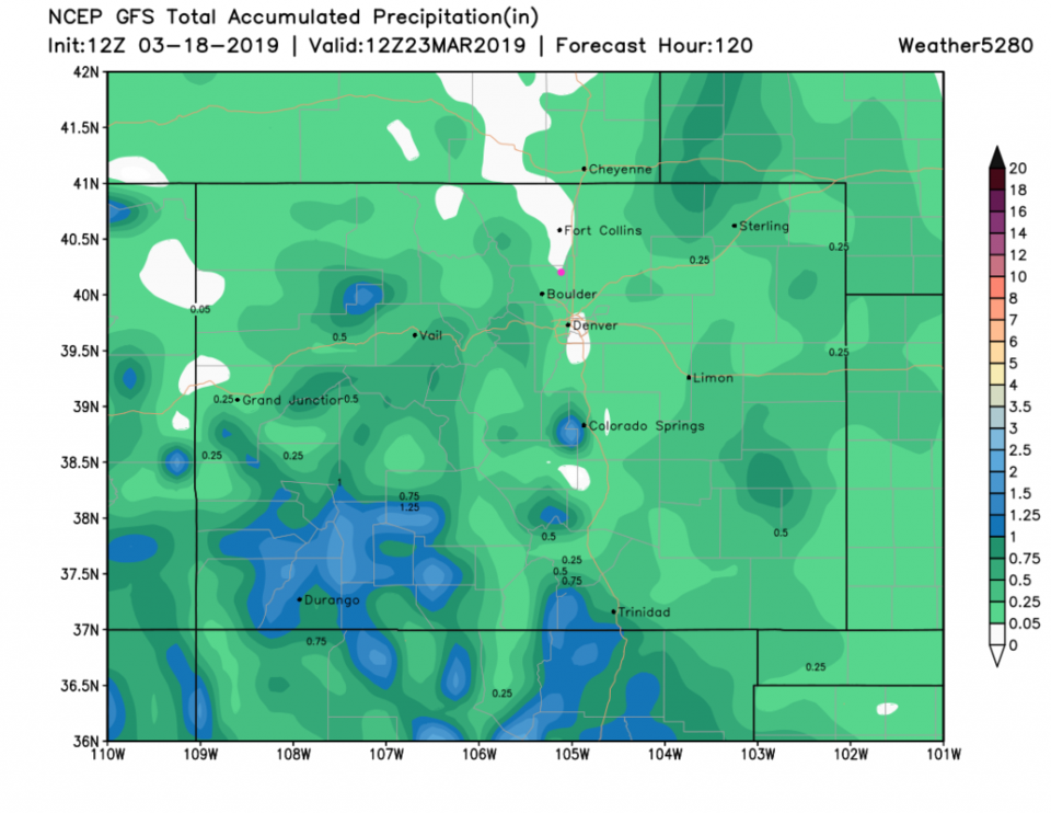
The longer range forecast:
A trough digs into the western US later in the week and a big cutoff low forms to our west and drifts slowly eastward. We end up in a moist, cloudy and showery (but still warm) period of time Friday through Monday (Figure 3).
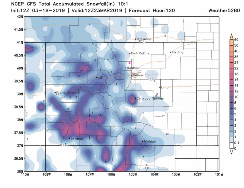
Water amounts will be light through this period - the next 5 days of snow show nothing in town (the heavier snow totals are in the southwestern mountains again (Figure 4). Rainfall is the story with this system. Most of Longmont should see around 1/10th an inch of water over the next 5 days.