This content was originally published by the Longmont Observer and is licensed under a Creative Commons license.
In Brief:
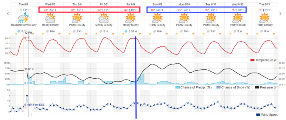
The afternoon storm pattern rolls on. Tomorrow (Wednesday), more moisture will flow into the state. The thunderstorms that do form will be capable of dropping a lot of rainfall in a small area (over an inch, maybe even 2 inches in a few neighborhoods). Things calm down the next day with temperatures in the lower 80's F (with a few afternoon thunderstorms) until a cool front moves in Saturday evening. Rain chances increase Saturday night and we cool to the 60'sF Sunday. Next week is more of the same with 70's F for highs each day.
11:30am Update:
The better moisture seems to have only made it up into southern Colorado. The precipitable water values went from 0.47 inch to 0.64 inch this morning at Denver. Storm motion IS going to be slow, coming out of the northwest (280 degrees) at only about 2-4 mph. If you have a cell move over you, you will see local flooding possible. The first storms to form this morning are up near the Continental Divide and are not moving hardly at all.
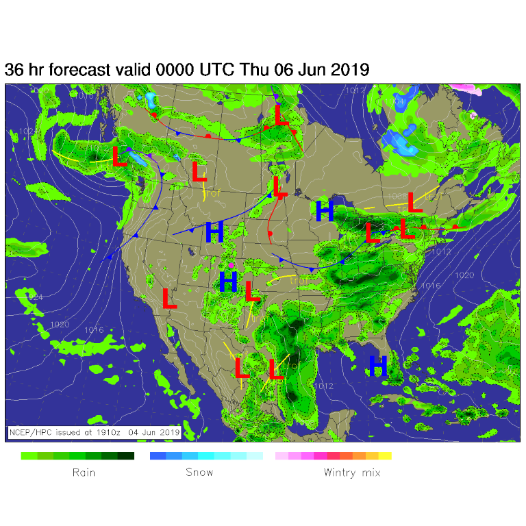
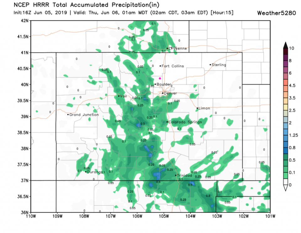
The HRRR is not excited about giving anyone precipitation along I-25 north of central Denver (Figure 1 update). There is a Flash Flood Watch over many counties in southern Colorado including Pueblo, Trinidad, over to San Louis Peak and up to Cotopaxi, to name a few spots.
End 11:30am Update.
Forecast Discussion:
The position of the upper level and surface lows tonight (Tuesday) and Wednesday will pump more moisture into the atmosphere over Colorado. A value I've not brought up since last year is precipitable water. It is a measure of moisture in the atmosphere that can be wrung out by rain making processes. Tuesday afternoon, it has climbed to 0.5". It may be as high as 0.8 to 1.0" of precipitable water Wednesday - which means that thunderstorms that form might drop locally flooding rain (an inch or two, but just over a few neighborhoods) Figure 1. Still, overall rain chances will be fairly low Wednesday - most won't see much water at all (Figure 2).
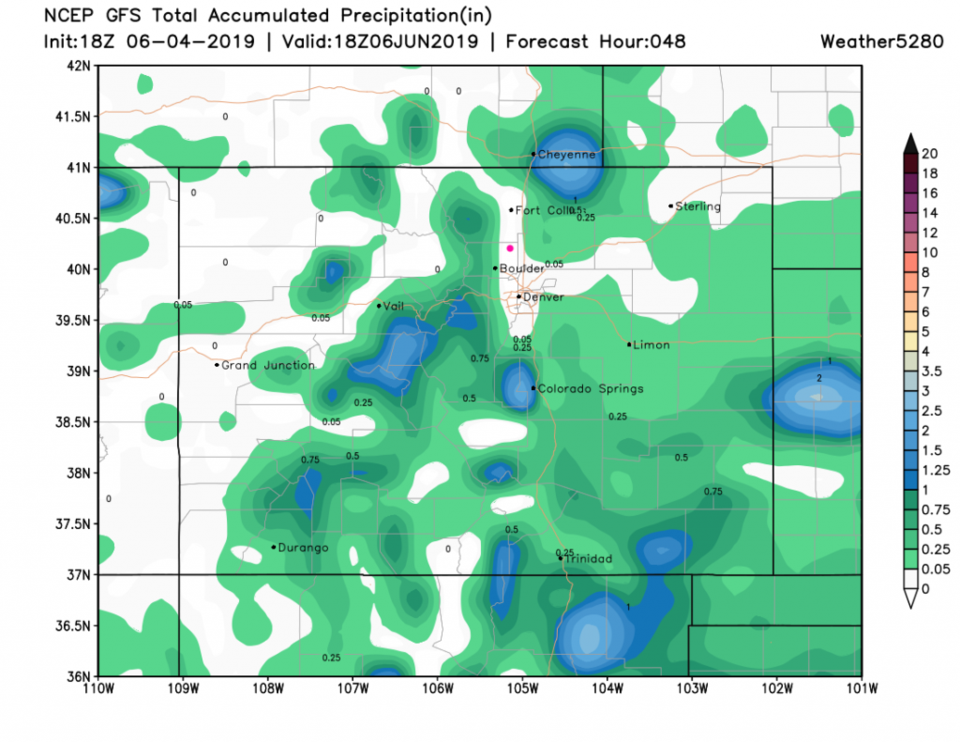
The 48 hour GFS shows local spots up to 2 inches (Figure 3). Don't put your money on that exact pattern, just the percentage cover and peak amounts.
The Longer Range Forecast:
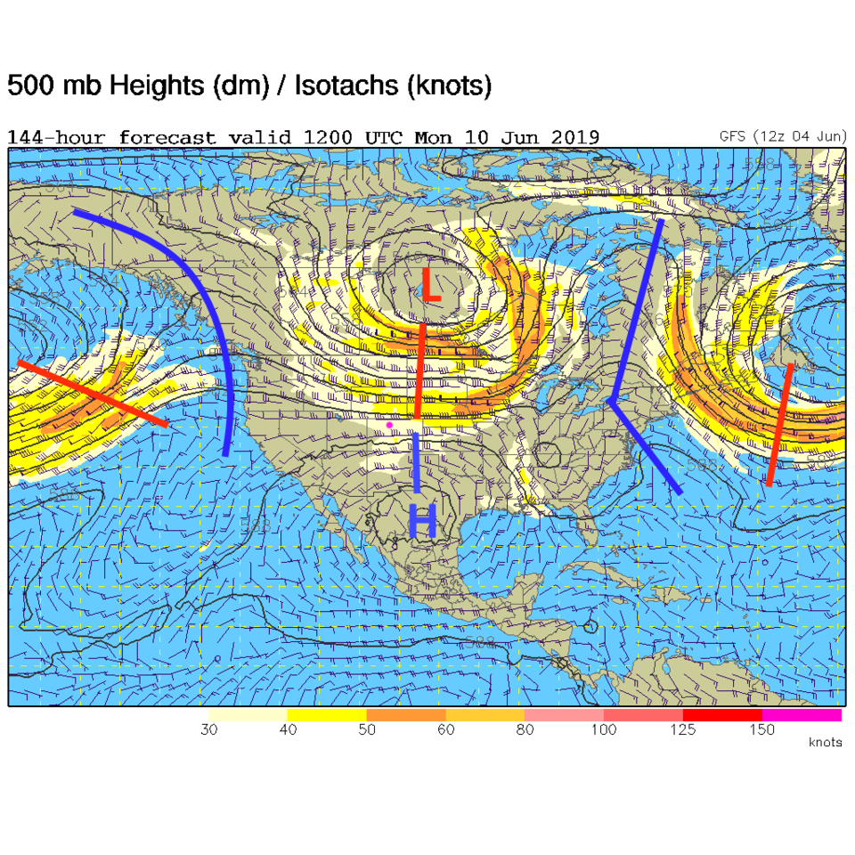
Things stay as they are with warm 80'sF each day and afternoon thunderstorms in spots. A cool front moves in Saturday evening (blue line Figure 2). It is driven by a northern branch jet stream trough (red line north of the state in Figure 4). This will put a chill in the air Sunday and keep us very seasonable all next week.