This content was originally published by the Longmont Observer and is licensed under a Creative Commons license.
In Brief:
The heat is here with 90's F on Thursday. We will get dangerously close to 100°F on Friday then we begin to drop a bit into the upper 90's F before a front arrives Saturday afternoon to cool us to the 80's F. Afternoon storms return on Saturday. Highs in the 80's F with afternoon storms is the new norm into next week.
Forecast Discussion:
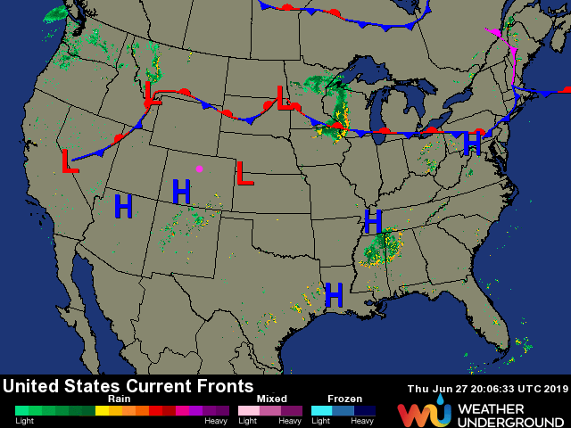
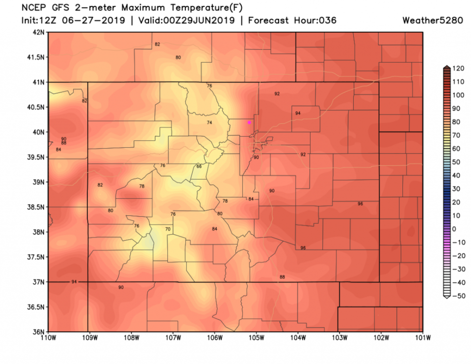
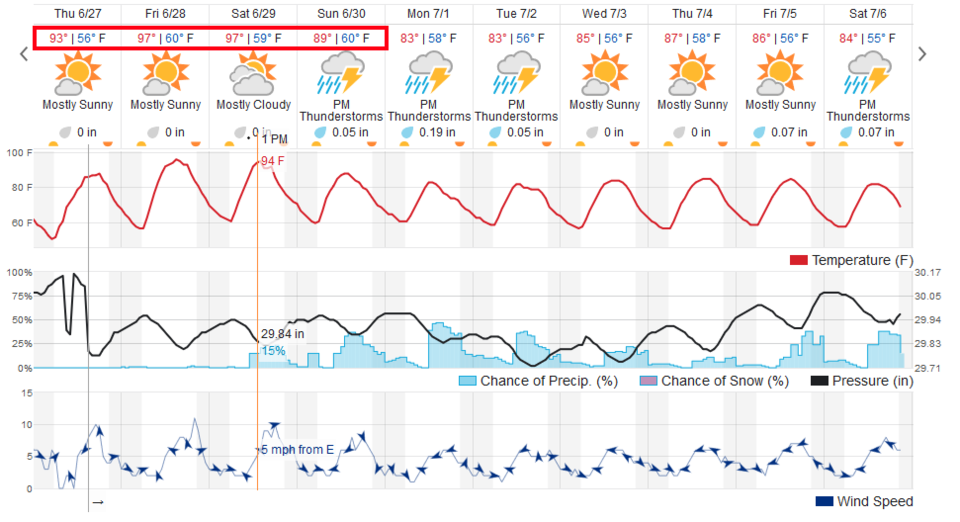
I'm still out beyond the reach of the interwebs (a half hour drive brought me back into the world briefly). The big question is will we hit 100°F Friday? Certainly locations out on the Plains will get to 100°F. We have a big high pressure front over the state through the weekend (Figure 1). The GFS is conservative with 90's F in the afternoon as the highest temperatures Friday (Figure 2). Weatherunderground.com gives us 97°F (Figure 3). My guess is locations southeast of Limon are most likely to get that hot.
No storms of much note are expected (you might see one or two in the distance).
The Longer Range Forecast:
Saturday is hot too (Figure 3) -but a front (seen up in Nevada in Figure 1) pushes in and takes the extreme off the heat. That also brings in moisture from a tropical system that is spinning off the Mexican coast and afternoon thunderstorms make a return with a weakening of the high pressure and a shift in the upper atmospheric ridge. Stay cool - I'm getting back to the camp site immediately. (We might hit 82°F while you folks are near 97°F.)