Skip to content

Next Storm/Next Snow Forecast Discussion from the Cherrywood Observatory – June 18, 2019

This content was originally published by the Longmont Observer and is licensed under a Creative Commons license.

In Brief:

Weather remains cool and stormy (afternoons) for two more days (the rest of Monday and Tuesday). We get hot and dry for Wednesday and Thursday (90F more more Thursday???). Cooler 70'sF and showers return Friday through Sunday. Severe weather is not expected around Longmont through Thursday (but updates will show up here).

Forecast Discussion:

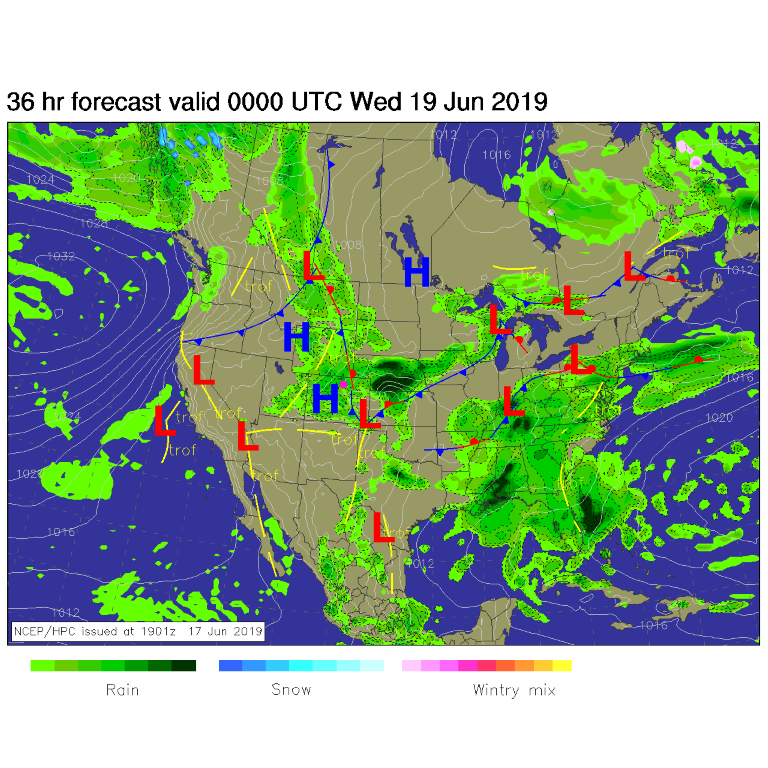
The cool front is still here (stationary) and the trough is still overhead. Afternoon showers are drifting around Monday (severe to our east) and will return (non-severe) Tuesday (Figure 1).

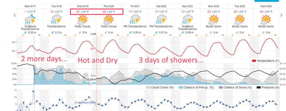
We might pick up 1/3rd of an inch of rain depending on where storms wander Tuesday (Figure 2).

The Longer Range Forecast:

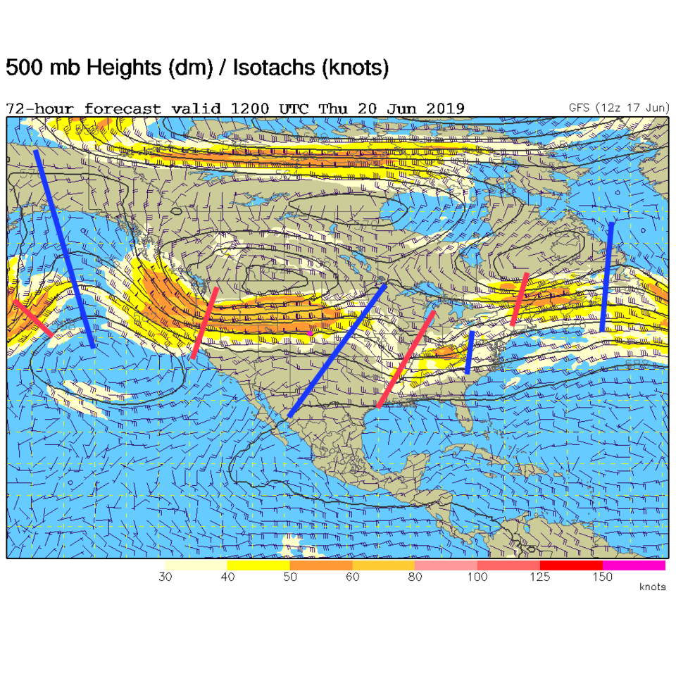
After this, we get a very short, 2 day visit from summer (Figure 2). That is due to a ridge that will move rapidly by Wednesday and Thursday (Figure 3 - blue line to our east).

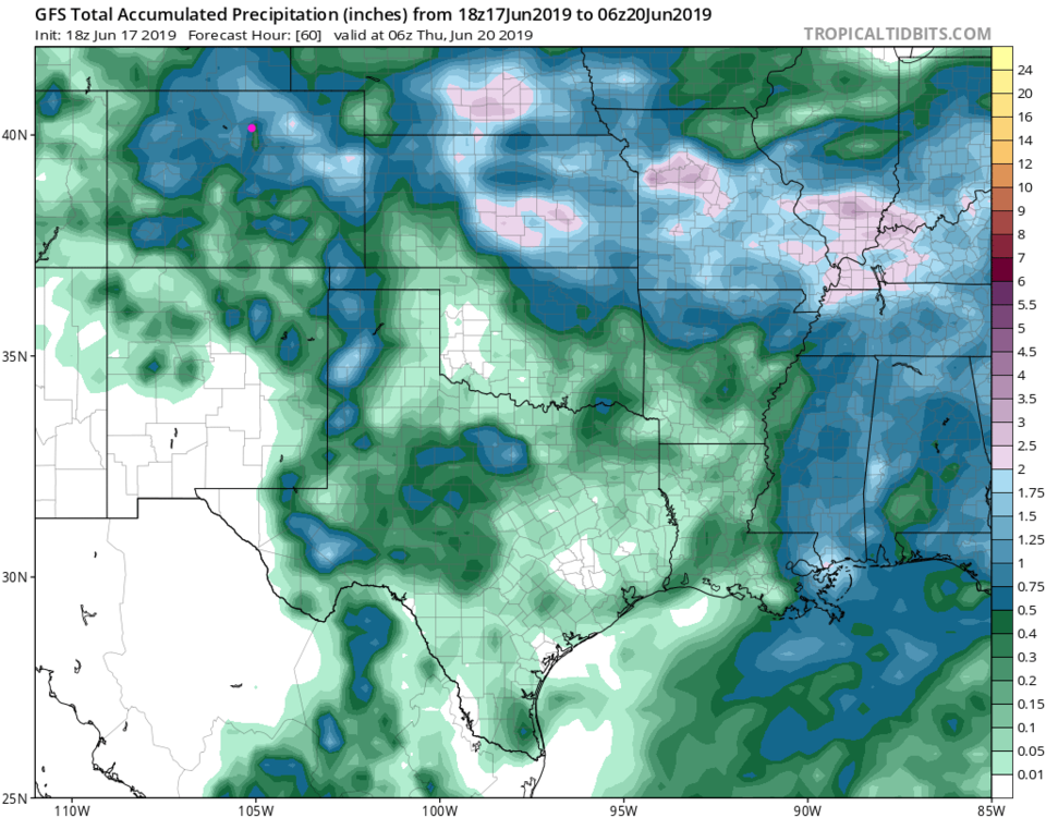
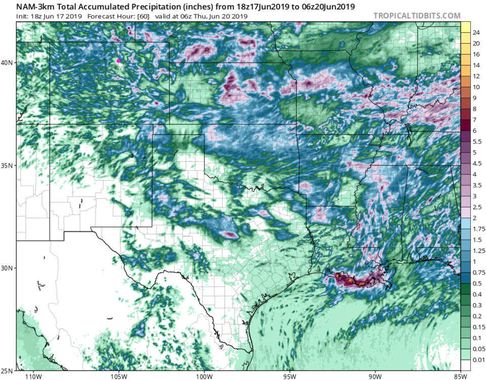
The trough to our west moves in for the weekend and we go back to the current pattern (Figure 2). The GFS gives us about 1/2 inch of water over the next 5 days (Figure 4). The NAM seems to be about 0.3-0.4 inch over the same time period (Figure 5).

Figure 1: The forecast surface map for Tudsday PM from NCEP.
Figure 2: the graphical forecast for the next 10 days for Longmont, CO from weatherunderground.com
Figure 3: The 500mb forecast upper air analysis for Thursday AM. Pink dot is Longmont. Red lines are troughs, blue lines are ridges.
Figure 4: the forecast accumulated precipitation map from the GFS and tropicaltidbits.com for Colorado,over the next 5 days.
Figure 5: the forecast accumulated precipitation map from the NAM and tropicaltidbits.com for Colorado,over the next 5 days.

Current Weather

Cloudy

Cloudy

41°F

UV Index
1 Low
Pressure
30.23 Steady
Visibility
7 miles
Dewpoint
36 °F
Humidity
82%
Wind
NNE 5.1 mph
Gust
8.8 mph
Wind Chill
38 °F

Hourly Forecast

Today
3 PM
41°F
Showers
Today
4 PM
42°F
Cloudy
Today
5 PM
40°F
Cloudy
Today
6 PM
39°F
Rain
Today
7 PM
38°F
Rain
Today
8 PM
37°F
Cloudy
Today
9 PM
35°F
Flurries
Today
10 PM
35°F
Cloudy
Today
11 PM
35°F
Rain and snow
Tomorrow
12 AM
35°F
Rain and snow
Tomorrow
1 AM
34°F
Cloudy
Tomorrow
2 AM
34°F
Snow

7 Day Forecast

Rain and snow

Friday

42 °F

Chilly; rain and snow showers this morning with little or no accumulation followed by rain and drizzle this afternoon


Rain and snow

Friday Night

32 °F

Periods of snow; rain mixed in early, accumulating 1-3 inches; roads could be slippery


Flurries

Saturday

39 °F

A bit of morning snow with little or no accumulation; otherwise, cloudy and chilly; storm total snowfall 1-3 inches


Intermittent clouds

Saturday Night

31 °F

A shower in places in the evening; otherwise, partly cloudy


Partly sunny

Sunday

64 °F

Partly sunny, pleasant and warmer


Mostly clear

Sunday Night

41 °F

Mainly clear


Intermittent clouds

Monday

79 °F

Warmer with a blend of sun and clouds


Partly cloudy

Monday Night

36 °F

Partly cloudy


Mostly cloudy

Tuesday

64 °F

Mostly cloudy and cooler


Mostly cloudy

Tuesday Night

40 °F

Mostly cloudy


Sunrise and Sunset

Sunrise
6:15 AM
Sunset
7:44 PM

Based on AccuWeather data