This content was originally published by the Longmont Observer and is licensed under a Creative Commons license.
In Brief:
We have a fairly wet and cool period running Sunday through Tuesday with maybe 3/4th inch of water (discounting a direct hit from a thunderstorm cell). Mid-week gets hot and dry with our first possible 90+F day. We repeat the cool and wet period Friday through Monday next weekend.
11:30am Update
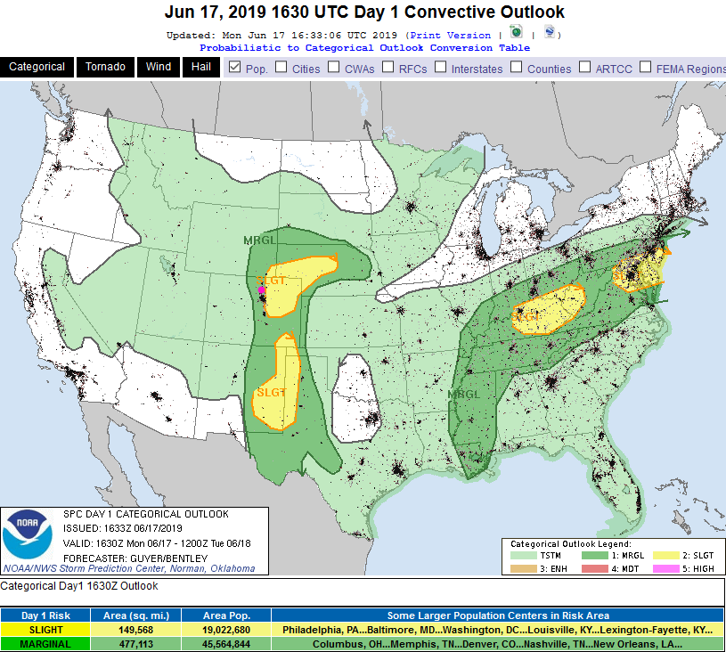
Today - there is a chance of large damaging hail and damaging winds along I-25 and up to the Divide to the west in the Marginal Risk zone. Just east of the interstate, in the Slight Risk zone, there is a small chance of tornado activity as well.
This is a value-added translation of the discussion from the SPC:
   Upper level heights will modestly rise today with mid-level westerlies
   generally weak. A surface cyclone will gradually deepen across
   southeast Colorado with an inverted trough otherwise extending
   northward into the Nebraska Panhandle. This will help maintain weak
   east/southeast low-level upslope trajectories, although regional 12Z
   (6am MT)   observed soundings/850 mb analysis suggest that low-level
   moisture will remain limited.

   Expectations are for widely scattered thunderstorms to develop and
   intensify as they spread generally eastward from the
   Colorado/southeast Wyoming Front Range into the adjacent High
   Plains. Moderate buoyancy (instability) and 20-30 kt effective shear
    should foster
   predominantly multicell clusters capable of mainly severe hail and
   strong wind gusts. Storms will tend to weaken later this evening as
   they encounter a more stable environment across western Kansas.
End 11:30am update.
Forecast Discussion:
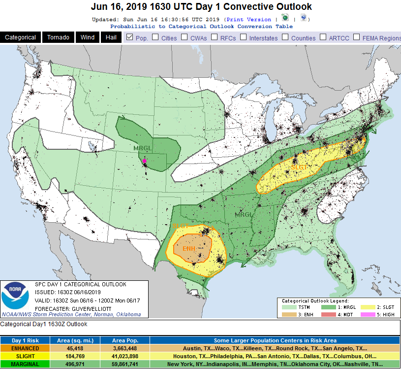
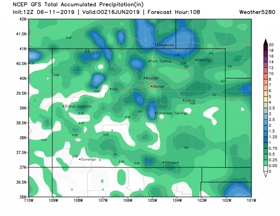
For Sunday afternoon we have a (marginal, in my opinion) Marginal Risk of severe weather where a few thunderstorms might drop damaging hail and damaging winds (Figure 1). With slightly higher precipitable water amounts today, and slow cell movement - we might see local flooding under some storms.
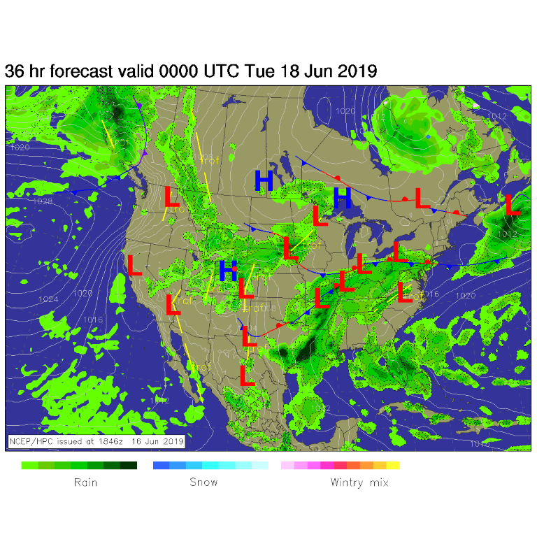
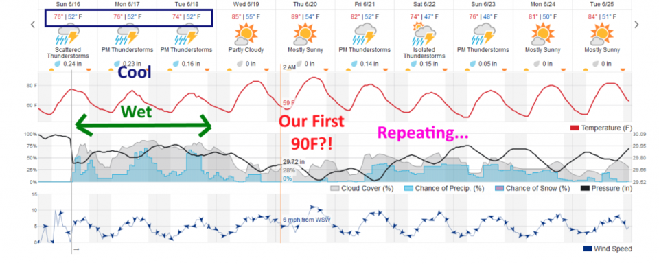
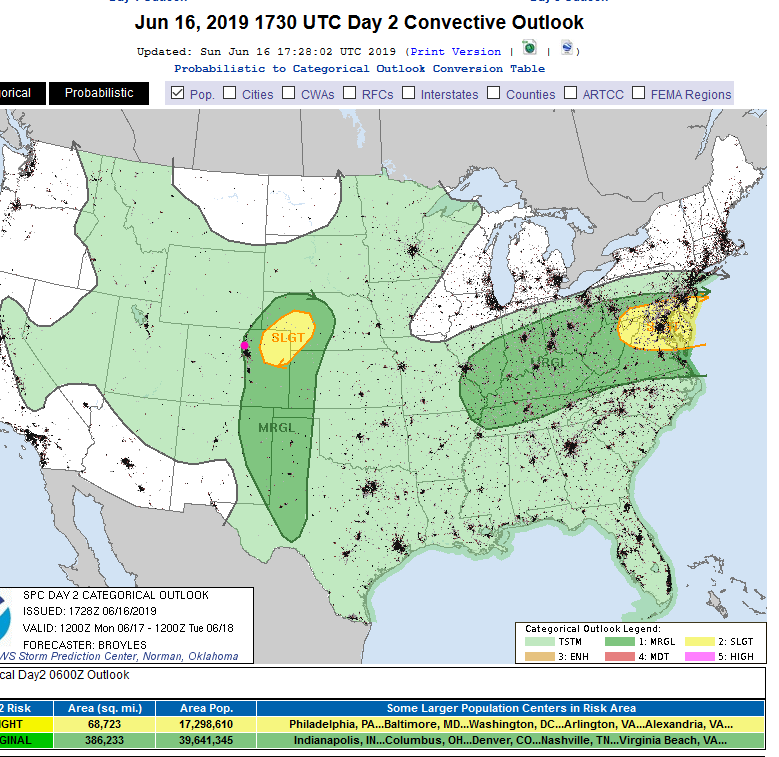
For Monday - we repeat the afternoon storm pattern with rain and thunderstorms midday into the evening (Figure 2 and 3). With another Marginal Risk (better Marginal risk this time) for hail and high winds. There is a slight risk just to our east- this might need to be expanded westward by the time Monday actually rolls around (Figure 4).
The Longer Range Forecast:
We switch from cool and wet Tuesday to hot and dry Wednesday (Figure 3). We may break 90F on Thursday before the big trough returns for the weekend for more coolness and shower/thundershower activity (Figure 3). The 4 day rainfall totals peak around 1-2 inches in a few spots but most of the area has about 1/2 inch over this time frame. Weatherunderground almost gives us 3/4th in before Wednesday. Not massive - unless a storm core hits.