This content was originally published by the Longmont Observer and is licensed under a Creative Commons license.
In Brief:
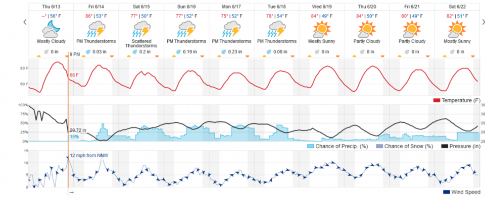
Today (Friday) will be quite hot (upper 80sF) then a cold front arrives around 3pm and the temperatures start to sink a bit. We are 10F cooler than today through Tuesday. Rain, severe thunderstorm chances (high winds primarily), and normal thunderstorm chances pick up with the front and continue- mainly each midday to early evening through Tuesday. We warm up and dry out after that.
2:30 pm Update:
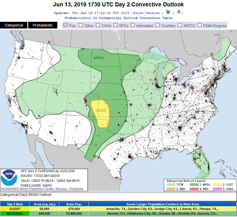
The SPC (Storm Prediction Center, Norman OK) has trimmed the western edge of our Marginal Risk off so it now begins about 10-20 miles east of I-25. It does include DIA but not Longmont at this time. General thunderstorms are the most likely storm effects we'll feel for the rest of the afternoon.
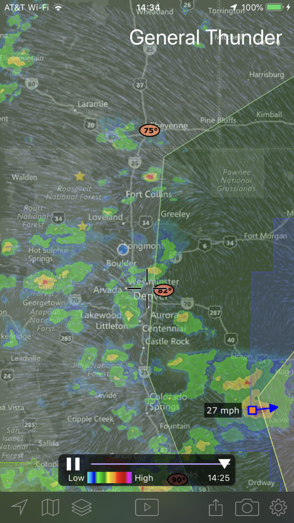
Figure 2 update shows the redrawn extent of the Marginal Risk and the first showers firing off.
End 2:30 pm Update.
9:30am Update:
There is a marginal risk of severe weather for Longmont today (Figure 1 update) - a 1 on a scale of 1-5. Some better moisture, a Denver cyclone, upper air energy (cold air), and serious daytime heating will come together to allow a few cells to reach severe limits today - high winds and large hail are now the primary threats. There is a slight risk (2 on a 1-5 scale) further to the southeast on the Plains. The western edge of the marginal risk runs from just south of Ft. Collins and includes Loveland to Boulder and western Denver southward. Peak thunderstorm time should run from 2pm to 6pm.
End 9:30am Update.
Forecast Discussion:
There is a front approaching today, as that happens that happens we'll have, maybe, the warmest day of the year so far, more atmospheric moisture, and a much better chance of afternoon thunderstorms (Figure 1). We will also be on the edge of a Marginal Risk (1 on a scale of 1-5) with the primary threat being powerful downburst winds (Figure 2).
The Longer Range Forecast:
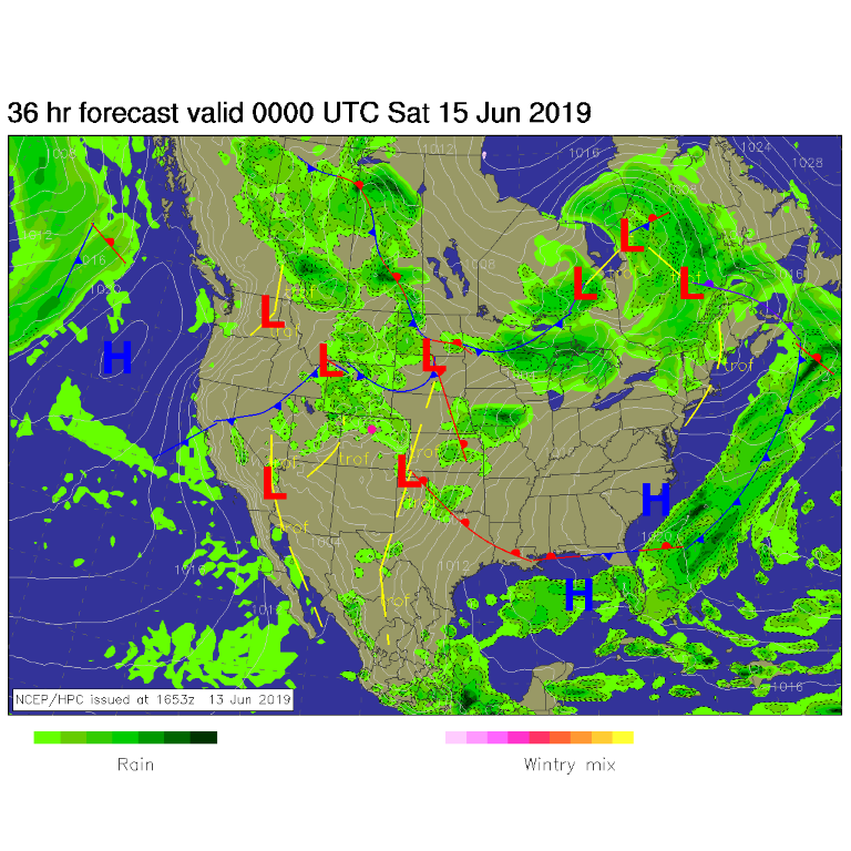
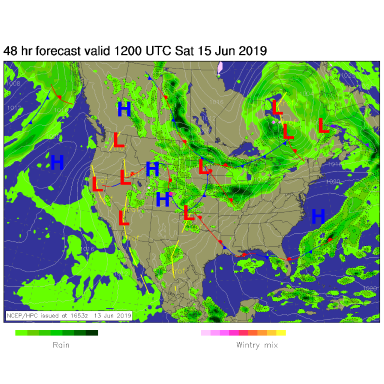
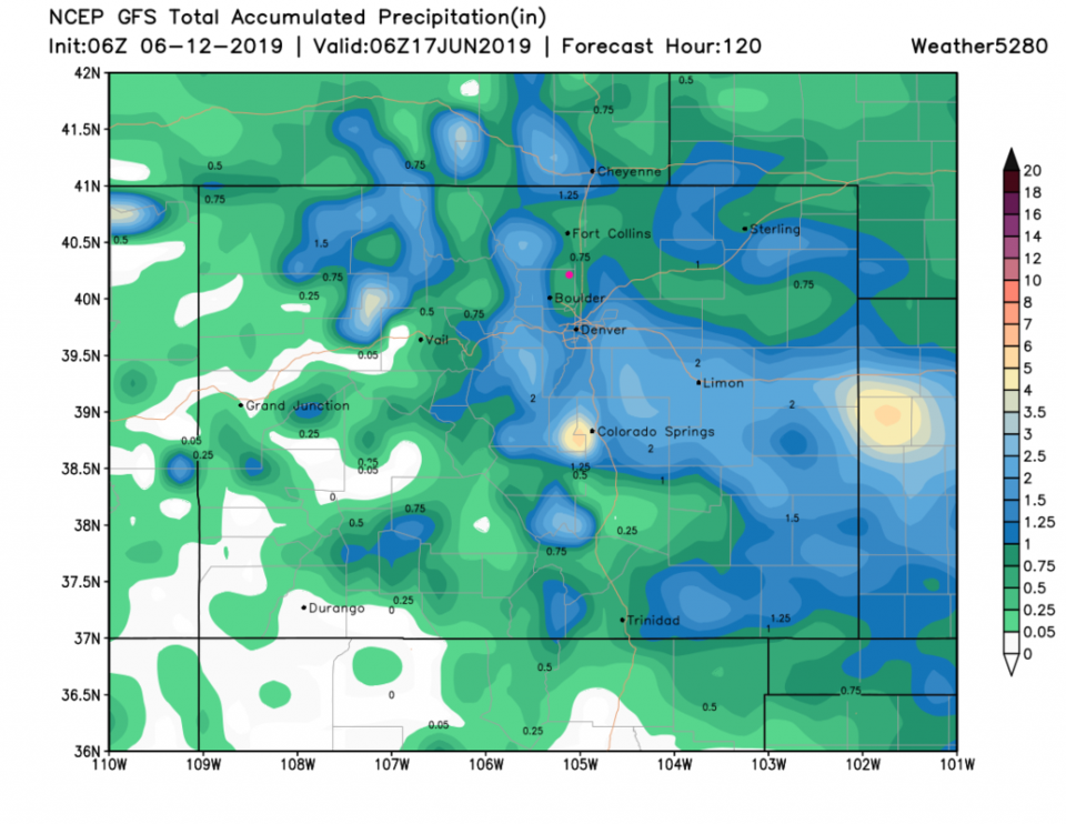
Oops, I forgot to mark features on Figure 3, but the front looks timed with the point where the black line bottoms out and winds peak on Friday around 2-3pm. Rain chances are highest with the front as well. By early Saturday morning, the front is down the Front Range and into Oklahoma (Figure 4). The amount of water we'll receive over the next 5 days is pretty substantial, now, over much of the northern and eastern parts of the state (Figure 5). This run gives Longmont 3/4th inch of water, but nearby locations get up to 2 inches.
Now to the much longer range forecast:
Some of the U.S. models (GFS!) have not been doing well in temperature and precipitation forecasts over the long range. The CFS has been doing a pretty good job.
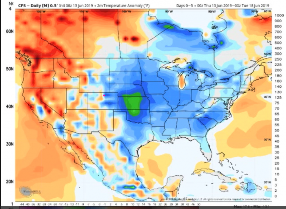
Figure 6 is the temperature departure for normal averaged over 5 days June 13-18 from the CFS. Longmont is quite a bit colder than normal.
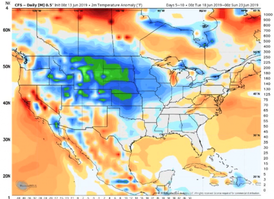
Figure 7 is the same but for June 18-23. We are colder than normal even compared to the previous 5 days.
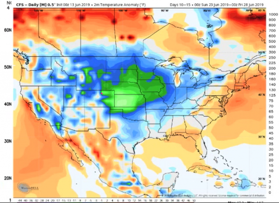
Figure 8 is June 23-28 - still quite a great deal below normal.
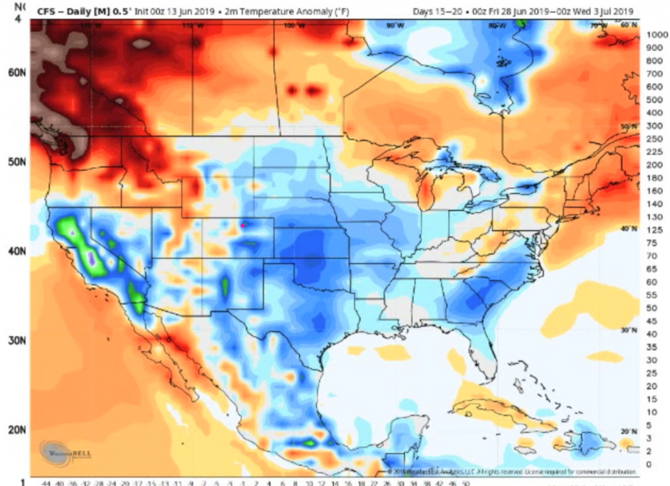
Figure 9 is June 28-July 3 and we are somewhat below normal.
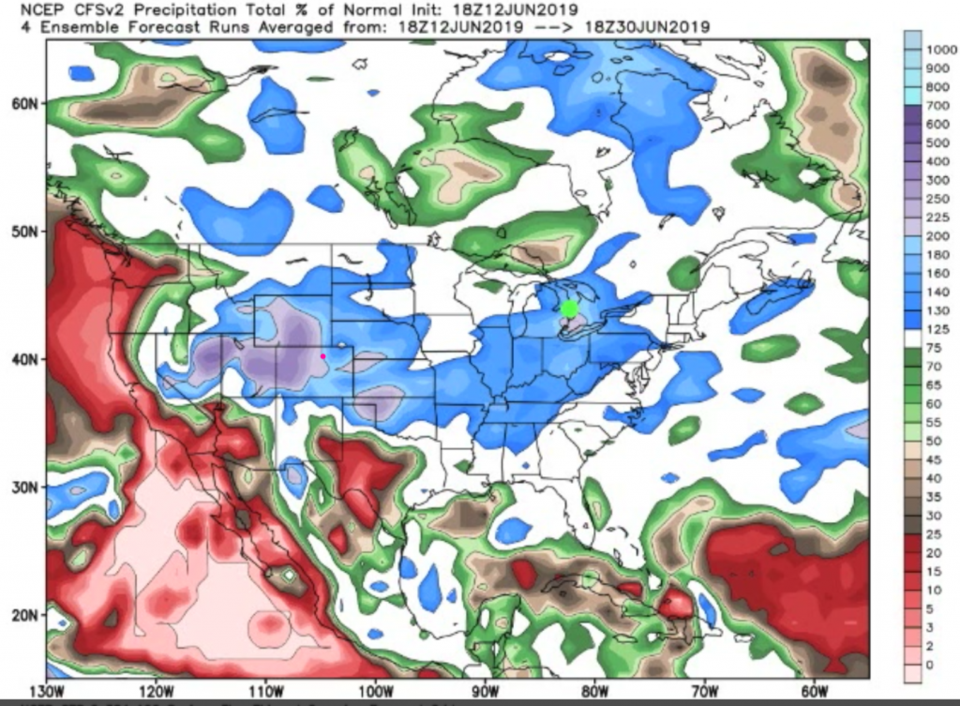
As for precipitation June 12 to 30 from the NCEP CFSv2 model - we are a good deal above normal (200%) for the amount of precipitation normally seen over the last half of June. Cool and Wet is our future.