This content was originally published by the Longmont Observer and is licensed under a Creative Commons license.
In Brief:
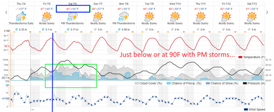
A front passes Friday evening cooling things to (maybe) only the upper 70'sF for a high Saturday. We bounce back to hovering in the mid 80'sF to around 90F for the rest of the week. There is a better chance of showers from Friday afternoon through Sunday morning with a passing trough and the nearness of the front.
9pm Update:
The restaurant I use for wifi has closed (near Red Feather Lakes) so I'm having to drive further - we'll pick up with a normal update Sunday. The forecast is on track with a return to upper 80'sF Sunday - Wednesday with a couple more days of enhanced chance of afternoon storms. (That was one heck of a storm Friday night with hail and an inch of rain with nearly stationary storms!!)
End 9pm Update.
7:30am Update:
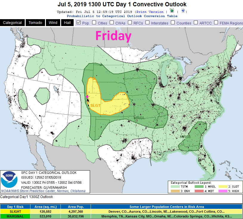
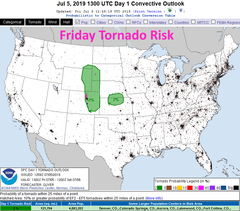
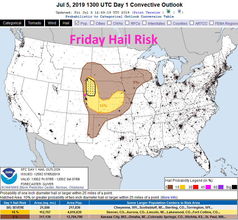
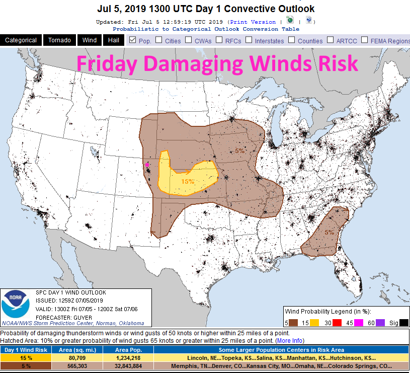
With a front around, upper level support, the right kinds of winds at different levels, and lots of atmospheric moisture - severe weather risks are back today. There is a slight risk of severe weather for Longmont this afternoon (after about 2pm- Figure 1 update). This includes tornadoes (Figure 2 update), large hail (Figure 3 update), and damaging winds (Figure 4 update).
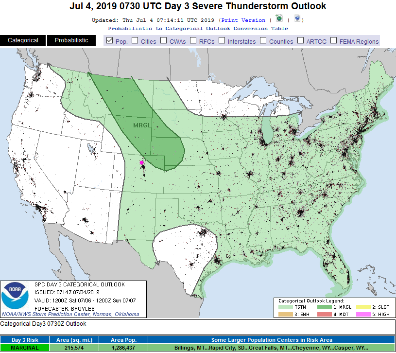
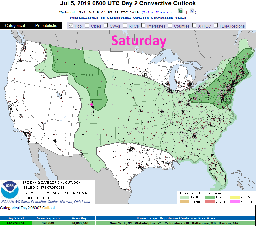
We'll see another marginal risk for the I-25 corridor Saturday (Figure 5 update). Wet and stormy afternoons are here!
End 7:30am Update.
Forecast Discussion:
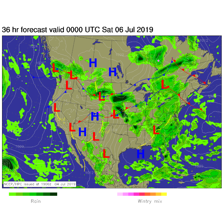
A front slides down the state and piles more moisture up against the mountains (up slope flow - Figure 1). Shower chances increase Friday afternoon and continue through the first half of the (much cooler) weekend (Figure 2). There is a Marginal Risk for severe weather Friday - hail and high winds are most likely - with the front, high moisture levels, and upper level support (Figure 4).
The Longer Range Forecast:
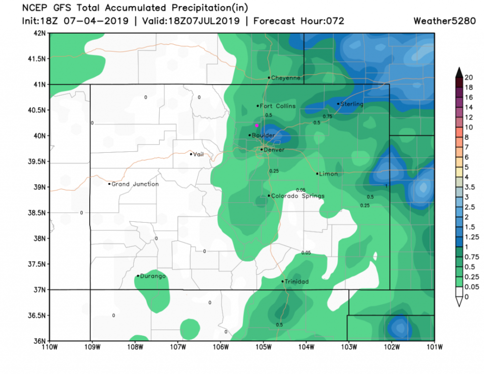
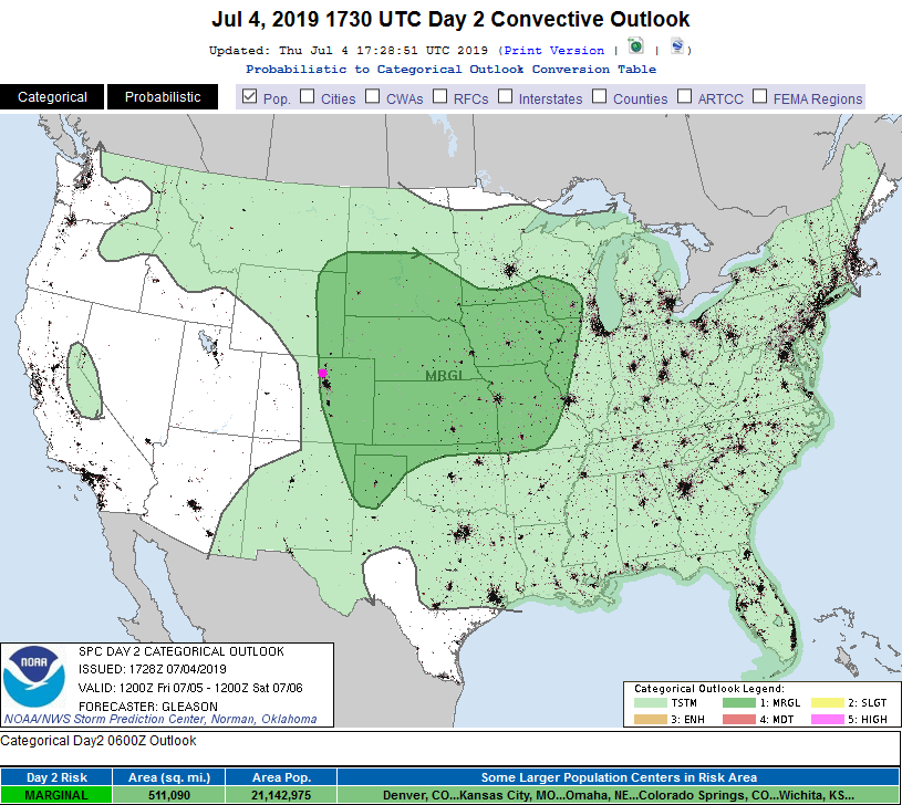
Rainfall over the weekend is confined to the northeast Plains (Figure 3). Many locations will see 1/4 to 1/2 inch of rain with wandering storms and showers. Saturday will see a marginal risk near the I-25 corridor (which might be expanded in area by the time the weekend arrives- Figure 5).
We settle into seasonal heat (mid 80's to 90F) with afternoon showers most days through the rest of next week.
I'm off to camping AGAIN - but this time with some trickle of internet and a nice library 2 miles from camp. After I set up shop - I'll resume daily or nearly daily updates. Keep an eye on your own weather apps, TV, and Radio to know the details of storms and severe weather that may form each day.