This content was originally published by the Longmont Observer and is licensed under a Creative Commons license.
In Brief:
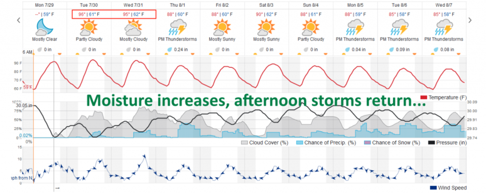
The ever present high to our south is shifting to a location that will funnel tropical moisture back into the state. After nearly reaching 100F again today, we will drop to the upper 80'sF and afternoon storms return each day.
Forecast Discussion:
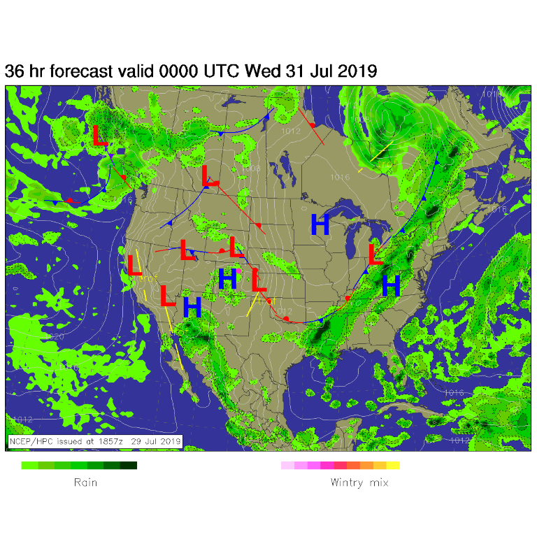
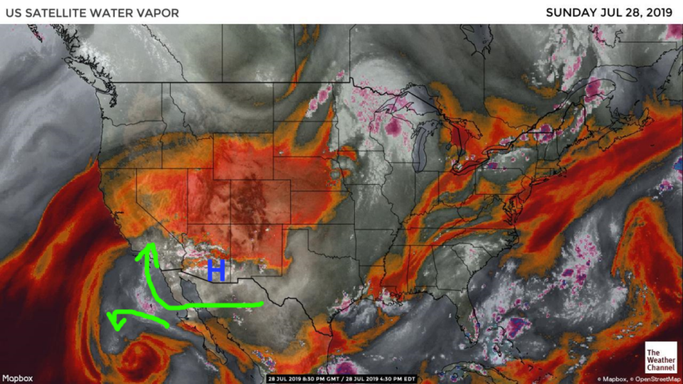
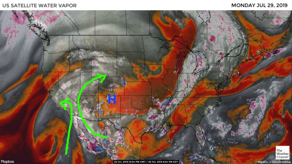
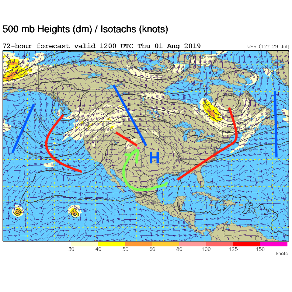
The surface map for Tuesday night shows a high over the Rockies and enough moisture flowing back into the mountains to kick off afternoon thunderstorms (that have been absent for a couple of days -Figure 1). The moisture flow over the weekend was completely cut off (red colors = dry air, the green arrows are the suppressed moisture flow - grey and white colors - Figure 2). On Monday, the high shifted eastward and the moisture is again flowing up into the Great Basin and the mountains of the West (Figure 3). The upper air pattern Tuesday morning shows the high sitting over northern New Mexico and a better tap into tropical moisture for Colorado (Figure 4). The moisture will make it harder for temperatures to get to the 90'sF starting Thursday and afternoon storms chances will be back (Figure 5).
The Longer Range Forecast:
Later in the week, the high shifts to Oklahoma and we have open access to the Gulf and tropical moisture to the south (Figure 6). Watch for storms and afternoon lightning chances every day and more upper 80'sF for highs.