This content was originally published by the Longmont Observer and is licensed under a Creative Commons license.
In Brief:
A fair amount of monsoon/tropical moisture will remain in place for a few days while another front will increase convergence and shower coverage some on Thursday. Things remain seasonably warm with afternoon showers on into next week.
Update for July 27th:
I'm winging it back from the Bay Area and there isn't any real change to the forecast. The upper level high (discussed below) will wobble around to our southwest. Various amounts of moisture will enter the state (with an overall downward trend through the middle of next week). There will be another front drifting in Saturday which will increase afternoon shower and thunderstorm chances and slightly depress temperatures. The bottom line is; not many will see rain. It's the summer doldrums!
End Update July 27th extension.
Forecast Discussion:
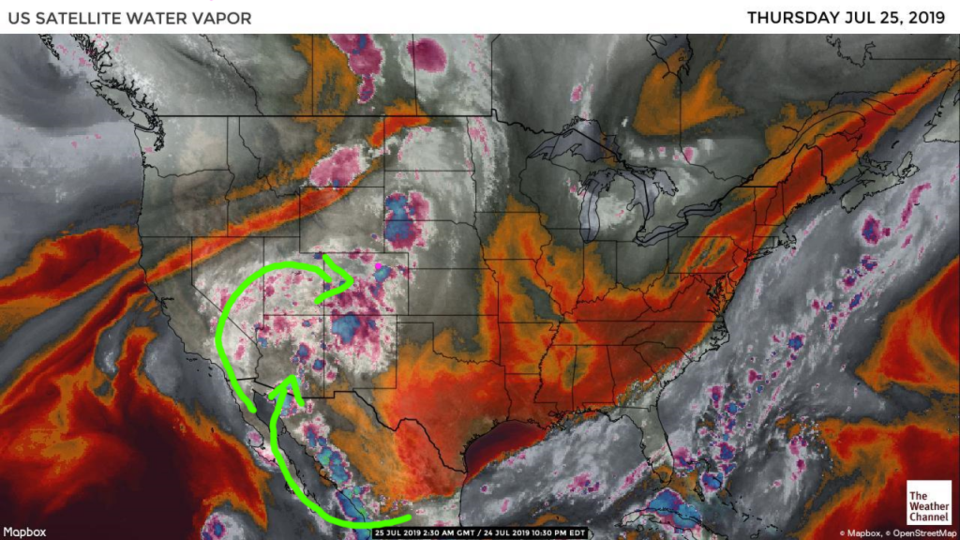
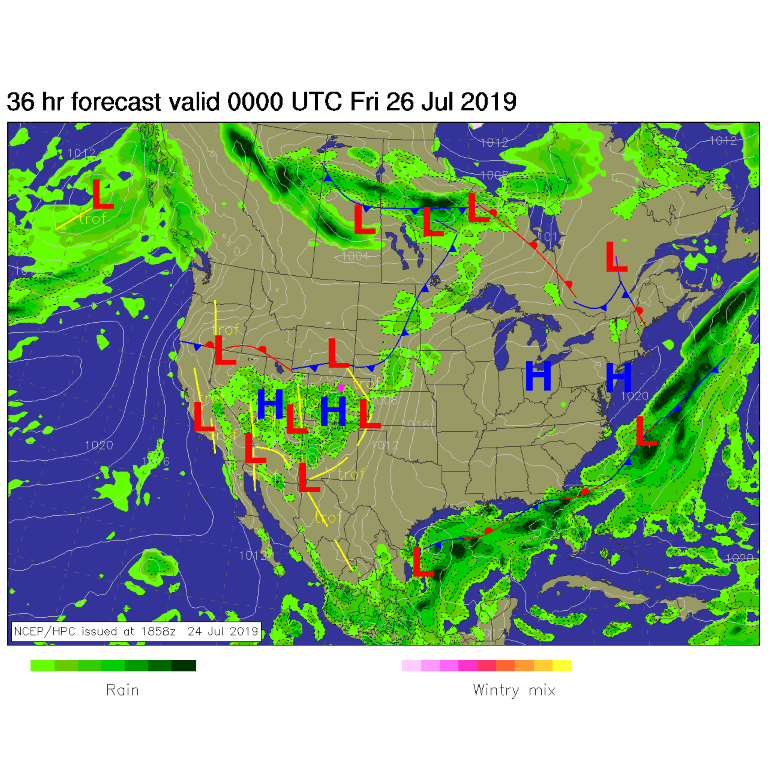
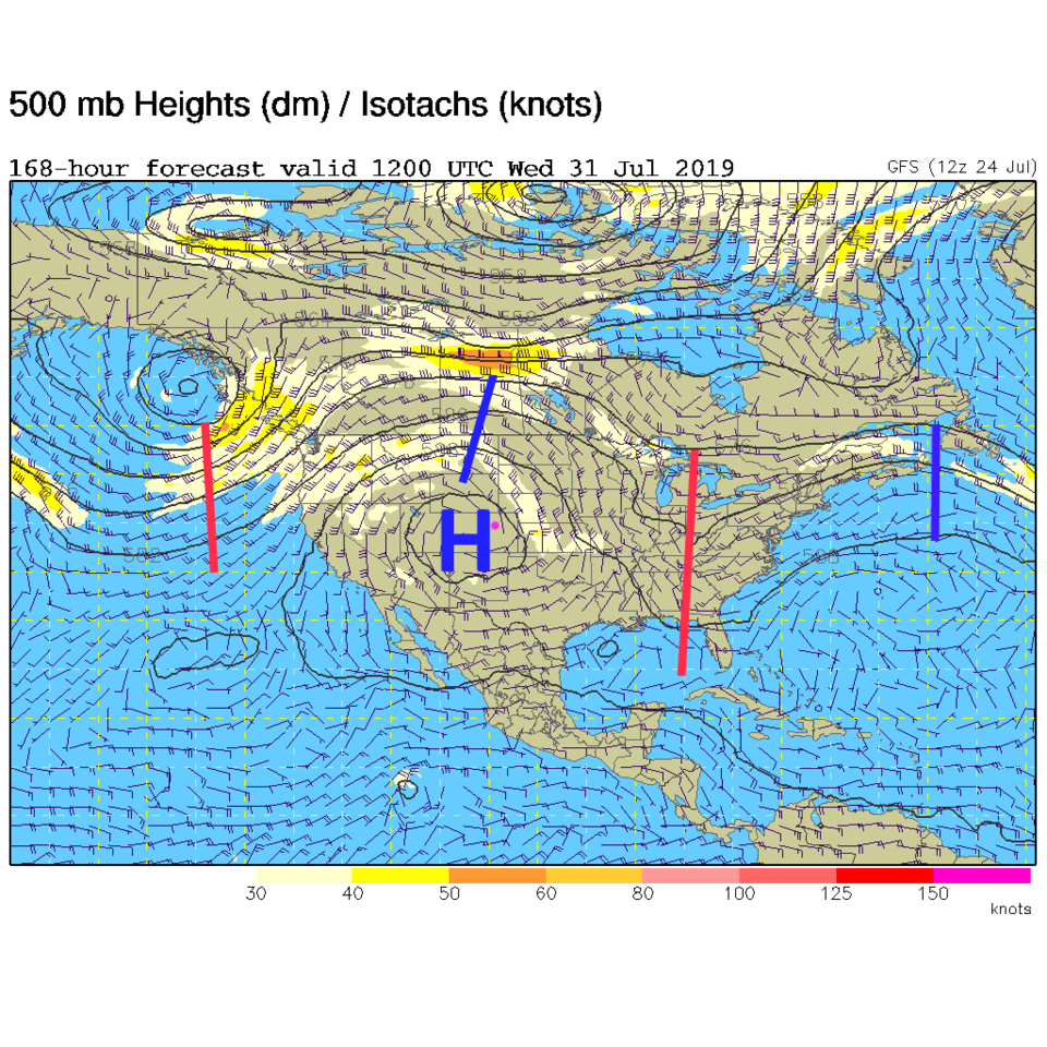
The upper level high pressure center (that well cover below) will continue to bring a flow of tropical moisture up into the state (green arrows and grey shades in Figure 1). This same high will bring a cool front down Thursday that will provide lift for more showers cross northeast Colorado (nothing severe is expected at this time - Figure 2).
The Longer Range Forecast:
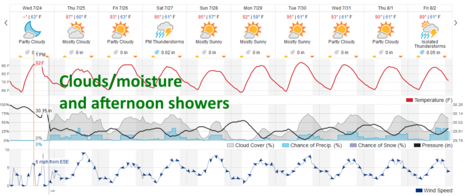
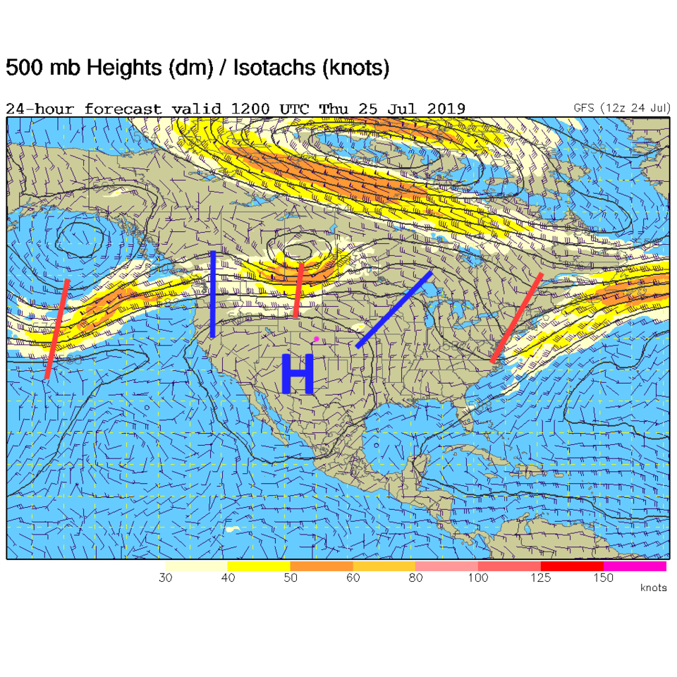
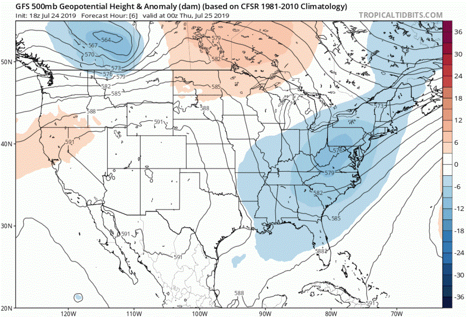
Even with afternoon showers and thunderstorms possible every day - the biggest effect of the front and moisture will be a lot of cloudiness and slightly cooler temperatures for a couple of days (Figure 3). The entire pattern is being governed by this large high pressure/high height center over the desert southwest (Thursday morning Figure 4 and next Wednesday Figure 5). Even though the ridge would normally give us above normal temperatures, we will remain on the eastern side of the high for the next 10 days (mostly) which will bring in northerly air flow. This will also keep the Great Plains unusually cool for a while (watch the high center wobble in the animation of the upper air pattern over the next 10 days - Figure 6). More later!