This content was originally published by the Longmont Observer and is licensed under a Creative Commons license.
In Brief:
Moisture is back in the state and high temperatures will reflect this by dropping to the middle and upper 80'sF for this week. Afternoon thunderstorm chances will be the daily routine.
Update 2pm:
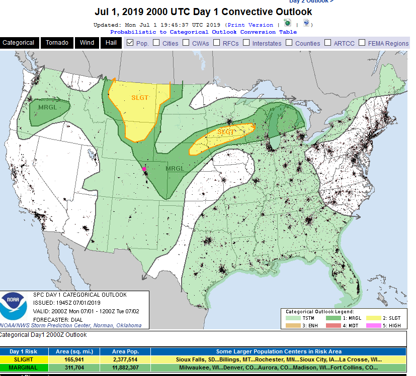
Precipitable water amounts have really increased over the last day - the Plains are sitting at 1 to 1.2 inch. With clear skies all morning, we are warming as much as we can today. The SPC has expanded the marginal risk of severe weather a bit further westward (it included Firestone and eastern Longmont early today - Figure 1 update). The marginal risk (1 on a scale of 1-5) includes Estes Park and Boulder (just barely) and most of Denver (except the southwest slice).
The primary risk is for damaging hail, microbursts (blasts of very strong winds that drop out of the storm and spread out in a fan-like pattern). Locally flooding rains are possible under the heaver, slow moving, cells.
Areas north of Denver might be included in a marginal risk again tomorrow (Tuesday). Stay tuned.
End update 2pm.
Forecast Discussion:
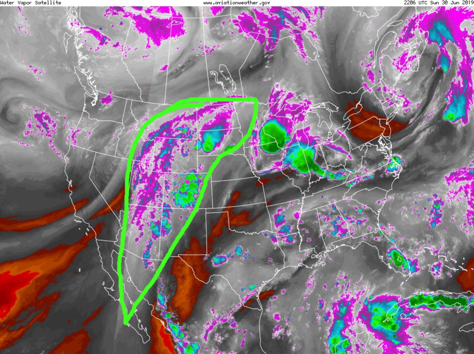
There is a front draped north of the state but high pressure at the surface (Figure 1). Temperatures will cool a bit, but not become "cold" by any stretch. The blob of Pacific moisture is sitting along the spine of the Rockies - which caused our storms and rain Sunday night (Figure 2).
The Longer Range Forecast:
The best chance of afternoon storms was Sunday PM and will be again this afternoon (Figure 3) before the blob gets stripped of some of its moisture by westerly flow. Still, there are afternoon storm chances every day for the next 10 days (Figure 3). The rainfall totals show the spotty nature of afternoon convection with some spots able to get up to an inch or more of rain over the next 5 days.
The 4th of July Forecast:
Right now, the 4th of July looks to be neither unusually hot or wet. There is an afternoon chance of showers for a few hours (4-7pm) and a high only around 86-88F.