Skip to content

Next Storm/Next Snow Forecast Discussion from the Cherrywood Observatory – January 8, 2019

This content was originally published by the Longmont Observer and is licensed under a Creative Commons license.

Forecast Discussion:

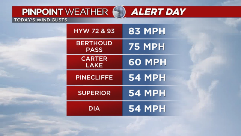
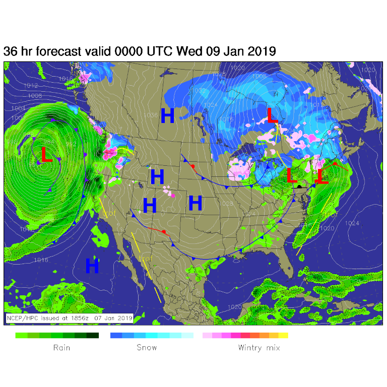
Tabulated winds Monday were pretty impressive (nothing reported above 90 mph as some said was possible - Figure 1). Our story today is: yes, warm dry weather continues. High pressure is back in control today (Figure 2) with fading winds.

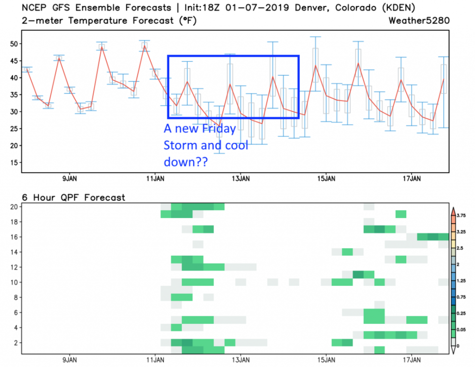
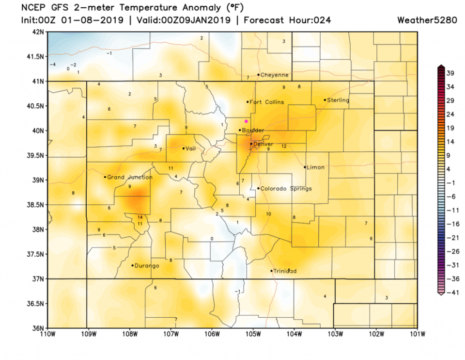
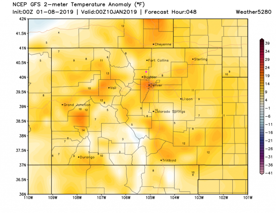
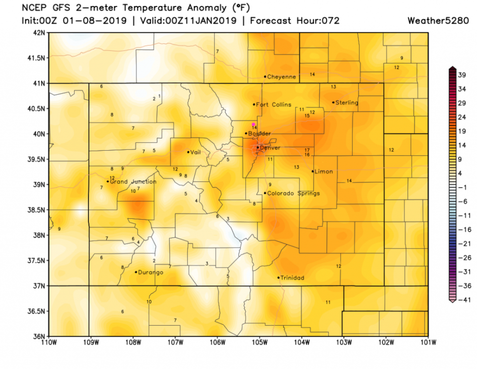
The next three days (snapshots just after sunset) will be 8-12 degrees above normal - Figures 3, 4 and 5. Pretty straight forward. But wait! What's that in the longer range forecast below?

Figure 1: Chart of peak wind gusts measured Monday from Matt Makins via Twitter.

Figure 2: The forecast surface map for Tuesday PM. From NCEP.

Figure 3: The surface temperature departure from normal for Tuesday PM from weather5280.com

Figure 4: The surface temperature departure from normal for Wednesday PM from weather5280.com

Figure 5: The surface temperature departure from normal for Thursday PM from weather5280.com

The longer range forecast:

A new (not very major) storm has appeared in the model data (the GFS - Figure 6) and at weatherunderground.com's model. That storm, if it materializes, will cool us to near normal temperatures again (lower 40's F) and bring a chance of rain. We'll keep an eye on it!!

Figure 6: 10 day meteogram from weather5280.com for DIA.

Current Weather

Mostly clear

Mostly clear

60°F

UV Index
0 Low
Pressure
29.9 Rising
Visibility
8 miles
Dewpoint
42 °F
Humidity
52%
Wind
NNW 3 mph
Gust
6.5 mph
Wind Chill
60 °F

Hourly Forecast

Today
11 PM
55°F
Intermittent clouds
Tomorrow
12 AM
53°F
Intermittent clouds
Tomorrow
1 AM
51°F
Partly cloudy
Tomorrow
2 AM
49°F
Mostly clear
Tomorrow
3 AM
47°F
Mostly clear
Tomorrow
4 AM
45°F
Clear
Tomorrow
5 AM
43°F
Mostly clear
Tomorrow
6 AM
41°F
Mostly clear
Tomorrow
7 AM
45°F
Partly sunny
Tomorrow
8 AM
49°F
Partly sunny
Tomorrow
9 AM
55°F
Partly sunny
Tomorrow
10 AM
62°F
Intermittent clouds

7 Day Forecast

Mostly sunny

Wednesday

75 °F

Mostly sunny, pleasant and warmer


Partly cloudy

Wednesday Night

41 °F

Patchy clouds


Mostly cloudy w/ t-storms

Thursday

75 °F

Turning cloudy, warm; breezy, a thunderstorm around in the afternoon


Thunderstorms

Thursday Night

49 °F

A thunderstorm in spots in the evening; otherwise, considerable cloudiness


Thunderstorms

Friday

70 °F

Mostly cloudy with a couple of thundershowers


Thunderstorms

Friday Night

46 °F

Cloudy with a couple of thundershowers


Rain

Saturday

50 °F

Chilly with periods of rain and a thunderstorm


Rain and snow

Saturday Night

39 °F

Cloudy with rain, mixed with a little snow late


Mostly cloudy

Sunday

59 °F

Mostly cloudy with a stray thundershower in the afternoon


Partly cloudy

Sunday Night

36 °F

Partly cloudy


Sunrise and Sunset

Sunrise
6:08 AM
Sunset
7:49 PM

Based on AccuWeather data