This content was originally published by the Longmont Observer and is licensed under a Creative Commons license.
In Brief:
A couple of weak cold fronts will keep snow going in the mountains the next day or two and finally bring a dusting (maybe an inch in a few spots?) of snow along I-25 overnight Wednesday and again Thursday late afternoon. A serious return of heat takes us into the upper 60'sF for the weekend before a (now looking more significant) possible major winter storm hits Monday and Tuesday next week.
Update 1/30 9:30am:
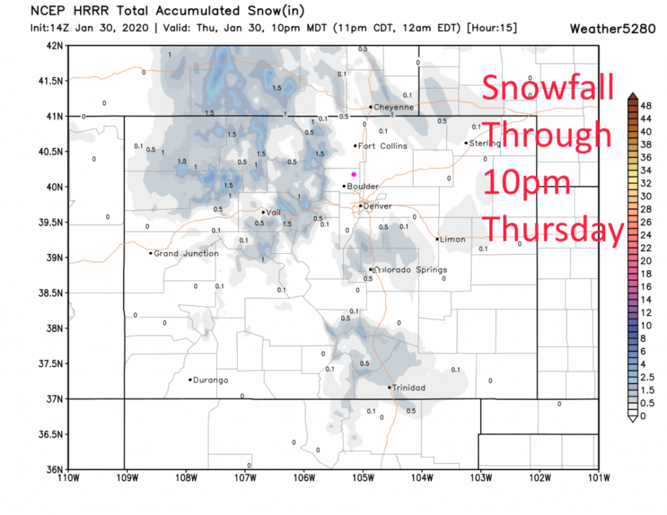
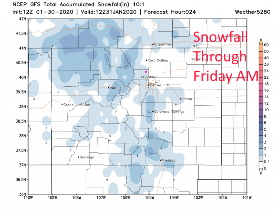
We received a couple of very light dustings of snow Wednesday PM to Thursday AM. Another impulse is on its way with another weak cold front. We could see another dusting this afternoon. The HRRR has small snow amounts for the mountains today and trace amounts on the Plains (Figure 1 update). The GFS actually gives Longmont a coating of 0.1 to 0.5 inch of snow (Figure 2 update).
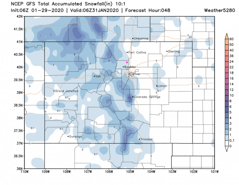
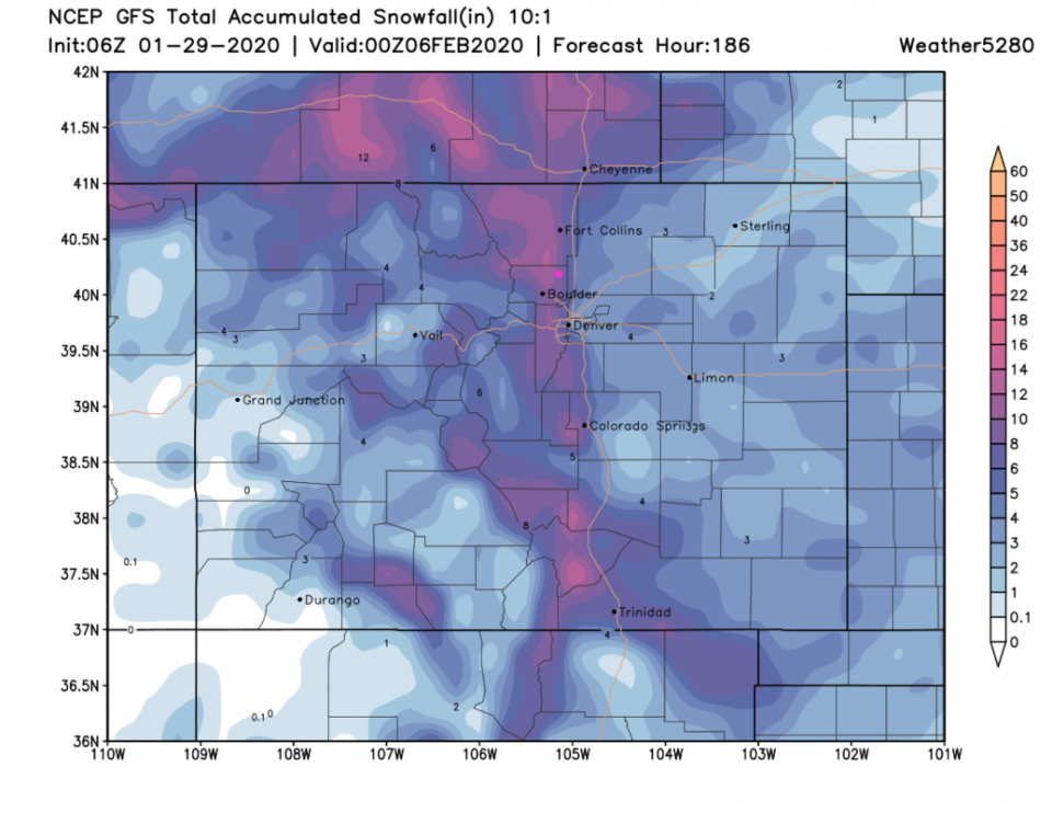
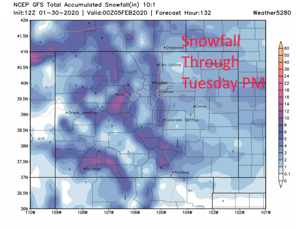
Looking again at the much bigger storm coming Monday/Tuesday - the GFS gives much of the I-25 corridor 4-6 inches of snow with that storm (Figure 3 update). That is down a bit from the model runs yesterday. We'll keep watching it!
End 1/30 9:30am update.
The Forecast Discussion:
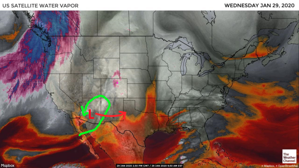
Change is in the air, but not until next week. In the mean time, a weak swirl in the atmosphere is drifting eastward across Arizona today giving us a bit of lift and moisture (ahead of the green swirl in Figure 1). At its peak, the precipitation is mostly confined to the mountains (Figure 2) with scattered showers in Arizona and New Mexico.
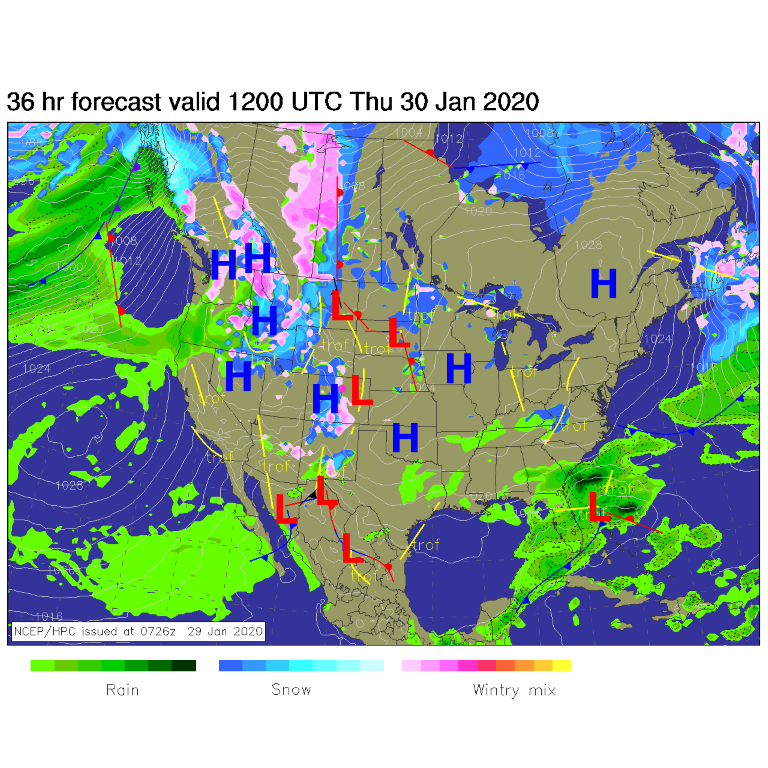
The two weak cold fronts arrive Wednesday (today) and Thursday afternoon (Figure 3). This time, with the aid of the system to the south, we might see some snow sweep down I-25 Wednesday evening (with may be flurries/sprinkles again Thursday afternoon).
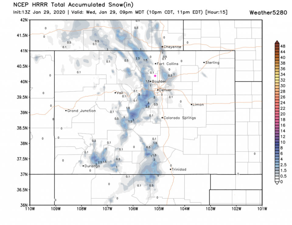
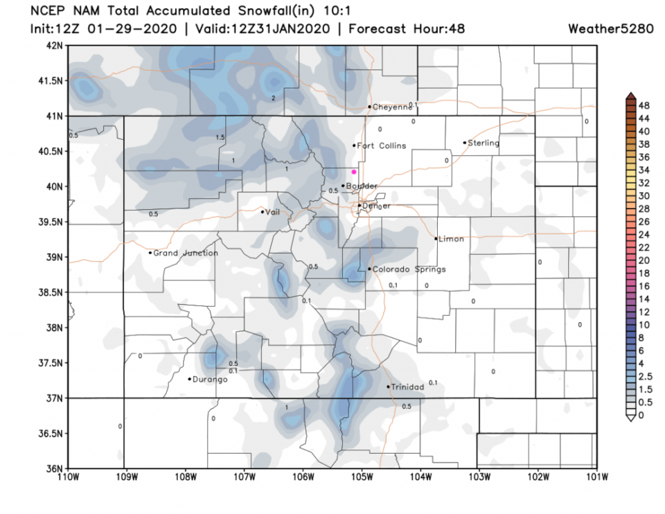
The HRRR shows snow in the foothills to the west and some snow on the Plains to our east (Figure 4). The GFS gives us a coating of actual snow Wednesday PM and a possible inch down in western and southern Denver (Figure 5). The NAM gives us a coating to 1/2 inch of snow mainly Wednesday PM (Figure 6). I'm excited! The 1/2 inch that hit Denver Monday broke the precipitation-free streak the area was experiencing since late December.
The Longer Range Forecast:
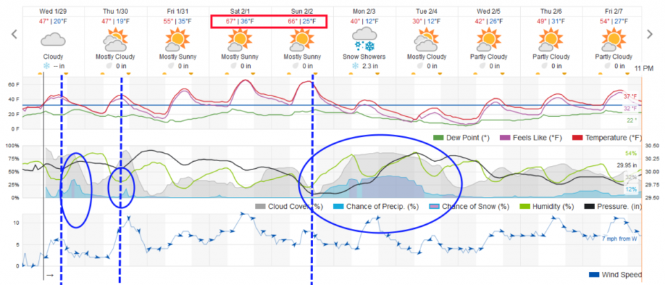
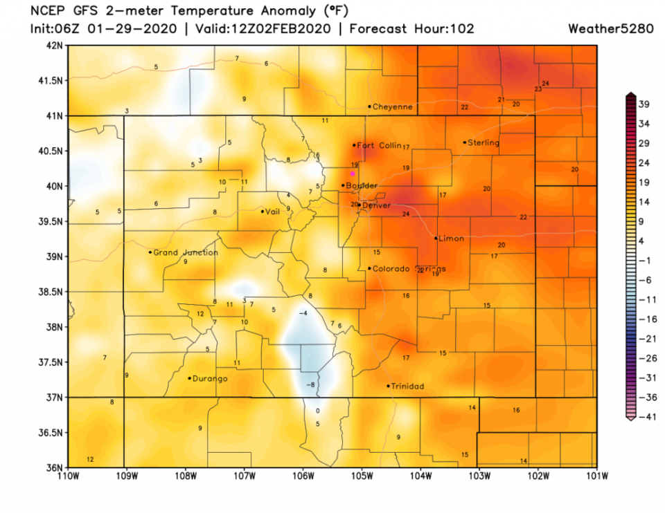
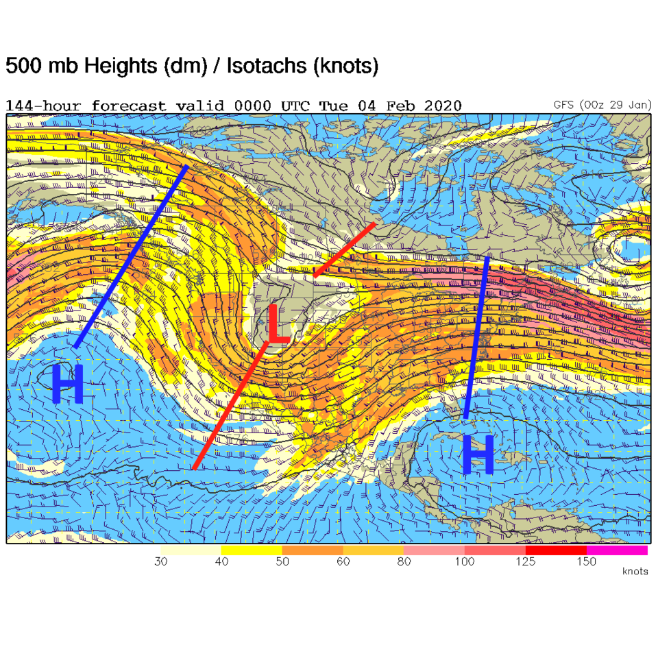
We quickly dry out and warm to about 10F above normal on Friday then warm another 10-12F for the weekend (Figure 3). This remarkable heat (still below the record high in the mid-70'sF set for Denver this weekend) is caused by a strong ridge sweeping over the state (Figure 7). The departure from normal (18-22F above normal - Figure 8) is amazing.
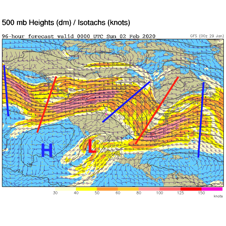
Coming over the horizon is hint of a major winter storm for Monday/Tuesday. A deep strong trough replaces that ridge by Monday afternoon (Figure 9). Weatherunderground's model has snow falling from Monday AM to Tuesday PM (Figure 3). The GFS gives us a whopping 6-8 inches of snow for this event.
Stay tuned for more details on this storm. Get out and enjoy the weekend (maybe not by skiing though).