This content was originally published by the Longmont Observer and is licensed under a Creative Commons license.
Forecast Discussion:
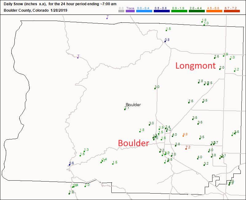
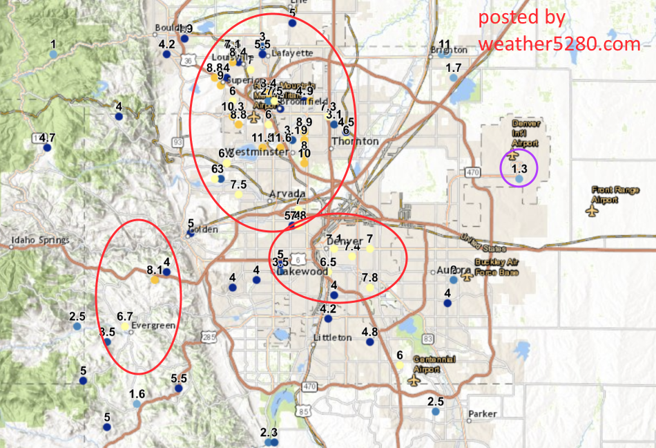
Wow, the area got real snow! My forecast was really good in Boulder county and northward (Figure 1), and out at the Denver airport... BUT what a surprise it was in north and central Denver (purple circle Figure 2). I'm eating snow (not crow) since (Figure 2 from weather5280.com) many places (red ovals) saw 5, 9 and even up to 12 inches of snow from Lafayette to Westminster and down into Denver and Lakewood. Wowzie.
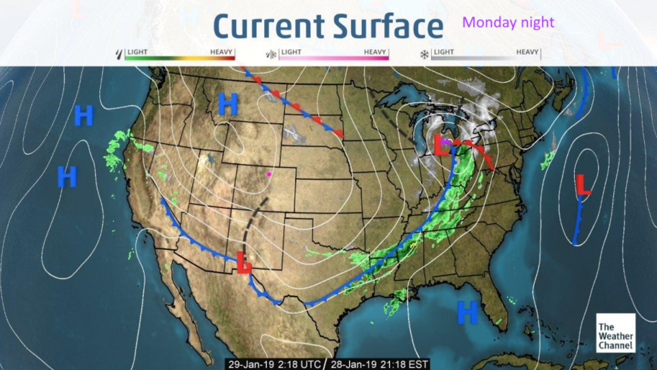
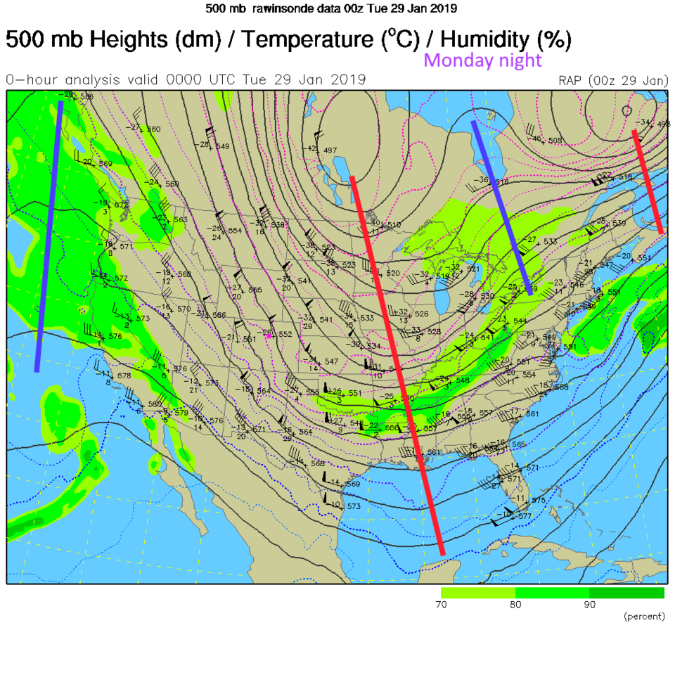
That system has swept out of the state leaving us high and dry (Figure 3). Note the position of the cold front from Arizona to Texas and into the Tennessee Valley etc. In figure 4, you can see the upper air pattern at the same time. Note the big trough mirroring the shape of the front with the lines of equal pressure height. Fun with weather.
The longer range forecast:
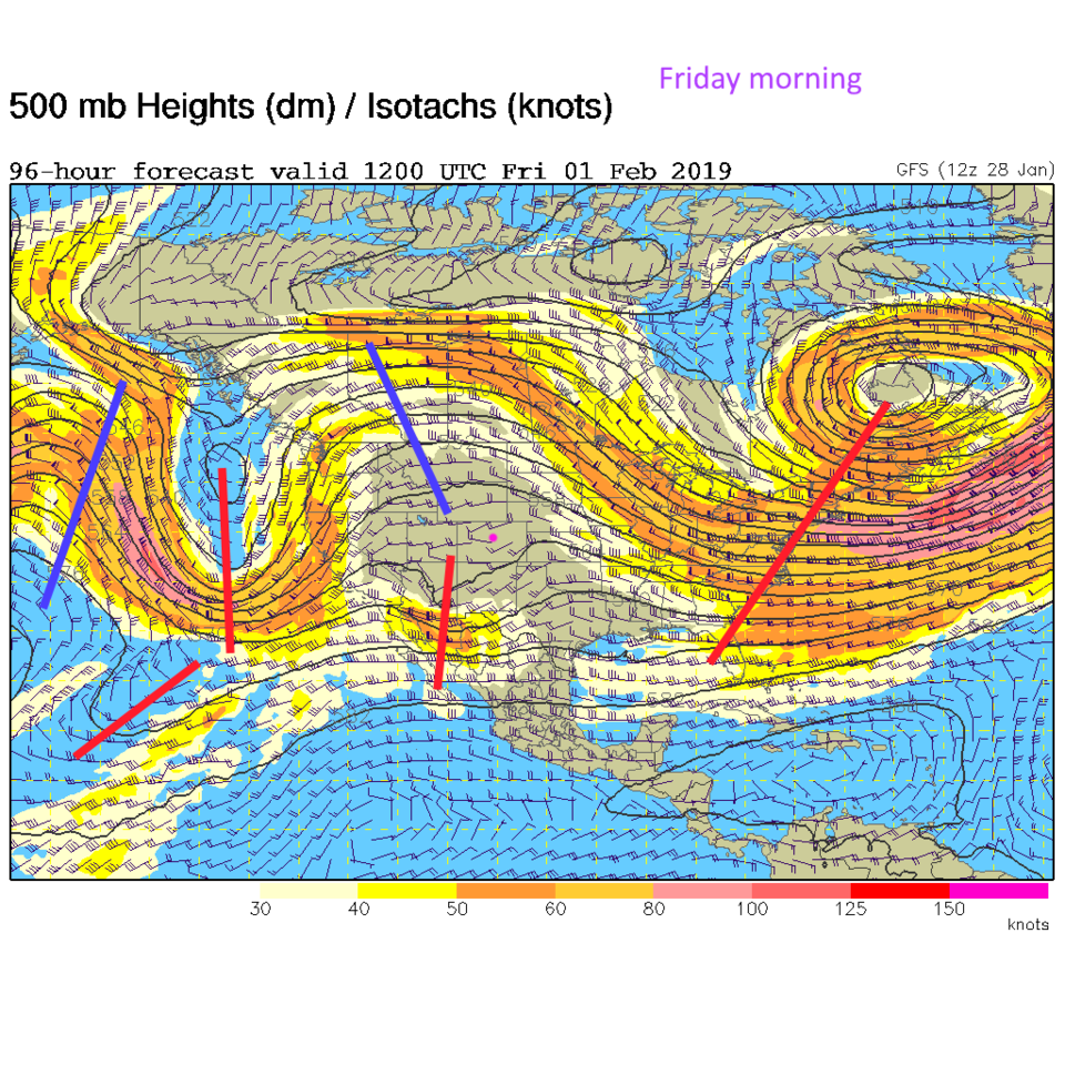
That ridge to our west (still part of the northwest flow pattern we've been under for quite a while) will slide eastward warming us up more each day. By Friday, there is a ridge overhead while a deep south storm slides across Arizona and New Mexico. That will bring some snow chances to the mountains (but what doesn't this winter - Figure 5).
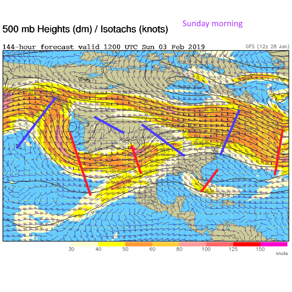
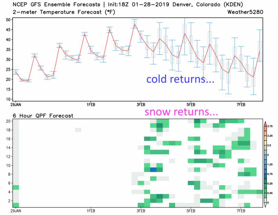
By Sunday morning, the next trough in the eastern Pacific is coming in with a vigorous short wave already moving into Colorado (Figure 6). Figure 7 is the GFS ensemble from weather5280.com that shows the effect of this broad trough moving in (temperatures dropping after February 3rd (UT)). Snow chances return for almost every day after that (this far out). That will be an interesting period if we have daily snow chances for a while. More to come!