This content was originally published by the Longmont Observer and is licensed under a Creative Commons license.
Forecast Discussion:
5pm Update:
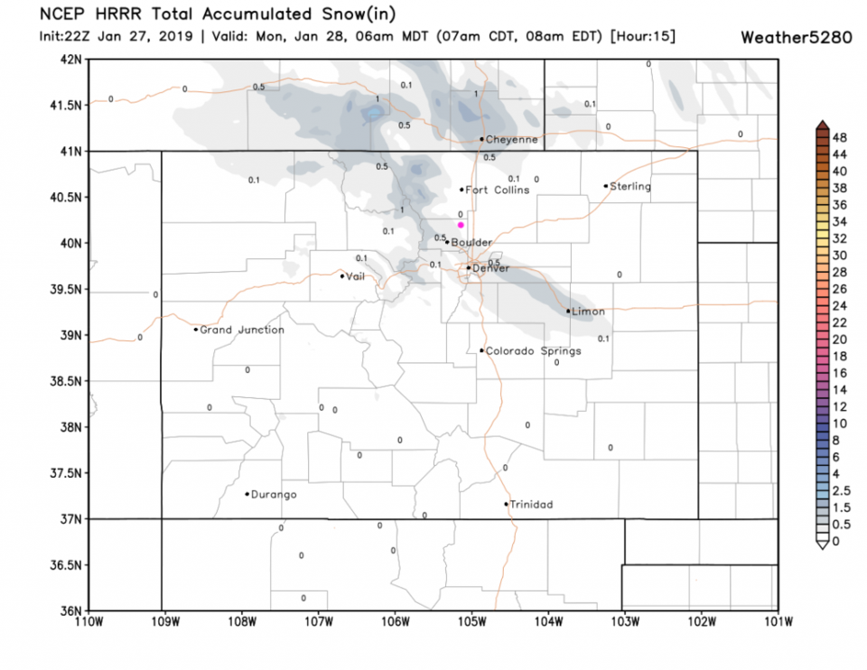
A quick update: the HRRR through 6am Monday snows one nice band of light snow through Boulder county and off to Limon. If this shifts a bit in reality, we might see a good coating of snow by sunrise!
End 5pm Update.
9am Update:
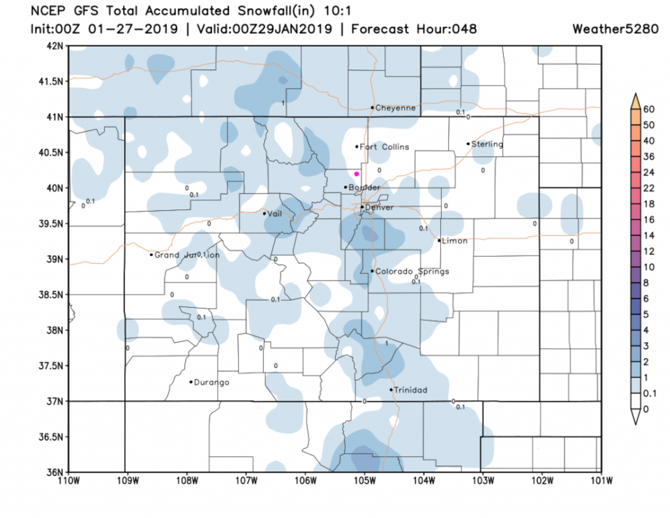
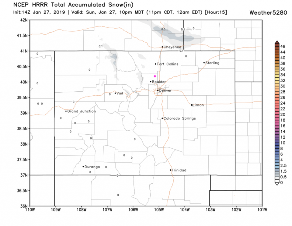
Here (Figure 1 update) is the output from the HRRR snow total forecast map through 10pm Sunday night. There is VERY little snow expected by then - and then only up in the mountains and Wyoming/Nebraska. The most likely snowfall period for Longmont is after midnight and up to the new morning (1am to 9am). There is a high wind warning for the northern mountains and foothills just to our west. If you drive uphill, hold on to your steering wheel.
End 9am Update.
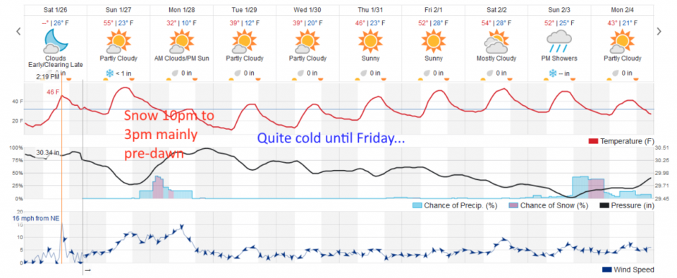
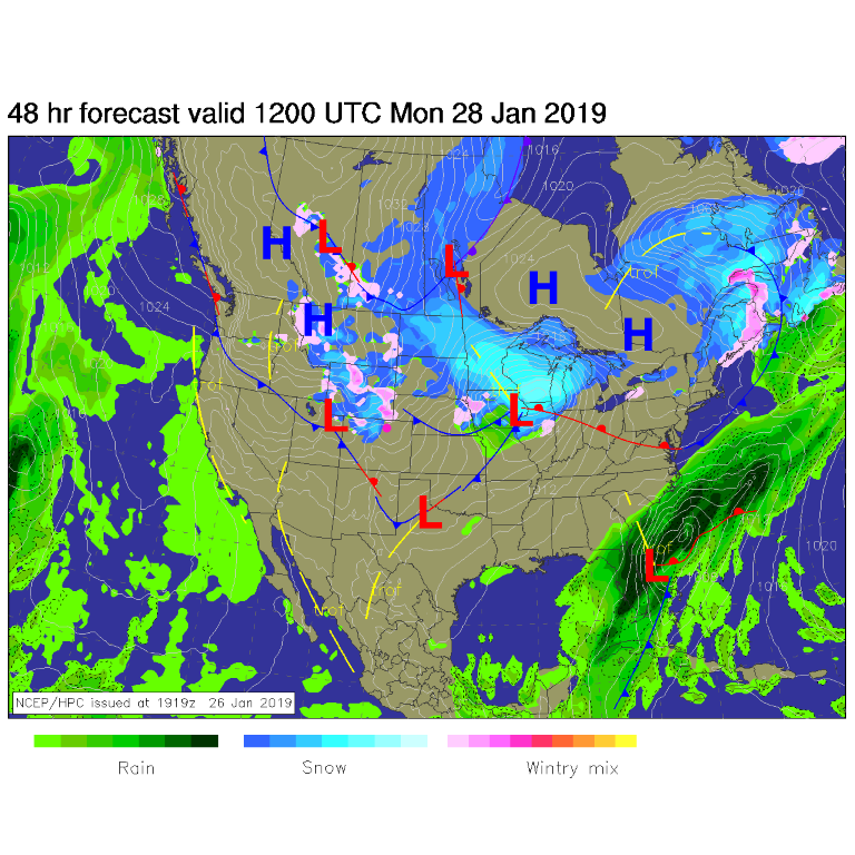
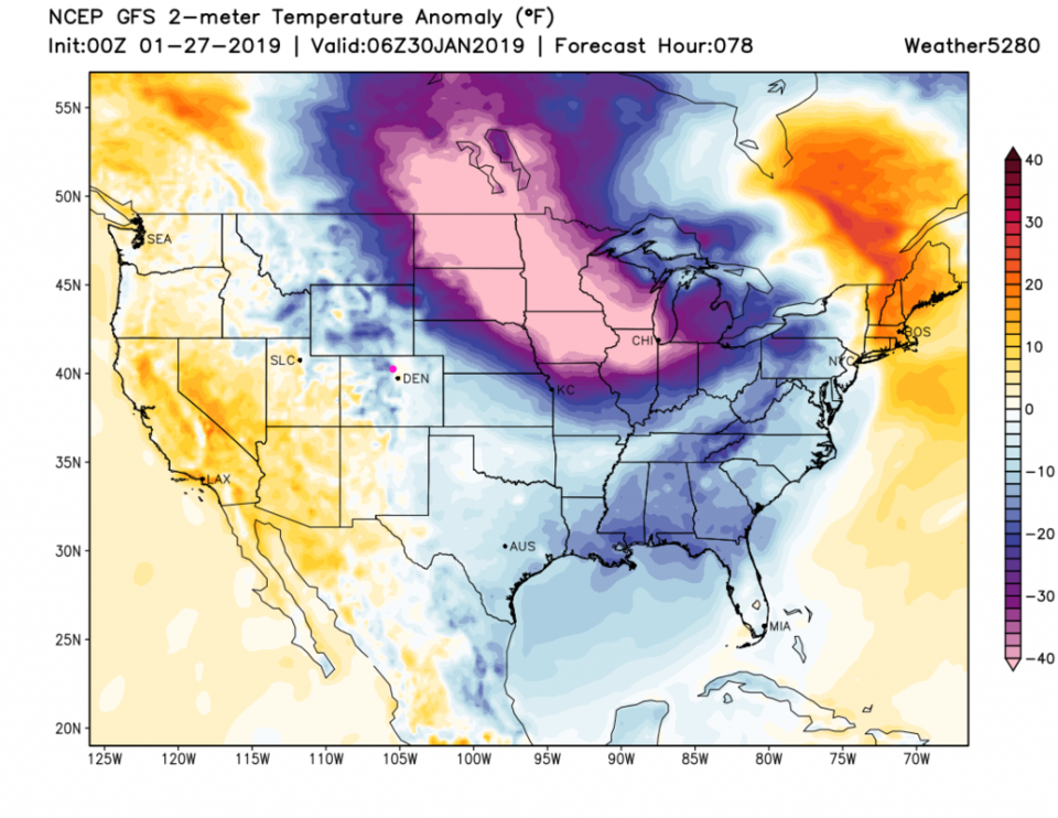
I'll start this discussion with the long-range graphic (Figure 1). We have a period of precipitation (snow) this evening through Monday afternoon, but most of the snow should fall in the pre-dawn hours. In Figure 2, you can see the front pushing down into New Mexico and yet more snow for the north-western slopes and northern Colorado mountains. Some may sneak off onto the Plains along I-25. The weatherunderground model gives us less than an inch. The GFS has us in the dusting to coating category (Figure 3). The Monday commute could be slippery.
The longer range forecast:
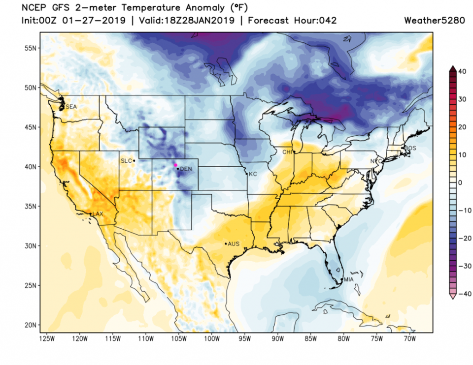
We quickly dry out, but remain cold this week through Thursday night. Friday brings a warm up. This is due to our position on the western "shoreline" of the incredibly cold (and shallow) arctic blast that will freeze out the central U.S. On Monday, you can see cold air back into Montana, Idaho, Wyoming and some of western Colorado with a push down almost to the Mexican border (Figure 4). By Tuesday night truly remarkably cold air is blasting the Dakotas down to Chicago (Figure 5). That is air that is 40F+ below average. Incredible.