Skip to content

Next Storm/Next Snow Forecast Discussion from the Cherrywood Observatory – January 23-25, 2020

This content was originally published by the Longmont Observer and is licensed under a Creative Commons license.

In Brief:

Very abnormally warm weather is settling in. Some models raise temperatures to 60F or higher Sunday. Another storm is lurking in the Monday night to Thursday morning time frame, but the precipitation will likely remain far to the east of our part of the state (with snow up in the mountains- as usual). The cool down associated with this system is also minimal. We bounce back to the upper 50'sF for the next weekend again.

Forecast Discussion:

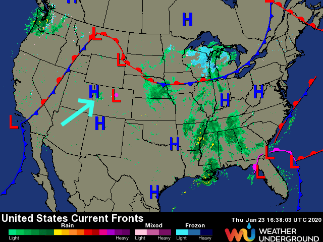
The cool air for the central and eastern parts of the U.S. called for by WeatherBell (see discussions at the start of the month) may have materialized, but we will not see that cold air make it back to Colorado. There are stiff iguanas in Florida, I've heard. We are high and dry with ongoing snow in the mountains. This snow is just enough to snarl traffic trying to make it through the mountains (blue arrow Figure 1).

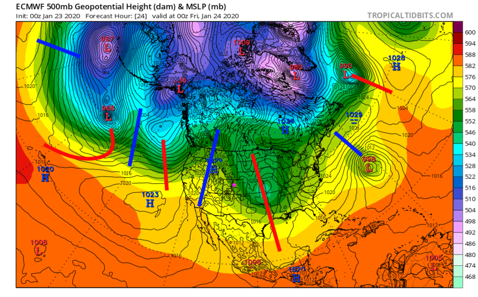
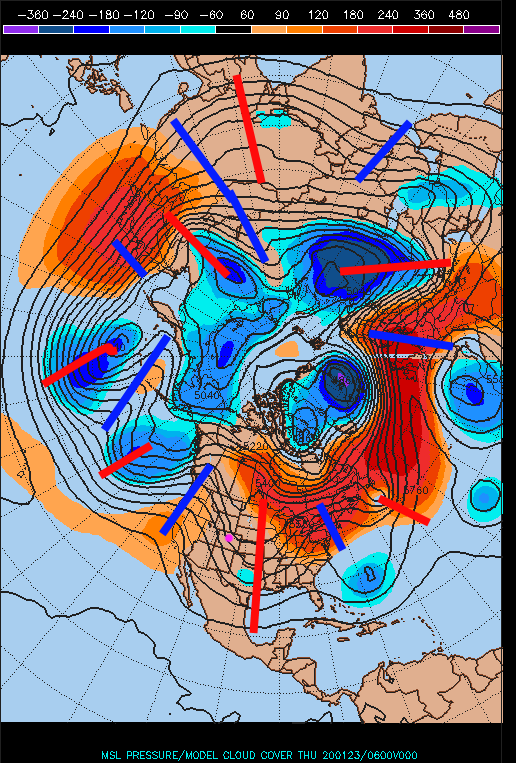
The big picture for Colorado is the big ridge in the western U.S. and big trough in the central/eastern portion of the nation (Figure 2). For fun, we can move our camera out further to pull in the entire northern hemisphere in Figure 3 for an even bigger picture. There is a large trough over the Himalayas, a ridge over Japan, a trough in the Pacific, our western ridge and eastern trough, a ridge over the western Atlantic, a trough over the central Atlantic and big ridge over Europe. On top of this pattern, there are a number of short waves rippling around the planet. This is a pretty stable situation. The ridge over the West should stay put for a while.

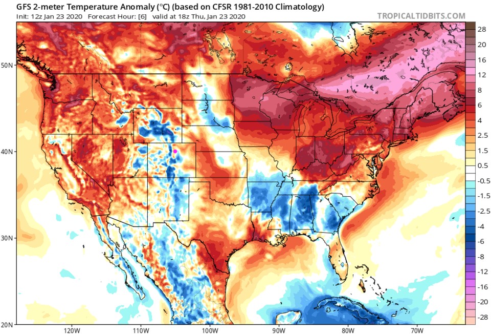
The temperature-departure-from-normal map (Figure 4) for the U.S. shows the remains of that super cold air in the middle of the country sitting down in the southeastern states. The rest of the nation is quite a bit above normal - like Colorado (outside of the mountains).

The Longer Range Forecast:

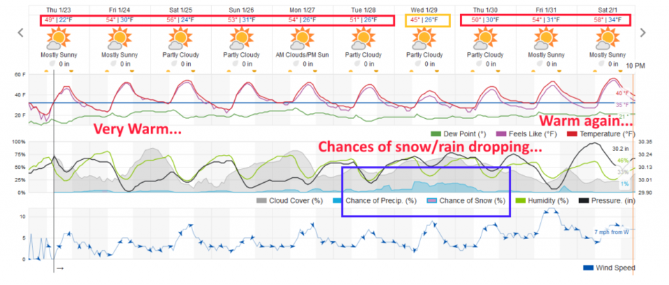
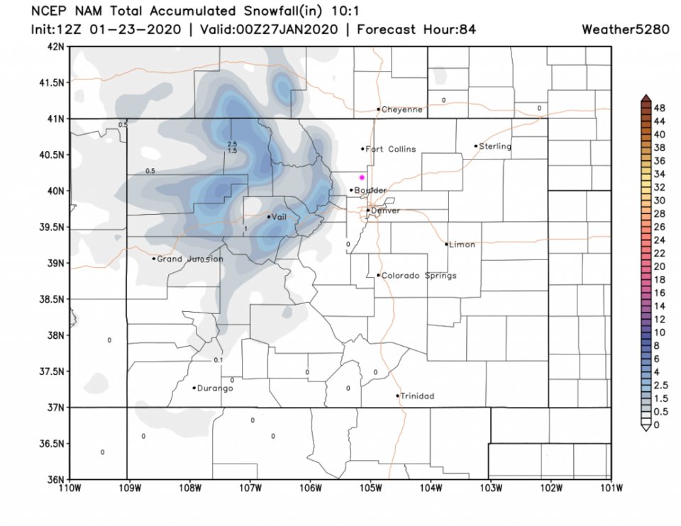
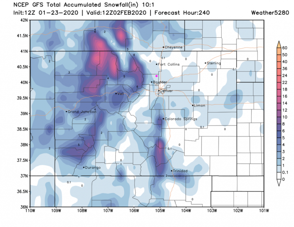
We warm to the middle to upper 50'sF for the weekend (Figure 5). We may even break 60F on Sunday with some down slope flow adding to the ridge overhead. Our storm next week is fading out (as they seem to do this year). We'll keep an eye on it here. New snowfall through the weekend is light in the northern and central mountains (Figure 6). The next storm - if it produces any snow next Tuesday-Thursday, may give us a coating to an inch west of town (Figure 7).

Figure 1: the current surface analysis map from Thursday AM and the weatherunderground.com site
Figure 2: the North America 500mb pattern from tropicaltidbitscom for Thursday afternoon.
Figure 3: the northern hemisphere 500mb pattern from Penn State weather wall for Thursday afternoon.
Figure 4: the North America surface temperature anomaly (departure from normal) from tropicaltidbitscom for Thursday afternoon.
Figure 5: the graphical forecast for the next 10 days for Longmont, CO from weatherunderground.com
Figure 6: 10:1 (snow to liquid) snowfall totals through Sunday night from the NAM and weather5280com for Colorado made Thursday AM.
Figure 7: 10:1 (snow to liquid) snowfall totals for the next 10 days from the GFS and weather5280com for Colorado made Thursday AM.

Current Weather

Cloudy

Cloudy

41°F

UV Index
0 Low
Pressure
30.14 Rising
Visibility
8 miles
Dewpoint
32 °F
Humidity
70%
Wind
NE 5.5 mph
Gust
10.7 mph
Wind Chill
38 °F

Hourly Forecast

Today
11 PM
42°F
Showers
Tomorrow
12 AM
41°F
Showers
Tomorrow
1 AM
40°F
Showers
Tomorrow
2 AM
39°F
Rain and snow
Tomorrow
3 AM
39°F
Cloudy
Tomorrow
4 AM
38°F
Cloudy
Tomorrow
5 AM
38°F
Cloudy
Tomorrow
6 AM
37°F
Cloudy
Tomorrow
7 AM
37°F
Cloudy
Tomorrow
8 AM
37°F
Cloudy
Tomorrow
9 AM
38°F
Flurries
Tomorrow
10 AM
39°F
Flurries

7 Day Forecast

Intermittent clouds

Wednesday

74 °F

Times of clouds and sun


Rain and snow

Wednesday Night

37 °F

Cloudy; a couple of brief showers late this evening followed by a rain or snow shower in spots late


Rain and snow

Thursday

47 °F

Cloudy and chilly with a couple of showers of rain or snow


Mostly cloudy

Thursday Night

34 °F

Mostly cloudy


Mostly cloudy w/ showers

Friday

52 °F

Breezy in the morning; otherwise, cool with some sun, then turning cloudy with a little rain in the afternoon


Rain and snow

Friday Night

32 °F

Snow at times, accumulating an inch or two; rain mixed in early


Flurries

Saturday

49 °F

A bit of morning snow with little or no accumulation; otherwise, cloudy and chilly; storm total snowfall an inch or two


Intermittent clouds

Saturday Night

31 °F

Partly cloudy


Partly sunny

Sunday

72 °F

Partly sunny and warmer


Partly cloudy

Sunday Night

44 °F

Partly cloudy


Sunrise and Sunset

Sunrise
6:18 AM
Sunset
7:42 PM

Based on AccuWeather data