This content was originally published by the Longmont Observer and is licensed under a Creative Commons license.
In Brief:
The previously mentioned mid-week storm is vanishing into the computer-model-ether. We have a mostly dry 7-10 day period ahead of us with a hint of another (fake?) storm coming early next week. Temperatures will remain almost 10F above normal day and night over most of this period.
Forecast Discussion:
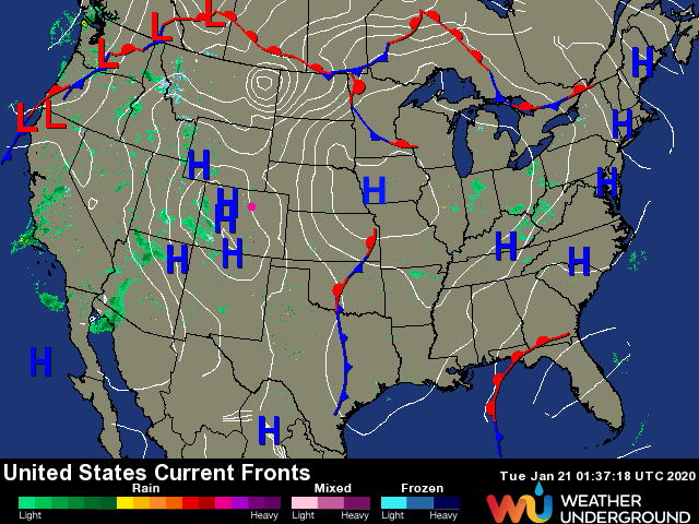
Extreme quiet weather warning! While blizzards rage in the middle of the country under record cold, and while repeated snow storms keep hitting the mountains of the Western U.S. states - we stay caught in the quiet middle (Figure 1). Even the western slopes of Colorado are having more excitement than we are.
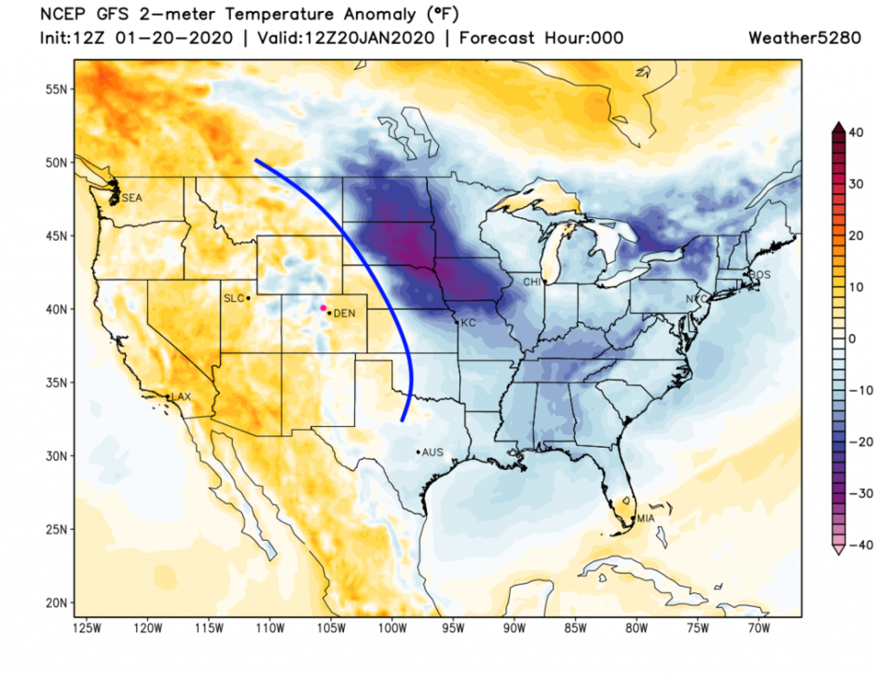
The cold pouring out of Canada is sitting on the other side of a quasi-stationary boundary (blue line - Figure 2) to our east.
The Longer Range Forecast:
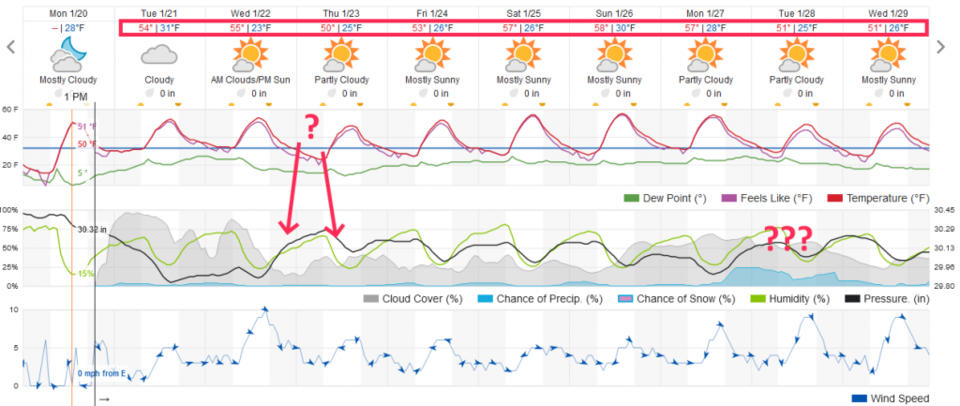
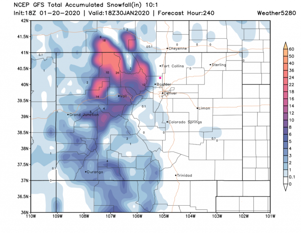
The normal high temperatures for this time of year is about 44F and the normal low is 11F. The entire stretch of the next 10 days sees 50F to almost 60F for highs and the low temperatures range from 25F to above freezing levels around 34F (Figure 3). The storm that we were watching for mid-week will hit the western slopes then reform over Kansas and Oklahoma. Over the next 10 days, two good systems will hit the Colorado mountains. The northern Rockies get hit by up to 2 feet of new snow - Longmont get skipped (Figure 4).