This content was originally published by the Longmont Observer and is licensed under a Creative Commons license.
Forecast Discussion:
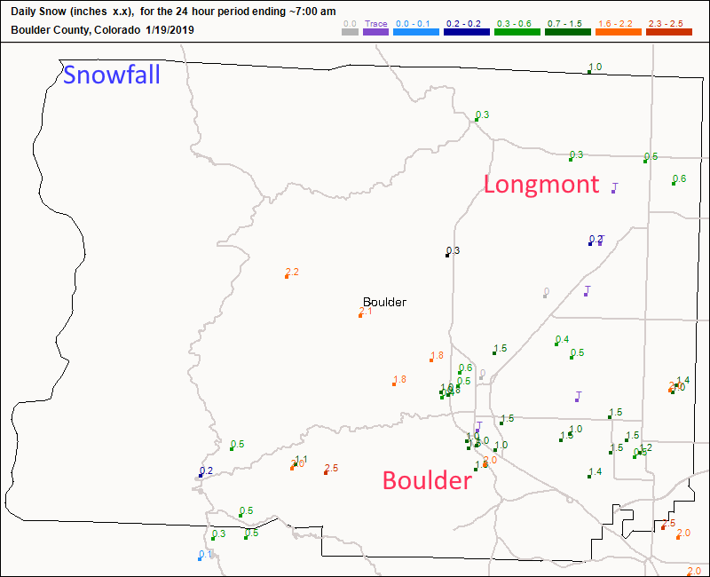
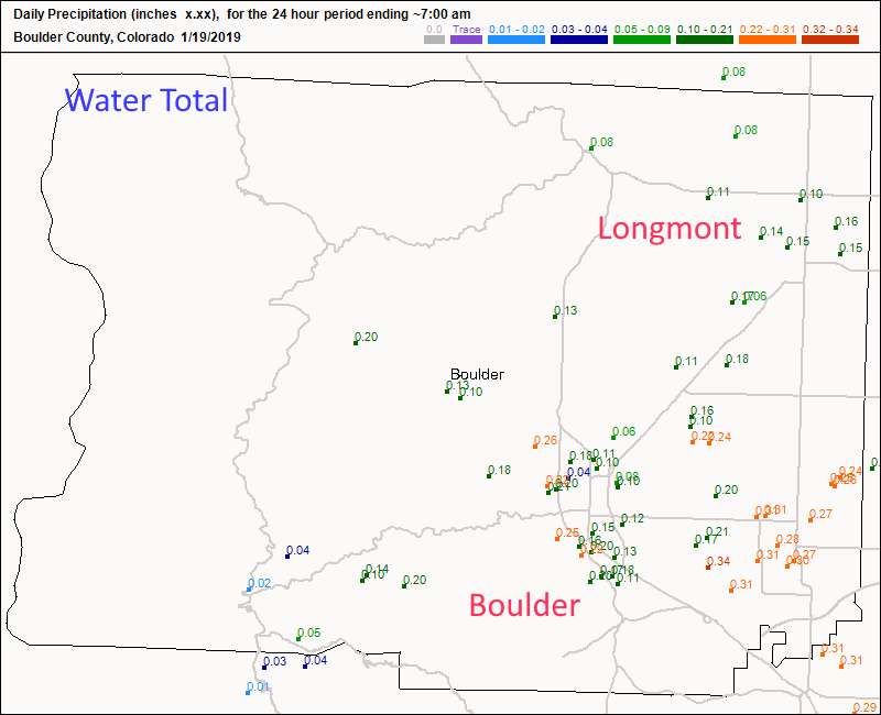
Something broke with my editing tools, so I could not update the post for Saturday to include snowfall reports and eclipse forecasts (as promised), so these graphics will start out our discussion today. Figure 1 update shows Longmont received just about 1/2 inch of snow (that melted pretty quickly). Boulder received 1/2 to 2 inches of snow in places. Figure 2 update shows we received about 1/5th inch of water while Boulder and areas closer to Denver received 1/4th to 1/3rd inch of water. Every drop helps!
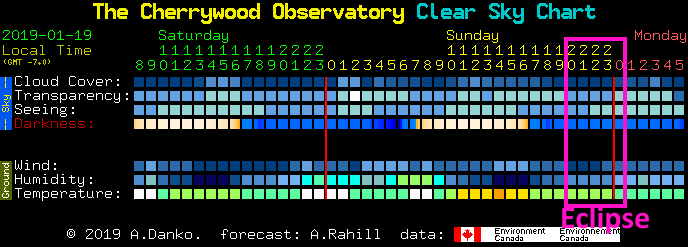
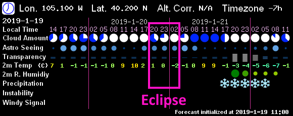
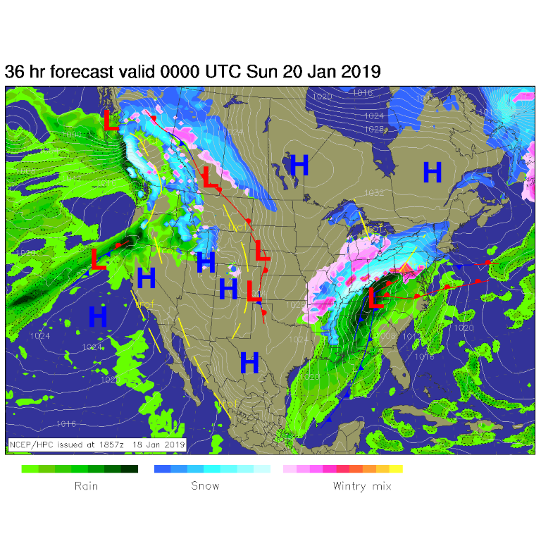
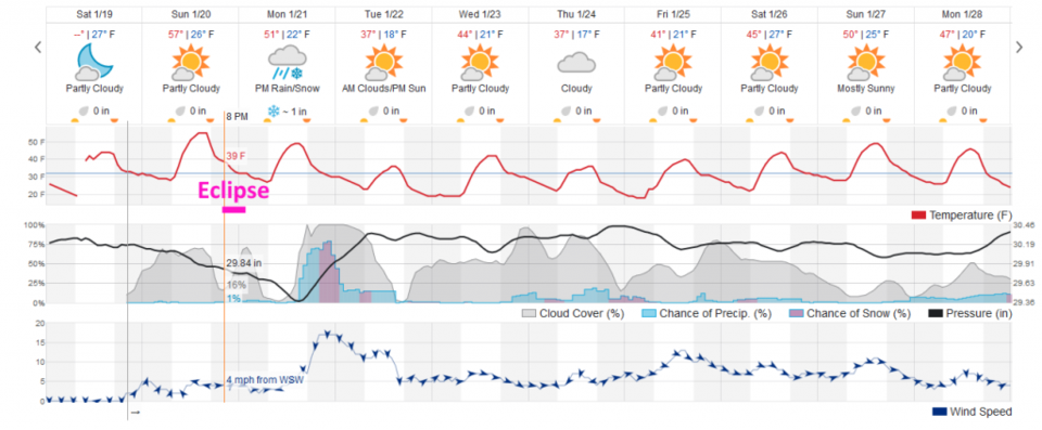
For the eclipse tonight (Sunday) -the model in Figure 3 update shows mostly clear skies (maybe a touch of haze/high clouds) during the eclipse. A great forecast. Figure 4 update, from 7Timer's model (the GFS) we have a bit more difficulty from clouds, but the moon can make it through clouds pretty well (until totality). Figure 2 shows nearly clear skies at the start of the eclipse, but getting worse as the night goes on (weatherunderground's model).
Please see my earlier invitation and eclipse timing post if you wish to come to the Cherrywood Observatory and look through some telescopes and get a tour of the night sky - clouds and bright moon permitting.
Now to the next snow storm. We have a big system to our distant northwest and our past storm is off pounding the southeastern states. This gives a chance at a nice eclipse viewing (Figure 1) and a quiet day Sunday. Figure 2 shows that we wake to clear skies Monday, but things cloud up rapidly and a brief, but strong, period of precipitation moves in after sunset Monday PM into early Tuesday AM (Figure 2).
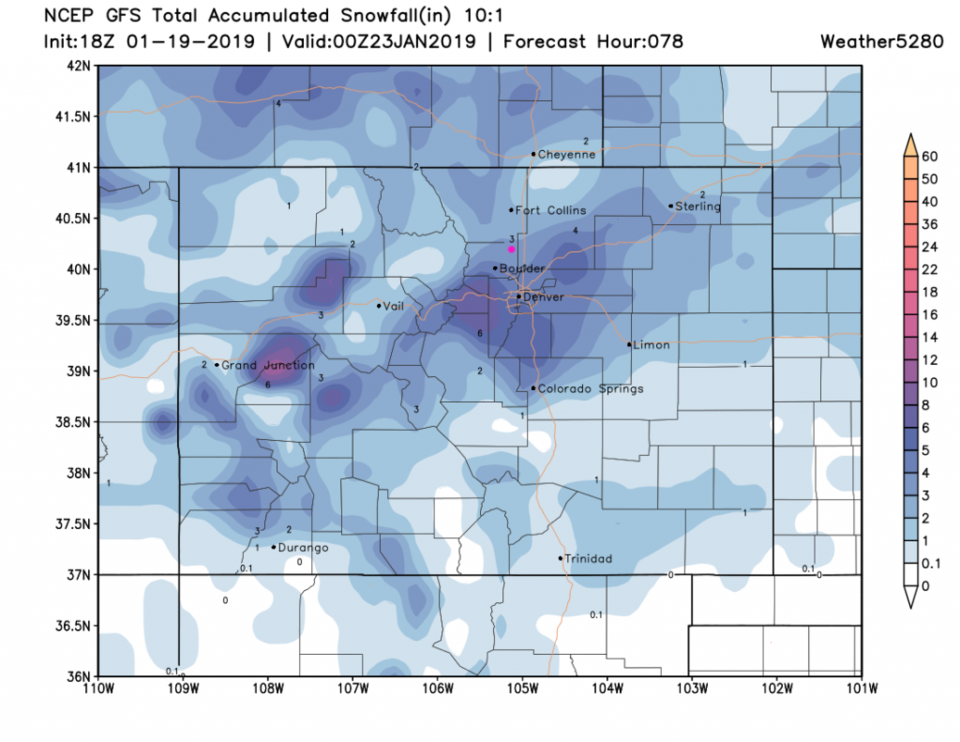
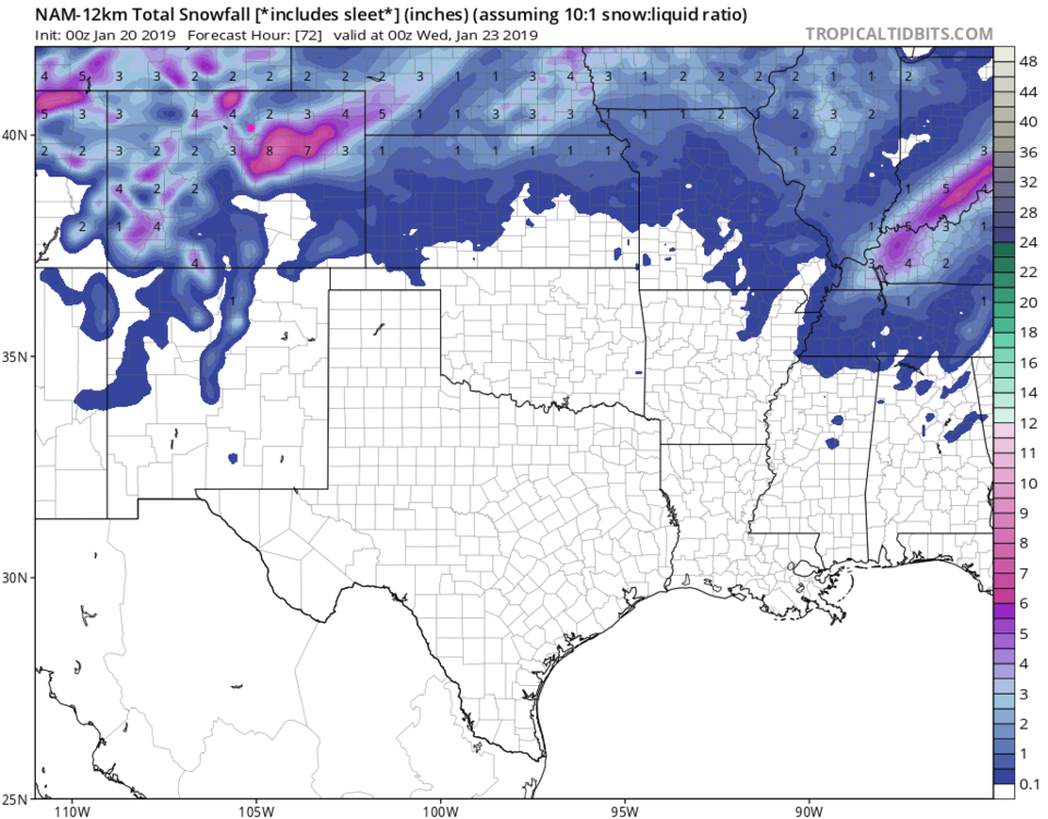
The GFS (Figure 3) gives us about 3-4 inches of snow (while weatherunderground gave us only about 1 inch - Figure 2). The NAM gives us about 1-3 inches on the Monday - Tuesday storm. This 'could' be a more substantial hit this time!
The longer range forecast:
Back to Figure 2, things get colder Tuesday through Saturday with highs mainly in the 30's and 40'sF. Major cold air will be pouring out of Canada east of our state. We only get a taste of it now and then - with small chances of snow/rain now and then. We'll cover the details more later!