This content was originally published by the Longmont Observer and is licensed under a Creative Commons license.
Forecast Discussion:
The snow reports will come in at 7am and through the day, so I'll update this article later on Saturday to see how our county did. We are clearly between systems today (and Sunday) as seen in Figure 1.
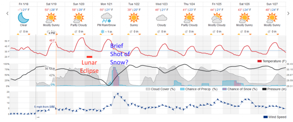
For the eclipse tomorrow night (Sunday night - see my earlier invitation to visit the Cherrywood Observatory during the eclipse) - skies seem to be 50/50 on clouds (but the moon clearly 'gets past' all but the worst sky conditions). Temperatures will be a few degrees above freezing and winds will be light around 5mph (red dash in Figure 2- Sunday). I'll add some sky forecast graphics tomorrow (Saturday afternoon) as they come out.
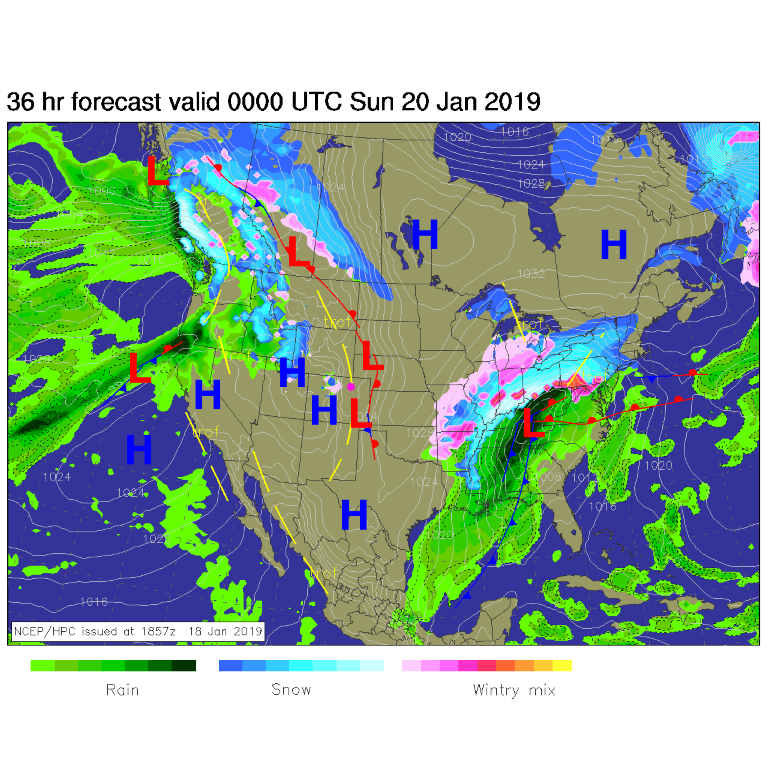
Figure 1: The forecast surface map for Saturday PM. From NCEP.The longer range forecast:
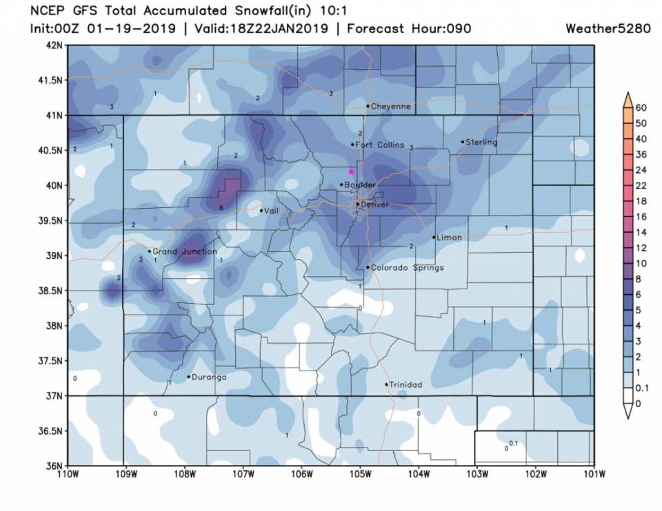
Monday, a very quick moving system gives a brief window of moderate to heavy snow. With marginal temperatures (yet again) weatherunderground is only giving us an inch or so (Figure 2). The GFS is more bullish and gives us 2-3 inches. This bears watching after the 1/2 inch NE Longmont received today - when (nearly) no snow was expected by the GFS. Watch for an update here tomorrow!