This content was originally published by the Longmont Observer and is licensed under a Creative Commons license.
Forecast Discussion:
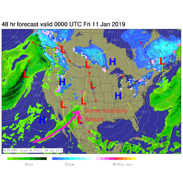
The stage is being set for our storm (I'll still use the word loosely, but I'm excited we'll see cloudy skies and falling water soon). Figure 1 shows the low tonight forming in SE Colorado and a hint of moisture being drawn in from the Pacific (purple arrow). The first snows are hitting Utah, Nevada and spots in Western Colorado already.
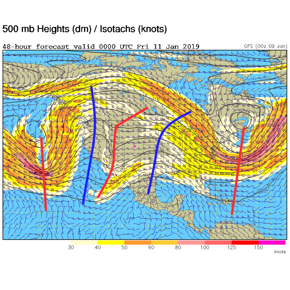
By tonight, the upper air trough is in as far as western Arizona and western Utah (red line in Figure 2).
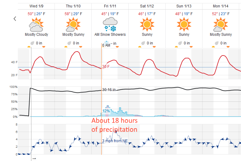
The timing of the storm, from weatherunderground: precipitation will start in the morning Friday, before sunrise. The peak precipitation occurs late morning into late afternoon with showers tapering off into the evening (Figure 3). Again, it should be all snow with temperatures not getting far into the 40'sF early in the day. It may not stick on pavement and bare ground at first.
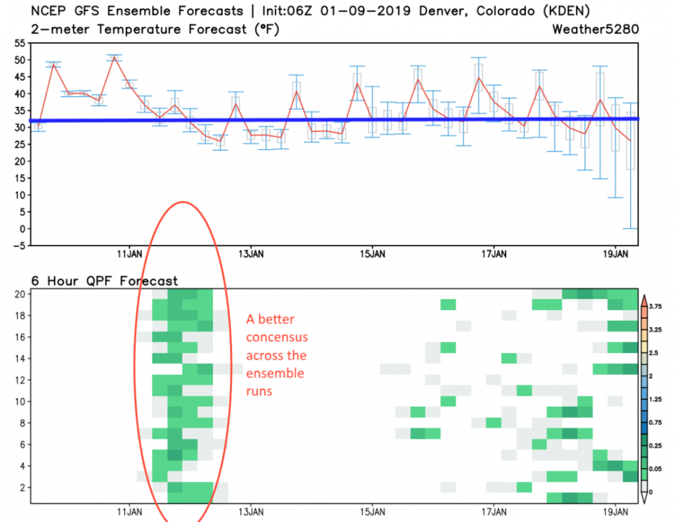
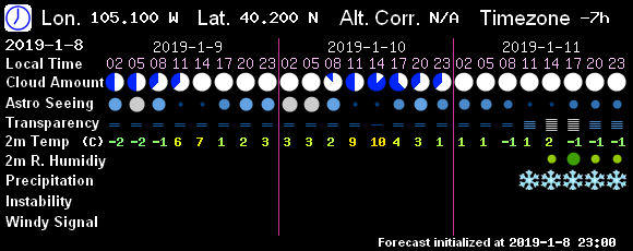
The GFS ensembles are in much more agreement that this period of precipitation will hit on Friday (Figure 4) and have temperatures only in the upper 30'sF at the start of the precipitation period. Even the model (7! Timer) used for astronomical purposes has snow falling after 8am and by 11am (Figure 5).
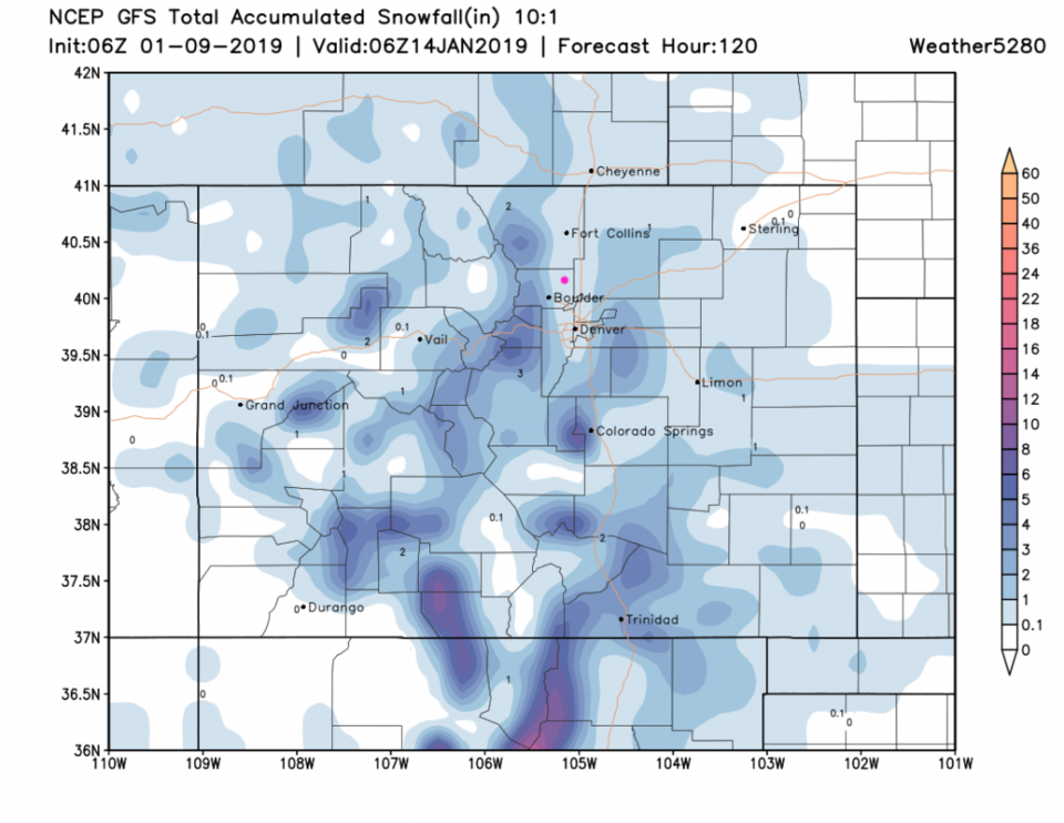
The totals are still light though, the GFS (Figure 6) gives Longmont 1/10th inch to 1 inch of snow over the next 5 days (this storm is it). The NAM (not shown) has more like 2-3 inches building up. The weatherunderground model (Figure 3) keeps us in the trace to coating area.
The longer range forecast:
Temperatures return to the 50'sF and things dry out in the long term. I don't have much to say about that beyond that!


