This content was originally published by the Longmont Observer and is licensed under a Creative Commons license.
In Brief:
We have a strong jet stream flow from the northwest most of the next 10 days. This means periods of warm down slope winds (especially for this weekend) and quite dry conditions. The mountains will keep getting periods of snow when moisture blobs travel in on that river of air flow aloft.
Forecast Discussion:
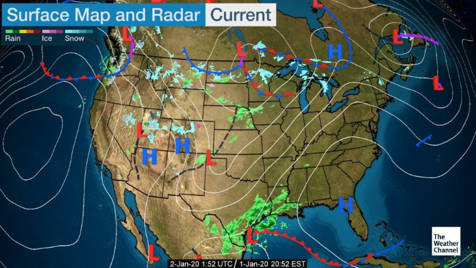
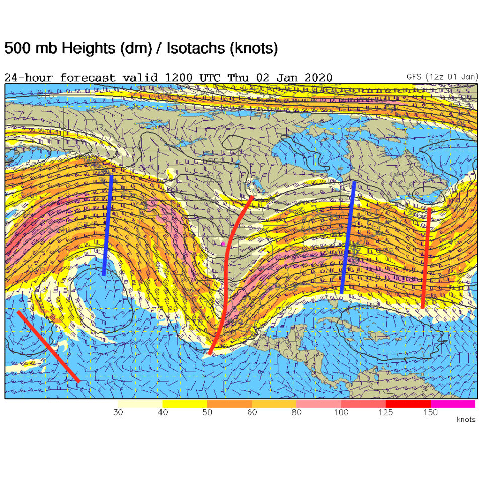
A flow of northwesterly winds aloft (Figure 2) dominate our weather pattern this week. A few cool fronts will keep temperatures around normal for this time of year (Figure 1). Snow will keep falling in the mountains (I saw it firsthand in Gunnison this week!). The trough that kicked up winds on Wednesday and dropped showers on the Plains is sliding to the east already (Figure 2).
The Longer Range Forecast:
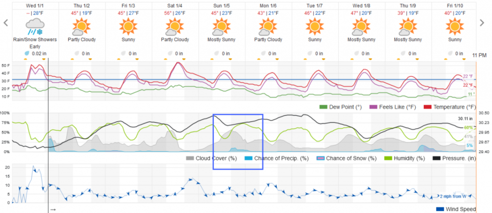
Increased down slope flow will toss Christmas decorations around now and then (pack-em away! - Figure 3). Temperatures remain normal to above normal through the week.
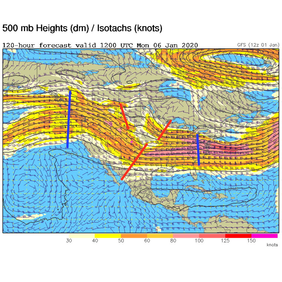
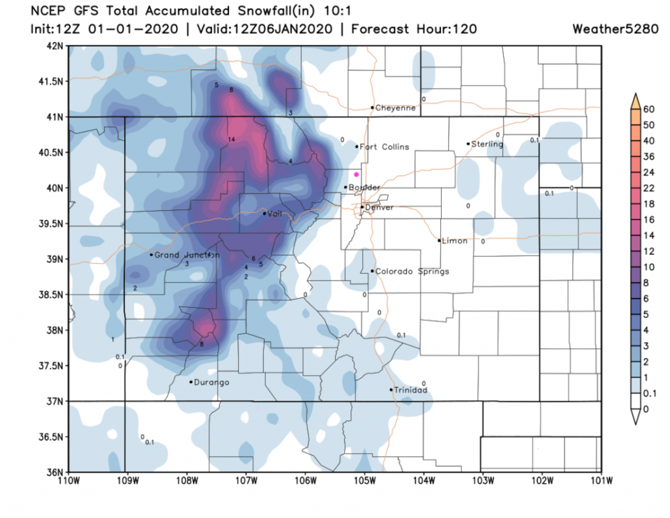
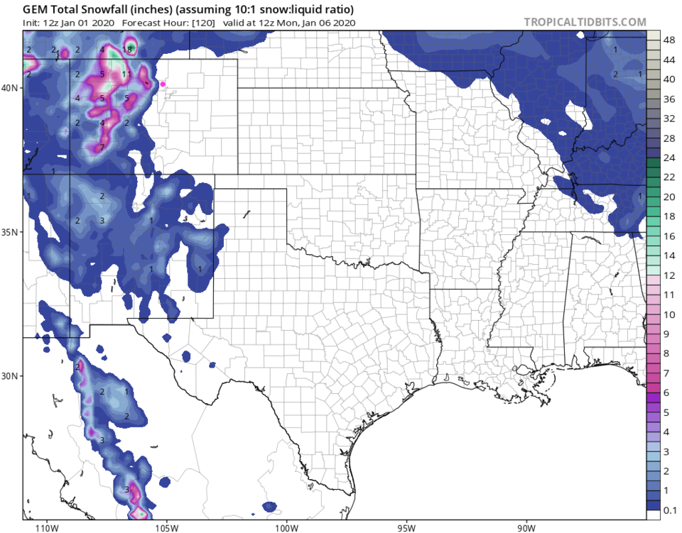
We were watching a system coming in later in the weekend earlier - that is now looking like a non-system for Longmont. Trough-y-ness is passing Sunday and Monday (Figure 4) but it is not deep and quite quick moving. The GFS sees a foot to a foot and a half of snow in the mountains by Monday - but nothing in Longmont (Figure 5). Even the weatherunderground model gives us only a slight chance of precipitation and a slight cool down Sunday into Monday (Figure 3). The GEM (Figure 6) dumps snow on the mountains with nothing on the Plains.
The January outlook and beyond:
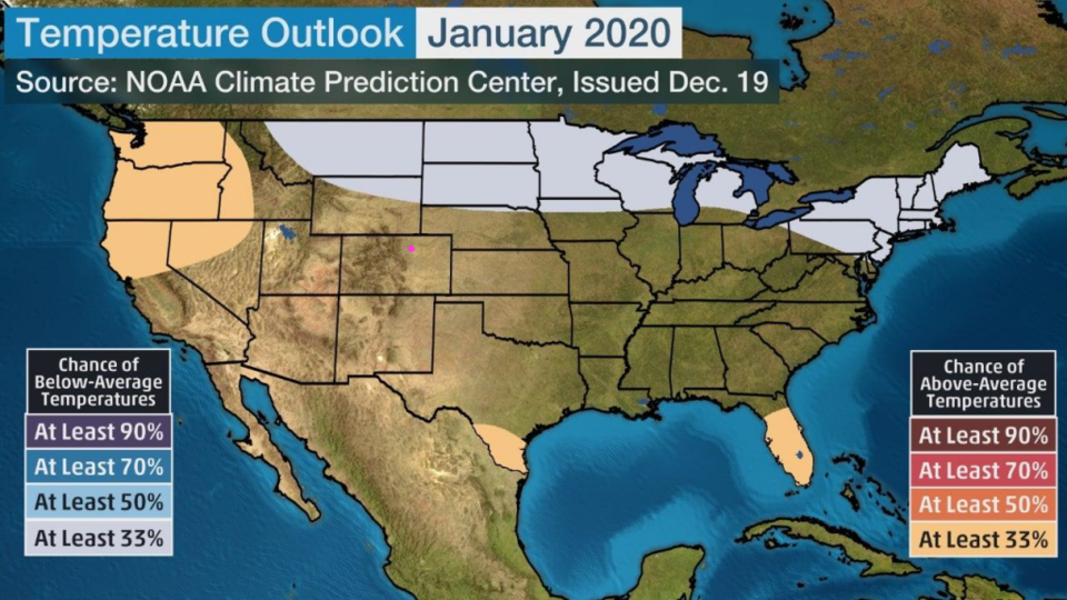
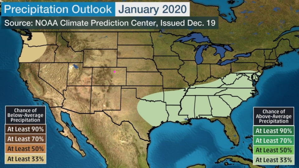
NOAA has us very normal temperature-wise (Figure 7) and equally boring as far as precipitation goes (Figure 8) for January 2020. The weather bell forecasters have us quite warm for January as well, but show how very cold and snowy weather may be in store for February-March (no graphic). We'll see!