This content was originally published by the Longmont Observer and is licensed under a Creative Commons license.
Forecast Discussion:
6pm Update:
The forecast turned out pretty close to my forecast...
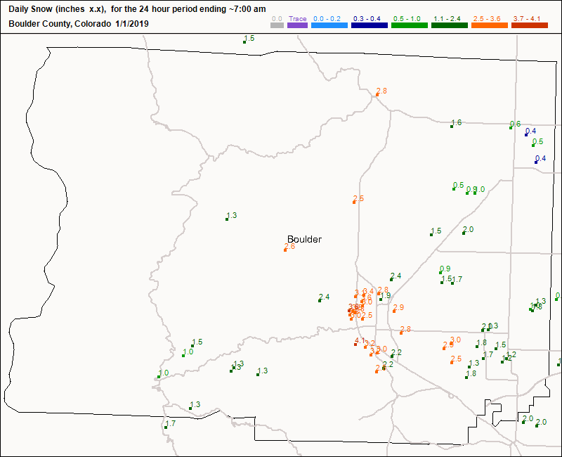
Longmont received about 1/2 inch, Boulder received 2-4 inches. Now for a long cold night...
End 6pm Update.
Posting early, before the eggnog takes hold... snow is tapering off and I'll update with snow reports in the am (official reporting is at 7 am MT). Immediately, the critical item is the cold tonight. The NWS has issued a...
...WIND CHILL ADVISORY REMAINS IN EFFECT UNTIL 8 AM MST TUESDAY......WINTER WEATHER ADVISORY WILL EXPIRE AT 5 PM MST THIS
AFTERNOON...
* WHAT...Very cold wind chills expected. Wind chills as low as
20 below zero expected.
* WHERE...Denver, Boulder and the western suburbs of Denver.
* WHEN...Through 8 AM MST Tuesday.
* ADDITIONAL DETAILS...The cold wind chills could cause
frostbite on exposed skin in as little as 30 minutes.
PRECAUTIONARY/PREPAREDNESS ACTIONS...
A Wind Chill Advisory means that cold air and the wind will
combine to create low wind chills. Frostbite and hypothermia can
occur if precautions are not taken. Make sure you wear a hat and
gloves.
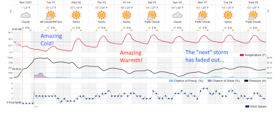
The longer range forecast:
Figure 1 shows the likely upper teens F high for today (Tuesday) as snow flurries taper off in the early morning. Temperatures rocket up as a ridge builds in the West giving us possible 60's F for a high on Friday. Wow.
The 'mimic' storm next weekend has become less of an 'item' at present. We'll watch it as the new year begins. Happy New Year all!