This content was originally published by the Longmont Observer and is licensed under a Creative Commons license.
In Brief:
As this post goes live, a front is slipping down the front range with a burst of rain/snow associated with it. Temperatures in the 50'sF are getting cut off as cold air flows. Weak up slope flow on Sunday will mean light snow totaling to a coating to maybe in inch in depth by Sunday night. The mountains will still get snow (on top of the many feet they received this week. Additional small snow chances hit Monday night, Wednesday night, Thursday night and next Saturday morning. We remain below normal as temperatures go for the entire next 10 days.
Update 2/10 8:30am:
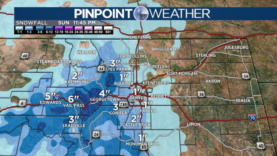
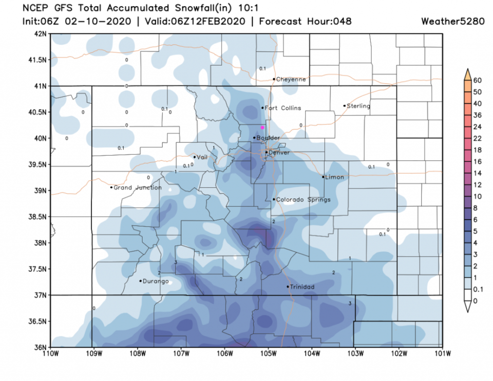
Our next shot of snow comes in just before the evening rush hour and pulls out late in the night. We should see a few inches again around Longmont. Even Estes Park may only see about 3 inches of snow. The NWS has issued another winter weather advisory on this storm (Figure 1 update). The GFS gives Longmont about 1-2 inches tonight (Figure 2 update).
Winter Weather AdvisoryIssued: 6:07 AM Feb. 10, 2020 – National Weather Service
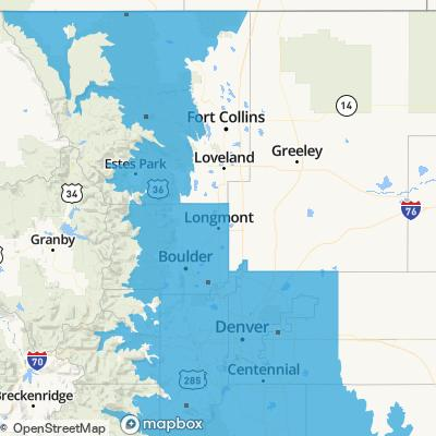
...WINTER WEATHER ADVISORY IN EFFECT FROM 5 PM THIS AFTERNOON TO
2 AM MST TUESDAY...

* WHAT...Snow expected. Total snow accumulations of 1 to 4
inches.

* WHERE...Boulder and the western suburbs of Denver and Denver.

* WHEN...From 5 PM this afternoon to 2 AM MST Tuesday.

* IMPACTS...Plan on slippery road conditions. The hazardous
conditions are expected to impact the evening commute.

PRECAUTIONARY/PREPAREDNESS ACTIONS...

Slow down and use caution while traveling.

The latest road conditions for the state you are calling from can
be obtained by calling 5 1 1.
End update 2/10 8:30am.
Update 2/9 10pm:
Just a quick update to include the Longmont Public Media Weekend Update video. Enjoy!
End 2/9 10pm update.
Update 2/9 7:30am:
We are waking up to more snow than the coating to 1 inch called for below. In fact the NWS has issued a winter storm advisory for Boulder county, the foothills, and counties south (see text and Figure 1 update).
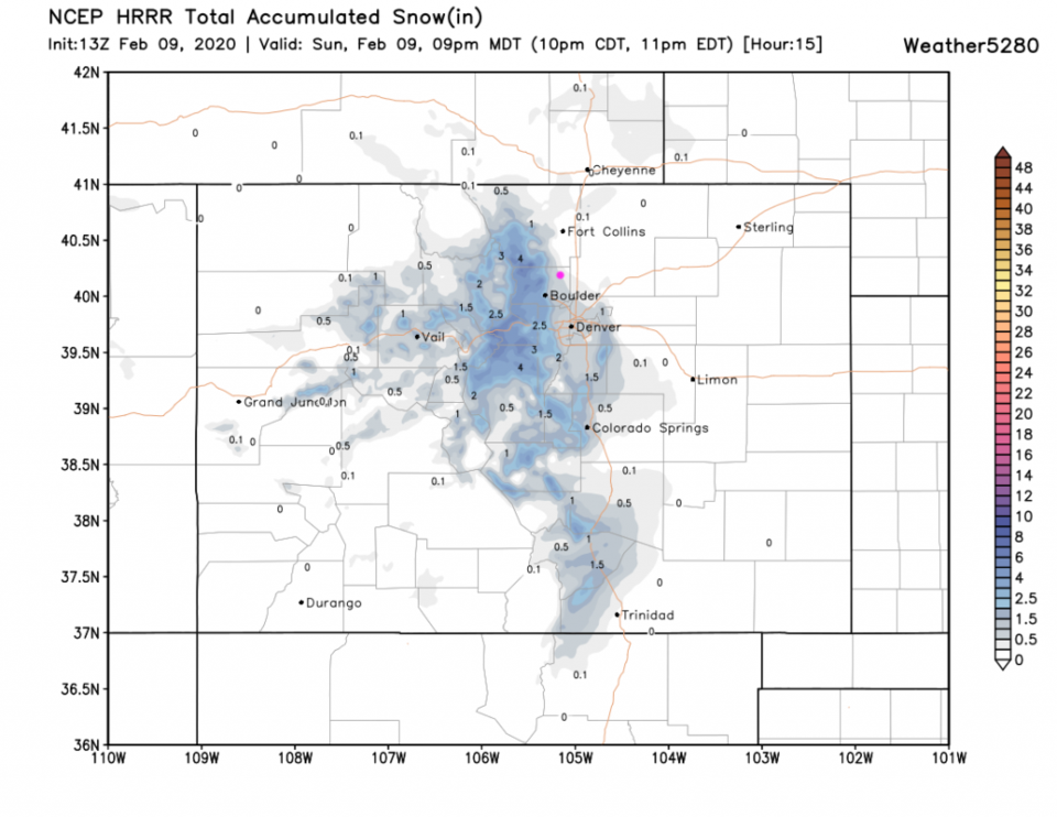
The NWS points out that the European model actually gives Boulder county 4-10 inches today while the GFS gives us 1-4 inches. This is due to a fairly subtle tweak in the location of the jet stream that will put a region of expanding air flow overhead that will act as a smaller scale vacuum that will lift the air a bit more efficiently. A second surge of cold air will increase the up slope easterly flow at the surface as well. Small changes that may matter a lot for snowfall amounts. The HRRR in Figure 2 update, though, is unimpressed and only gives us a trace for the rest of the day. This is an 'on the edge' forecast. Since it is snowing pretty well this AM - I'd err on the side of the NWS's advisory below.
Note also, the Monday night snow is now shaping up to be more significant - maybe in the 1-4 inch area for Longmont. Keep the shovels out!
Winter Weather Advisory Issued: 7:00 AM Feb. 9, 2020 – National Weather Service
...WINTER WEATHER ADVISORY IN EFFECT UNTIL NOON MST TODAY...

* WHAT...Snow. Total snow accumulations 2 to 4 inches, heaviest in
the western and southern suburbs and Palmer Divide.

* WHERE...Boulder and the western suburbs of Denver, Denver and
Castle Rock.

* WHEN...Until noon MST today.

* IMPACTS...Plan on slippery road conditions.

PRECAUTIONARY/PREPAREDNESS ACTIONS...

Slow down and use caution while traveling.

The latest road conditions for the state you are calling from can
be obtained by calling 5 1 1.
End 2/9 7:30am update.
Forecast Discussion:
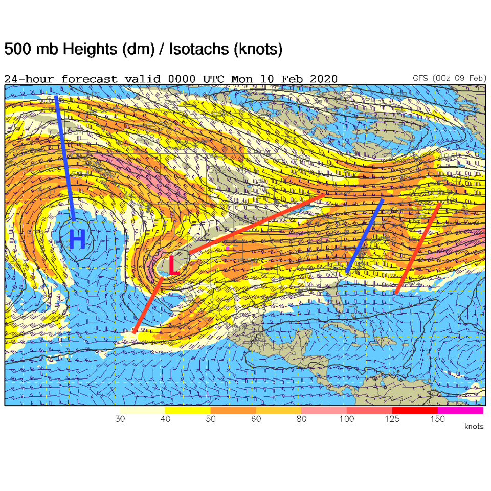
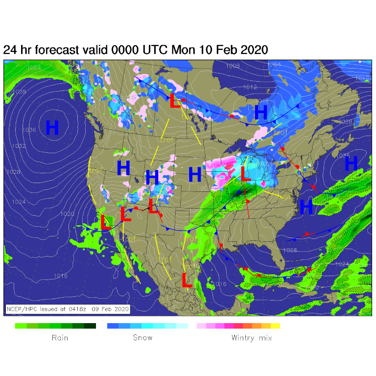
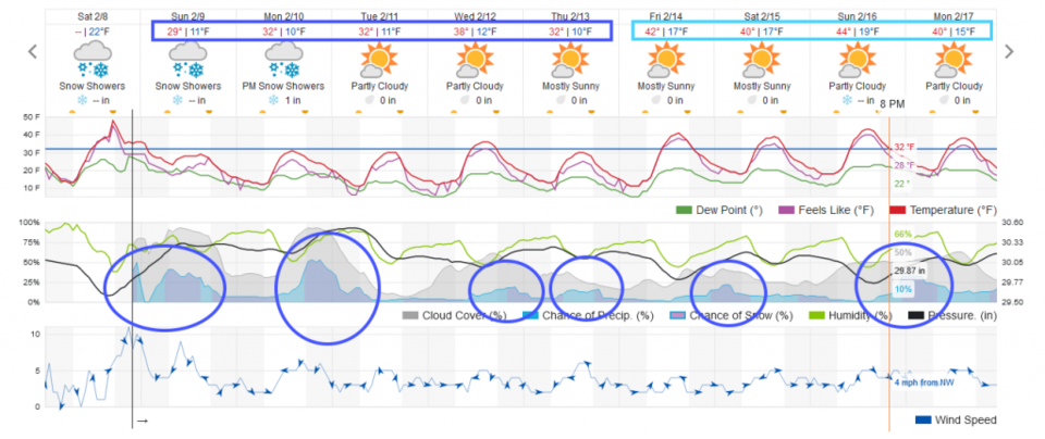
The big ridge remains off the West coast as a cut off low rolls past the state over the rest of the weekend (Figure 1). A trough passing means a cold front is sliding down again. Up slope snow on Sunday will give us a period of light snow with the jet stream aloft enhancing that snowfall a bit (Figure 2). This is NOT going to be as significant as the last two storms (I received 2.7 inches of snow - which was just below my 3-6 inch forecast this time. Darn.). Light snow should form again around sunrise Sunday and last until a few hours after sunset (Figure 3).
Snowfall Roundup:
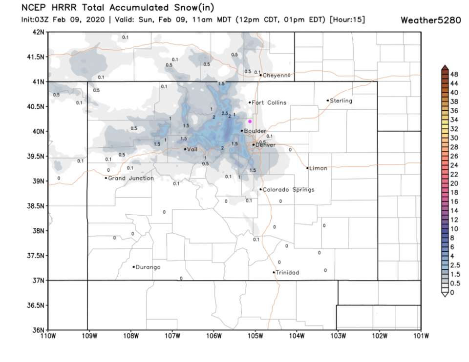
The HRRR (through 11am Sunday - Figure 4) give us a dusting to 1/2 inch of snow.
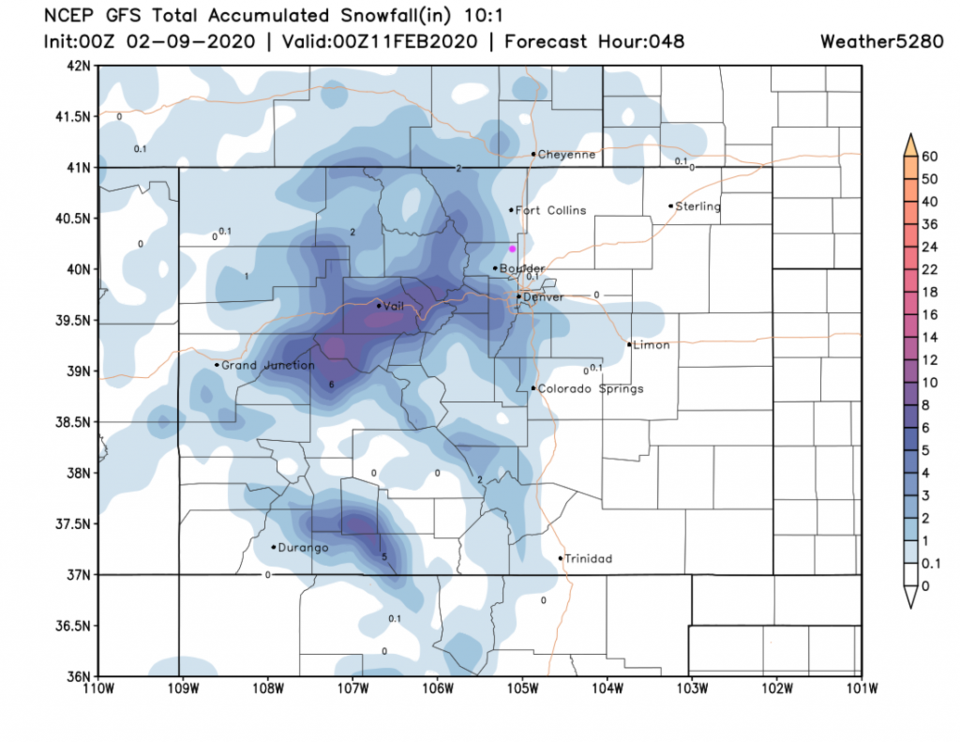
The GFS over the next 48 hours paints us with a coating to 1 inch of snow (Figure 5).
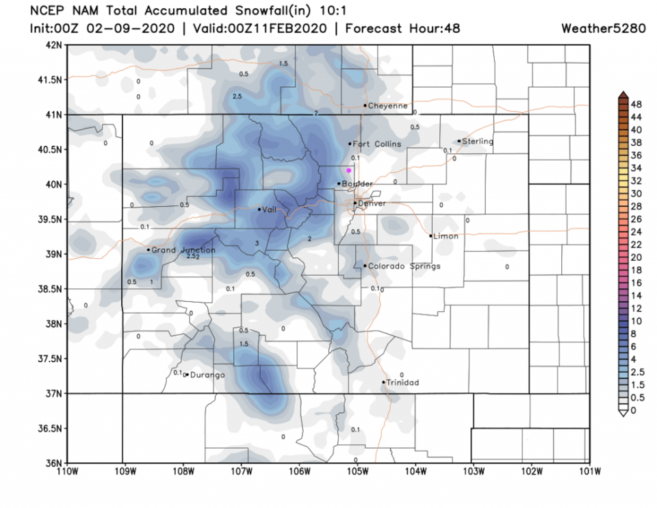
The NAM for the same period gives us 1/10th to 1/2 inch of snow (Figure 6).
Fox 31 Denver forecasters (Figure 7) gives us a trace to 1 inch.
This isn't a big storm this time - just chilly and damp.
I like calling for a coating to 1 inch by late Sunday night.
Programming note: I plan to put up a weekend video forecast from home (with 2 week-day video forecasts in studio during the week) each weekend. Between watching my daughter sing the national anthem with her choir at the Eagles game Fri PM and a B-day party we ran for my son today - I'll have to focus on that on Sunday.
The Longer Range Forecast:
The ridge remains to the west with short waves rippling by all week. We have at least 5 more (smallish) snow chances with cold weather all week (Figure 3). We'll watch the details unfold each day! Stay warm!